
4 Maddock DriveCranbourne East VIC 3977
Property Details for 4 Maddock Dr, Cranbourne East
4 Maddock Dr, Cranbourne East is a 4 bedroom, 2 bathroom House with 2 parking spaces and was built in 2008. The property has a land size of 466m2 and floor size of 167m2. While the property is not currently for sale or for rent, it was last sold in March 2016.
Last Listing description (November 2024)
Welcome to your dream home at 4 Maddock Drive, Cranbourne East, situated in the well-established heart of the Hunt Club Estate! This stunning 4-bedroom family residence perfectly blends comfort and convenience, featuring two bathrooms and two inviting living areas, ideal for relaxation and entertaining.
The double garage provides secure parking and additional storage. Located within walking distance of Hunt Club Shopping Centre, multiple schools, and secondary colleges, including the highly regarded Casey Grammar, this home is perfect for families. Youll also find convenient childcare facilities, a medical center, and various recreational amenities nearby, such as Casey Racecourse, a swimming pool, and a gym. With its spacious layout and family-friendly features, 4 Maddock Drive is more than just a house; its a lifestyle. Dont miss out on this gemschedule a viewing today and discover why this is the perfect place to call home!
Special features recap:
# Double garage with internal access and an additional shutter for rear access
# Solar panels
# Ducted heating to keep you cozy in winter
# Evaporative cooling, plus an additional split system for the master bedroom
# Spacious alfresco area for outdoor entertainment and a beautiful backyard and side yard with established garden beds
# Recently completed landscaping, so zero additional cost
# Security cameras
# Carpets throughout the bedrooms and timber flooring throughout the living and dining areas
Close by amenities:
# Walking distance to The Hunt Club Shopping Centre
# Westfield Shopping Centre, Cranbourne Park, and Casey Central Shopping Centre are within a 15-minute drive (approx.)
# Walking distance to Casey Stadium and Casey RACE for fitness and leisure
# Walking distance to Casey Grammar School
# Walking distance to Cranbourne Library for quiet study or reading
# Close to Chisholm Institute, Cranbourne, and Federation University, Berwick, for higher education
# Walking distance to a new hospital currently being built for future healthcare needs
# Walking distance to Broad Oak Medical Centre for regular GP visits
Dont miss out on securing this ultra-modern home. For more information or to arrange a viewing, please contact Beg at 0425 424 654 or Simon at 0425 042 462.
Call us to book an inspection.
Photo ID required for an Inspection
Note. All stated dimensions are approximate only, and photos are for illustrative purposes. Particulars given are for general information only and do not constitute any representation on the part of the vendor or agent.
Please see the below link for an up-to-date copy of the Due Diligence Check List: http://www.consumer.vic.gov.au/duediligencechecklists
Property History for 4 Maddock Dr, Cranbourne East, VIC 3977
- 20 Sep 2024Listed for Sale $760000- $800000
- 13 Mar 2016Sold for $465,000
- 09 Mar 2016Listed for Sale UNDER CONTRACT

Recent sales nearby
See more recent sales nearbySimilar properties For Sale nearby
See more properties for sale nearby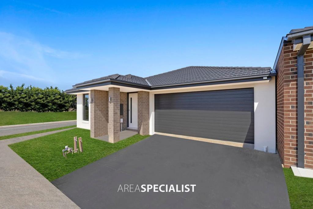 0
0 0
0 0
0Similar properties For Rent nearby
See more properties for rent nearby 0
0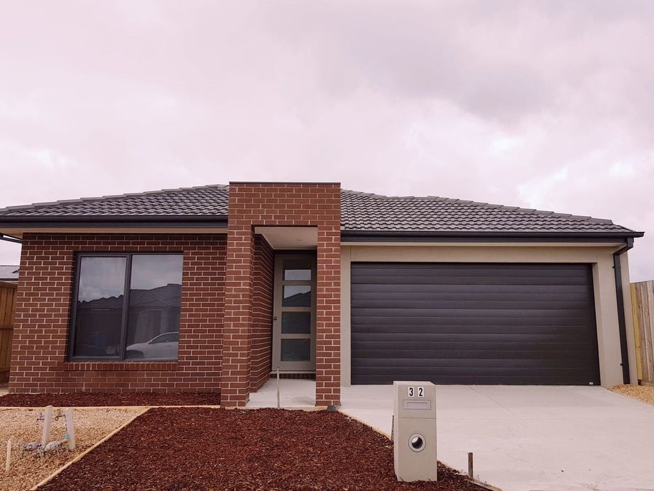 0
0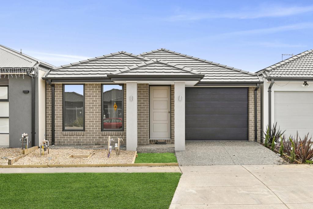 0
0About Cranbourne East 3977
The size of Cranbourne East is approximately 13.4 square kilometres. It has 35 parks covering nearly 9.1% of total area. The population of Cranbourne East in 2016 was 16195 people. By 2021 the population was 24679 showing a population growth of 52.4% in the area during that time. The predominant age group in Cranbourne East is 30-39 years. Households in Cranbourne East are primarily couples with children and are likely to be repaying $1800 - $2399 per month on mortgage repayments. In general, people in Cranbourne East work in a trades occupation.In 2021, 71.30% of the homes in Cranbourne East were owner-occupied compared with 76.70% in 2016.
Cranbourne East has 10,808 properties. Over the last 5 years, Houses in Cranbourne East have seen a 26.87% increase in median value, while Units have seen a 34.04% increase. As at 28 February 2026:
- The median value for Houses in Cranbourne East is $809,588 while the median value for Units is $575,847.
- Houses have a median rent of $595 while Units have a median rent of $530.
Suburb Insights for Cranbourne East 3977
Market Insights
Cranbourne East Trends for Houses
N/A
N/A
View TrendN/A
N/A
Cranbourne East Trends for Units
N/A
N/A
View TrendN/A
N/A
Neighbourhood Insights
© Copyright 2026. RP Data Pty Ltd trading as Cotality (Cotality). All rights reserved. No reproduction, distribution, or transmission of the copyrighted materials is permitted. The information is deemed reliable but not guaranteed.
While Cotality uses commercially reasonable efforts to ensure the Cotality Data is current, Cotality does not warrant the accuracy, currency or completeness of the Cotality Data and to the full extent permitted by law excludes all loss or damage howsoever arising (including through negligence) in connection with the Cotality Data.
This product uses cookies and other similar technologies to improve and customise your browsing experience, to tailor content and adverts, and for analytics and metrics regarding visitor usage on this product and other media. We may share cookie and analytics information with third parties for the purposes of advertising. By continuing to use our website, you consent to cookies being used. View our Privacy Policy here.
X