
14 Anne PlaceWahroonga NSW 2076
Property Details for 14 Anne Pl, Wahroonga
Last Listing description (May 2026)
Rarely does land of this scale and potential come to market. Spanning approximately 2,065sqm, this NSW Government-owned vacant lot presents an exciting opportunity for homebuyers and investors alike. Zoned R2 for low residential development, it sits at the end of a peaceful cul-de-sac adjoining council reserve and surrounded by prestige homes. An unobstructed grassed level block just moments to Hampden Road shops, transport and bushland trails, this blue ribbon address sits within Wahroonga's coveted 'Bush School' catchment and is positioned just moments from elite private schools including Abbotsleigh, Knox and Barker College.
Sold via public auction on site Sat 9th May @ 3pm
Approx 2,065sqm vacant level block of land in Wahroonga's prestigious east side
Owned by NSW Government and zoned for R2 low-density residential development
Close to Abbotsleigh, Knox, PLC, Ravenswood, Brigidine and Barker College
East side address close to Wahroonga Village, Westfield Hornsby and St Ives
Seldom offered landholding presenting exciting development potential (STCA)
Location
300m East Wahroonga Shops, medical, dentist, chemist, supermarket, caf & restaurants
600m Claude Cameron Grove, off the leash dog park
1.2km Golden Jubilee Field, Jubes Mountain Bike Park & bush walking tracks
2.7km Wahroonga Village, shops, cafes & restaurants
3.7km St Ives Shopping Village
3.8 km Westfield Hornsby
3.7km Hornsby Hospital
Transport
350m Bus 575 servicing Turramurra Station via, Hornsby Station, Hornsby Westfields and Macquarie Shopping Centre/Macquarie University
800m 591 Bus to St Ives
2.7km Wahroonga Station
3km Turramurra Station
Schooling
1.3km Wahroonga Public School
2.1km Prouille Catholic School
2.5km Wahroonga Preparatory School
2.4km Knox Preparatory School
3km Abbotsleigh
2.4km St Lucy's School
Disclaimer:
All information provided has been gathered from sources we deem reliable; however, we cannot guarantee its accuracy. Prospective purchasers are advised to carry out their own investigations to verify details such as measurements, inclusions, and property features. Images and descriptions are intended as a guide only and may include digitally enhanced or indicative content.
Property History for 14 Anne Pl, Wahroonga, NSW 2076
- 09 May 2026Sold for $4,525,000
- 09 Apr 2026Listed for Sale Not Disclosed
- 27 Sep 2007Sold for $1,275,000
Recent sales nearby
See more recent sales nearbySimilar properties For Sale nearby
See more properties for sale nearby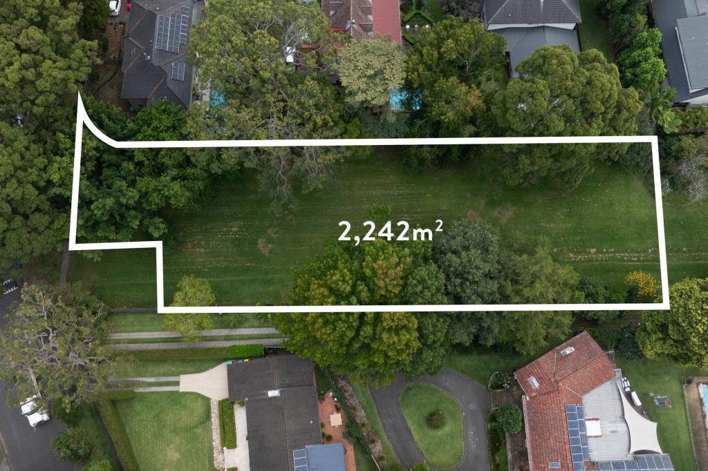 0
0 0
0 0
0Similar properties For Rent nearby
See more properties for rent nearby 0
0 0
0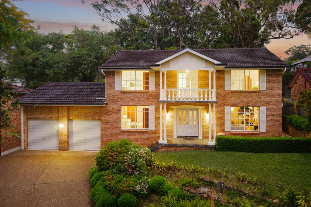 0
0About Wahroonga 2076
The size of Wahroonga is approximately 9.7 square kilometres. There are 36 parks, covering nearly 13.3% of the total area. The population of Wahroonga in 2016 was 17371 people. By 2021 the population was 17853 showing a population growth of 2.8% in the area during that time. The predominant age group in Wahroonga is 10-19 years. Households in Wahroonga are primarily couples with children and are likely to be repaying over $4000 per month on mortgage repayments. In general, people in Wahroonga work in a professional occupation.In 2021, 78.00% of the homes in Wahroonga were owner-occupied compared with 80.60% in 2016.
Wahroonga has 7,371 properties. Over the last 5 years, Houses in Wahroonga have seen a 6.04% increase in median value, while Units have seen a 21.98% increase. As at 30 June 2026:
- The median value for Houses in Wahroonga is $2,704,608 while the median value for Units is $1,143,615.
- Houses have a median rent of $1,349 while Units have a median rent of $745.
Suburb Insights for Wahroonga 2076
Market Insights
Wahroonga Trends for Houses
N/A
N/A
View TrendN/A
N/A
Wahroonga Trends for Units
N/A
N/A
View TrendN/A
N/A
Neighbourhood Insights
© Copyright 2026. RP Data Pty Ltd trading as Cotality (Cotality). All rights reserved. No reproduction, distribution, or transmission of the copyrighted materials is permitted. The information is deemed reliable but not guaranteed.
While Cotality uses commercially reasonable efforts to ensure the Cotality Data is current, Cotality does not warrant the accuracy, currency or completeness of the Cotality Data and to the full extent permitted by law excludes all loss or damage howsoever arising (including through negligence) in connection with the Cotality Data.
This product uses cookies and other similar technologies to improve and customise your browsing experience, to tailor content and adverts, and for analytics and metrics regarding visitor usage on this product and other media. We may share cookie and analytics information with third parties for the purposes of advertising. By continuing to use our website, you consent to cookies being used. View our Privacy Policy here.
X