
28 Seidel AvenuePicnic Point NSW 2213
Property Details for 28 Seidel Ave, Picnic Point
28 Seidel Ave, Picnic Point is a 4 bedroom, 2 bathroom House with 1 parking spaces. The property has a land size of 294m2. While the property is not currently for sale or for rent, it was last sold in June 2026. There are other 4 bedroom House sold in Picnic Point in the last 12 months.
Last Listing description (June 2026)
Revealing impressive proportions and impeccable, light-filled interiors, this quality 'Meadan Homes' build expertly captures sleek, contemporary luxury. Boasting a sought-after cul-de-sac address, it sits nearby reserves, cafs and Picnic Point Public School.
- Soaring ceilings frame exceptional, open plan family zones
- Stylish interiors infused with an abundance of natural light
- Gorgeous stone-top gas kitchen with coffee nook, breakfast bar
- Generous, well-appointed bedrooms with big built-in wardrobes
- Feature freestanding tub, rainfall showers to chic bathrooms
- Ducted air conditioning, main bedroom suite balcony, gas connections
- Modern, recently built home with incredible storage solutions
- Automatic garage with wall-spanning cabinetry, internal entry
- Sought after school catchment, close to parks and transport
Property History for 28 Seidel Ave, Picnic Point, NSW 2213
- 12 Jun 2026Sold
- 26 May 2026Listed for Sale Contact agent

Recent sales nearby
See more recent sales nearbySimilar properties For Sale nearby
See more properties for sale nearby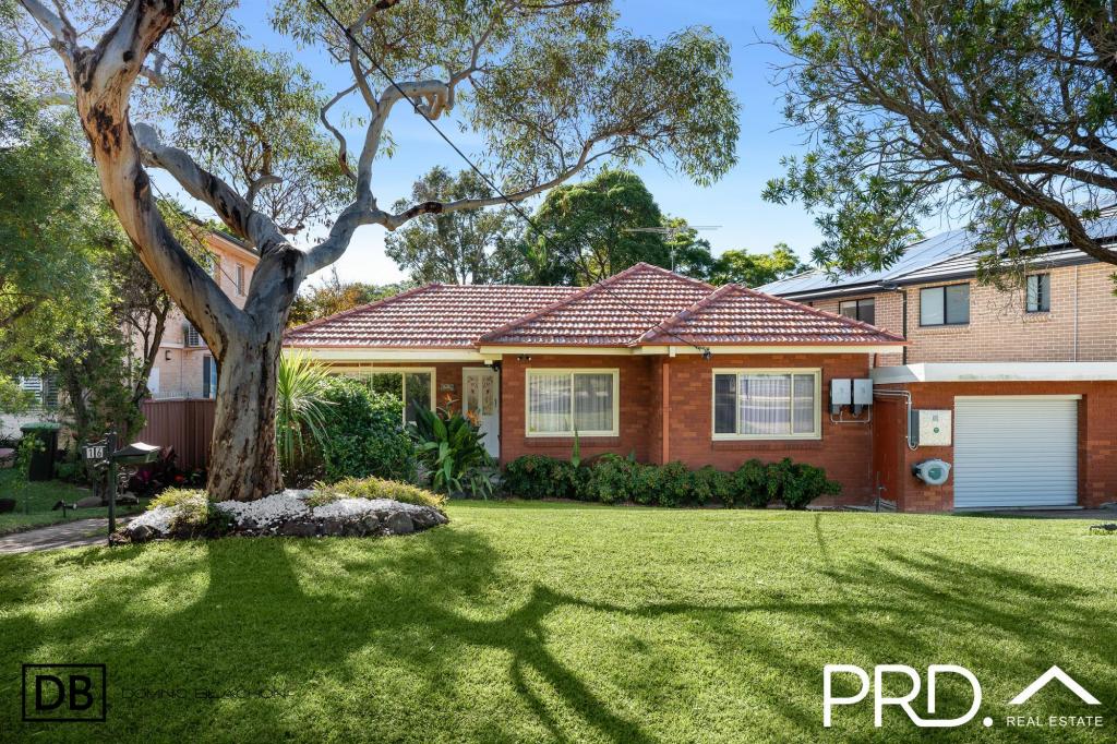 0
0 0
0 0
0Similar properties For Rent nearby
See more properties for rent nearby 0
0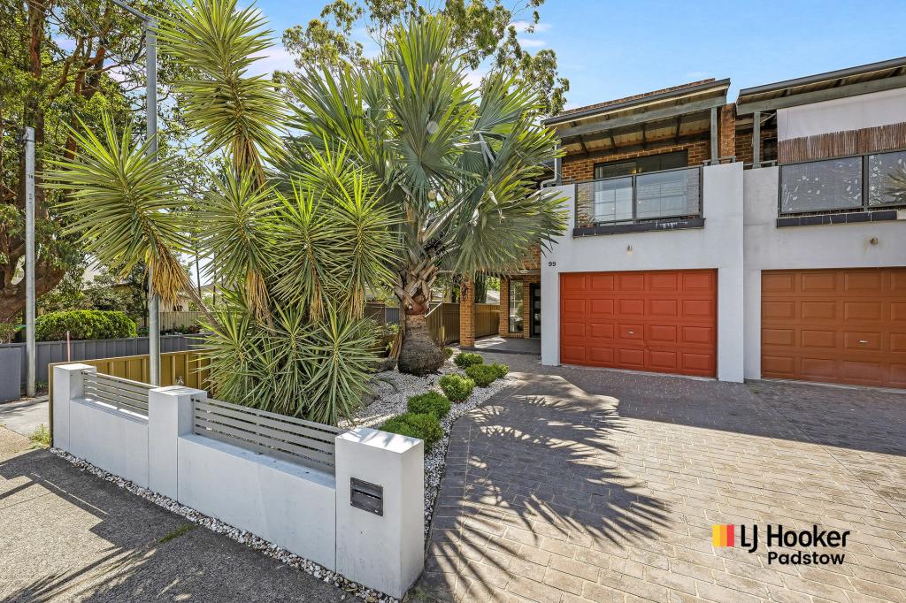 0
0 0
0About Picnic Point 2213
The size of Picnic Point is approximately 3.8 square kilometres. There are 9 parks, covering nearly 64.5% of the total area. The population of Picnic Point in 2016 was 6160 people. By 2021 the population was 6413 showing a population growth of 4.1% in the area during that time. The predominant age group in Picnic Point is 10-19 years. Households in Picnic Point are primarily couples with children and are likely to be repaying $3000 - $3999 per month on mortgage repayments. In general, people in Picnic Point work in a professional occupation.In 2021, 83.70% of the homes in Picnic Point were owner-occupied compared with 84.10% in 2016.
Picnic Point has 2,502 properties. Over the last 5 years, Houses in Picnic Point have seen a 31.54% increase in median value, while Units have seen a 45.38% increase. As at 30 June 2026:
- The median value for Houses in Picnic Point is $1,673,840 while the median value for Units is $1,210,920.
- Houses have a median rent of $965 while Units have a median rent of $860.
Suburb Insights for Picnic Point 2213
Market Insights
Picnic Point Trends for Houses
N/A
N/A
View TrendN/A
N/A
Picnic Point Trends for Units
N/A
N/A
View TrendN/A
N/A
Neighbourhood Insights
© Copyright 2026. RP Data Pty Ltd trading as Cotality (Cotality). All rights reserved. No reproduction, distribution, or transmission of the copyrighted materials is permitted. The information is deemed reliable but not guaranteed.
While Cotality uses commercially reasonable efforts to ensure the Cotality Data is current, Cotality does not warrant the accuracy, currency or completeness of the Cotality Data and to the full extent permitted by law excludes all loss or damage howsoever arising (including through negligence) in connection with the Cotality Data.
This product uses cookies and other similar technologies to improve and customise your browsing experience, to tailor content and adverts, and for analytics and metrics regarding visitor usage on this product and other media. We may share cookie and analytics information with third parties for the purposes of advertising. By continuing to use our website, you consent to cookies being used. View our Privacy Policy here.
X