
52C Henley StreetComo WA 6152
Property Details for 52c Henley St, Como
52c Henley St, Como is a 3 bedroom, 1 bathroom House with 1 parking spaces and was built in 1996. The property has a land size of 450m2 and floor size of 141m2. While the property is not currently for sale or for rent, it was last sold in January 2025.
Last Listing description (May 2026)
This is a once in 30 year opportunity to purchase this versatile home with solid foundation - built in 1996 for the original owner.
Set on 450sqm green title block - why pay strata fees when you can have total independence with this move in ready option?
Catering to a large array of buyer including downsizers, investors, or the perfect city base, there is huge potential to personalise and enhance future value add.
> Three bedrooms
> Semi-ensuite bathroom
> Two toilets
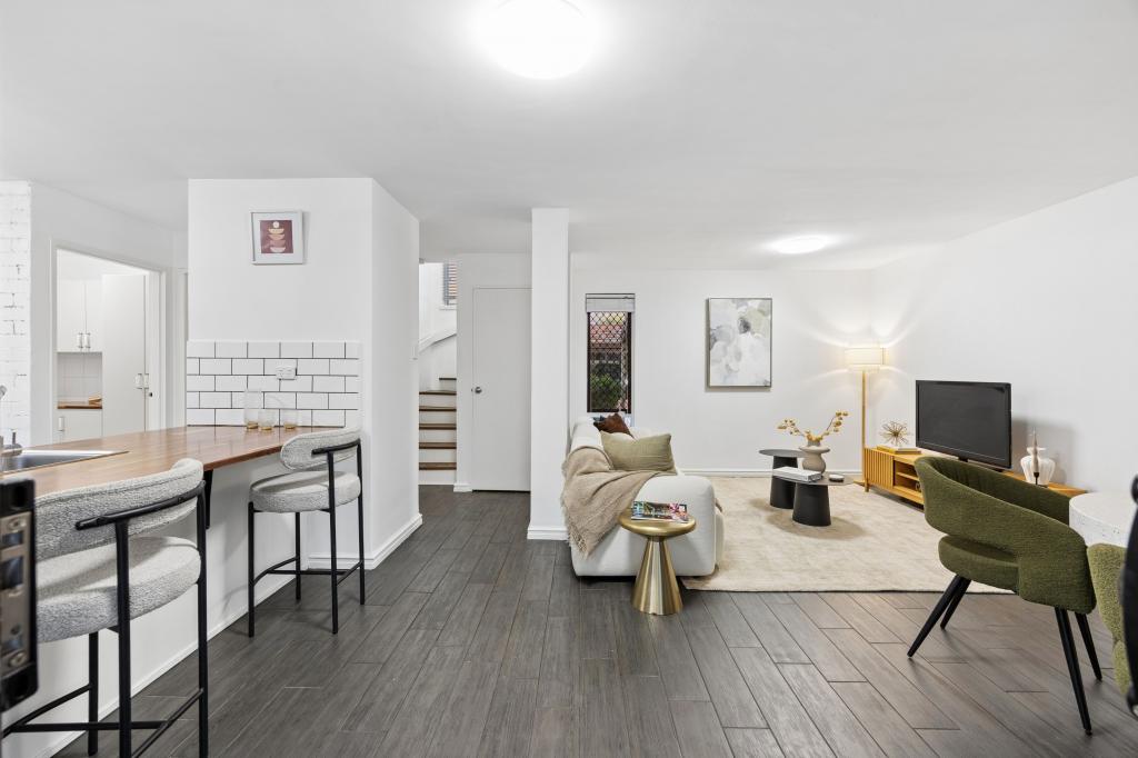
> Two separate living zones with open plan kitchen family meals
> Great yard space to enjoy and entertain from patio setting
> Single lock up garage with internal shoppers entrance and rear yard access.
> Bore reticulation
Quiet slip road access to this outstanding and sought after location a short stroll to McDonald park plus easy access to both train and bus stations. Great pre-school, primary and high schools at your fingertips plus Curtin University - all within walking distance.
OUTGOINGS:
Council Rates: $2,597.19 per annum approx.
Water Rates: $1,320.29 per annum approx.
Get in touch with Shaun Yeo on 0417 836 667 for more information or to receive an appraisal on your property.
Disclaimer: Whilst every care has been taken in preparing this advertisement and all information is provided in good faith, neither the agent nor the seller accept responsibility for any errors, omissions, or mis-descriptions. Prospective buyers should make their own independent enquiries to their full satisfaction in relation to the property prior to submitting an offer.Monday
Property History for 52c Henley St, Como, WA 6152
- 16 Jan 2025Sold for $1,086,000
- 08 Jan 2025Listed for Sale UNDER CONTRACT - Contact Agent
- 17 Oct 1995Sold for $120,000

Recent sales nearby
See more recent sales nearbySimilar properties For Sale nearby
See more properties for sale nearby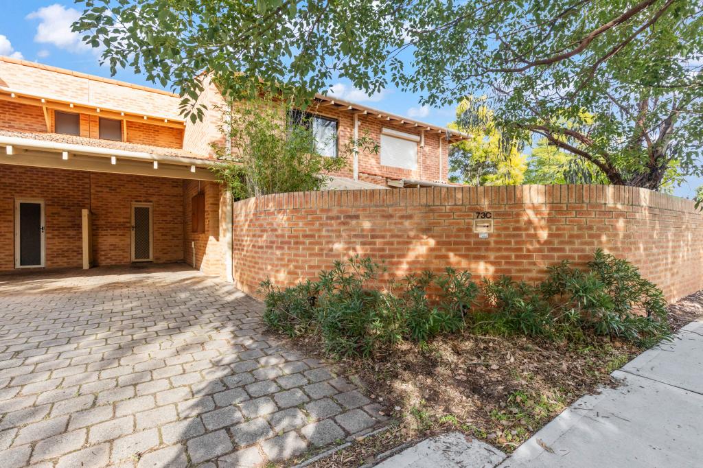 0
0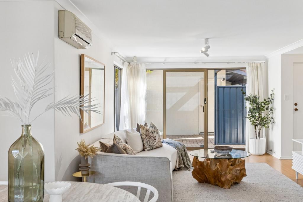 0
0
 0
0Similar properties For Rent nearby
See more properties for rent nearby 0
0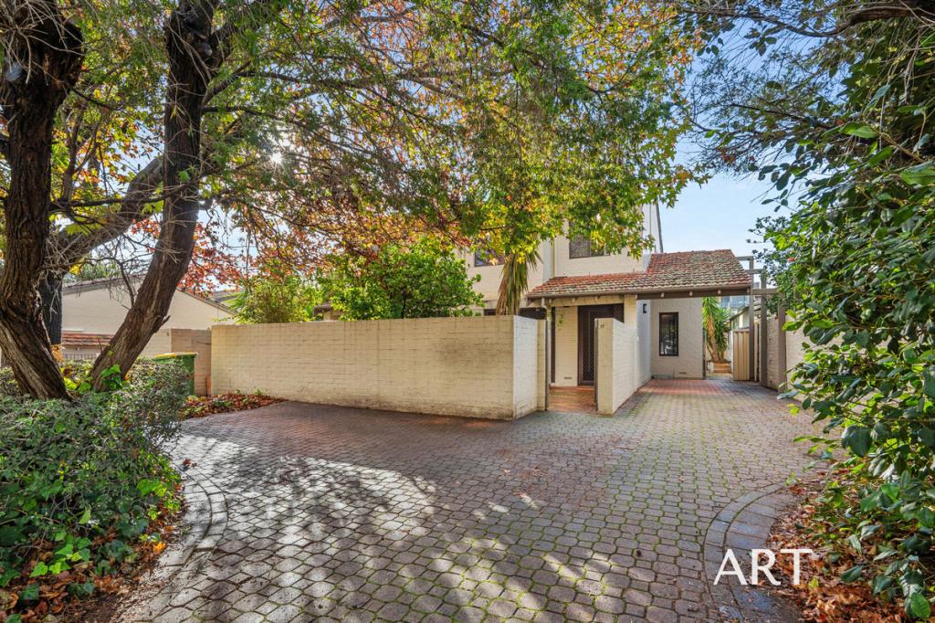 0
0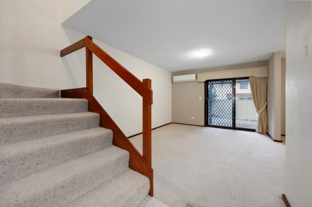 0
0About Como 6152
The size of Como is approximately 6.5 square kilometres. There are 16 parks, covering nearly 20.7% of the total area. The population of Como in 2016 was 14138 people. By 2021 the population was 14786 showing a population growth of 4.6% in the area during that time. The predominant age group in Como is 20-29 years. Households in Como are primarily childless couples and are likely to be repaying $1800 - $2399 per month on mortgage repayments. In general, people in Como work in a professional occupation.In 2021, 55.40% of the homes in Como were owner-occupied compared with 54.70% in 2016.
Como has 9,387 properties. Over the last 5 years, Houses in Como have seen a 79.00% increase in median value, while Units have seen a 88.80% increase. As at 30 June 2026:
- The median value for Houses in Como is $1,733,670 while the median value for Units is $902,795.
- Houses have a median rent of $880 while Units have a median rent of $700.
Suburb Insights for Como 6152
Market Insights
Como Trends for Houses
N/A
N/A
View TrendN/A
N/A
Como Trends for Units
N/A
N/A
View TrendN/A
N/A
Neighbourhood Insights
© Copyright 2026. RP Data Pty Ltd trading as Cotality (Cotality). All rights reserved. No reproduction, distribution, or transmission of the copyrighted materials is permitted. The information is deemed reliable but not guaranteed.
While Cotality uses commercially reasonable efforts to ensure the Cotality Data is current, Cotality does not warrant the accuracy, currency or completeness of the Cotality Data and to the full extent permitted by law excludes all loss or damage howsoever arising (including through negligence) in connection with the Cotality Data.
This product uses cookies and other similar technologies to improve and customise your browsing experience, to tailor content and adverts, and for analytics and metrics regarding visitor usage on this product and other media. We may share cookie and analytics information with third parties for the purposes of advertising. By continuing to use our website, you consent to cookies being used. View our Privacy Policy here.
X