
9 Edward StreetWesburn VIC 3799
Property Details for 9 Edward St, Wesburn
Last Listing description (July 2023)
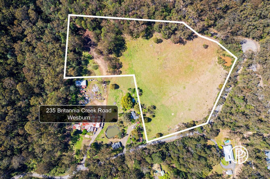
Nestled next to the Yarra State Forest this cleared land approx 5440 sqm (approx) with plans and permits.
Enjoy the Yarra Valley lifestyle just 90 minutes from Melbourne's CBD where you can build your new bush escape home with fire rating status
•Plans and Permits ready to build with power on site and available services close by for connection
•Well serviced by general store, restaurants and takeaway food outlets
•5km to Warburton Golf Course
•Wesburn Primary School 500 metre walk
•Direct entry to Yarra State Forest for walking, riding and family enjoyment
•Variety of shops, restaurants, hotels and nearby tourist attractions for visitors and friends
Note: Only one hour from snow play and sight seeing. Yankee Jim Creek next door. Yarra State Forest at your gate. Lots of duck, deer and other native wildlife grace the property with their presence. Contact Agent to meet onsite
Property History for 9 Edward St, Wesburn, VIC 3799
- 17 Jul 2023Listed for Sale Not Disclosed
- 11 Mar 2023Sold for $455,000
- 24 Feb 2023Listed for Sale $450,000 - $495,000
Recent sales nearby
See more recent sales nearbySimilar properties For Sale nearby
See more properties for sale nearby 0
0
 0
0
 0
0About Wesburn 3799
The size of Wesburn is approximately 40.9 square kilometres. There are 7 parks, covering nearly 65.1% of the total area. The population of Wesburn in 2016 was 1019 people. By 2021 the population was 1052 showing a population growth of 3.2% in the area during that time. The predominant age group in Wesburn is 50-59 years. Households in Wesburn are primarily couples with children and are likely to be repaying $1800 - $2399 per month on mortgage repayments. In general, people in Wesburn work in a trades occupation.In 2021, 83.10% of the homes in Wesburn were owner-occupied compared with 83.90% in 2016.
Wesburn has 475 properties. Over the last 5 years, Houses in Wesburn have seen a 1.17% increase in median value, while Units have seen a -4.42% decrease. As at 30 June 2026:
- The median value for Houses in Wesburn is $783,091 while the median value for Units is $459,389.
- Houses have a median rent of $315.
Suburb Insights for Wesburn 3799
Market Insights
Wesburn Trends for Houses
N/A
N/A
View TrendN/A
N/A
Wesburn Trends for Units
N/A
N/A
View TrendN/A
N/A
Neighbourhood Insights
© Copyright 2026. RP Data Pty Ltd trading as Cotality (Cotality). All rights reserved. No reproduction, distribution, or transmission of the copyrighted materials is permitted. The information is deemed reliable but not guaranteed.
While Cotality uses commercially reasonable efforts to ensure the Cotality Data is current, Cotality does not warrant the accuracy, currency or completeness of the Cotality Data and to the full extent permitted by law excludes all loss or damage howsoever arising (including through negligence) in connection with the Cotality Data.
This product uses cookies and other similar technologies to improve and customise your browsing experience, to tailor content and adverts, and for analytics and metrics regarding visitor usage on this product and other media. We may share cookie and analytics information with third parties for the purposes of advertising. By continuing to use our website, you consent to cookies being used. View our Privacy Policy here.
X