
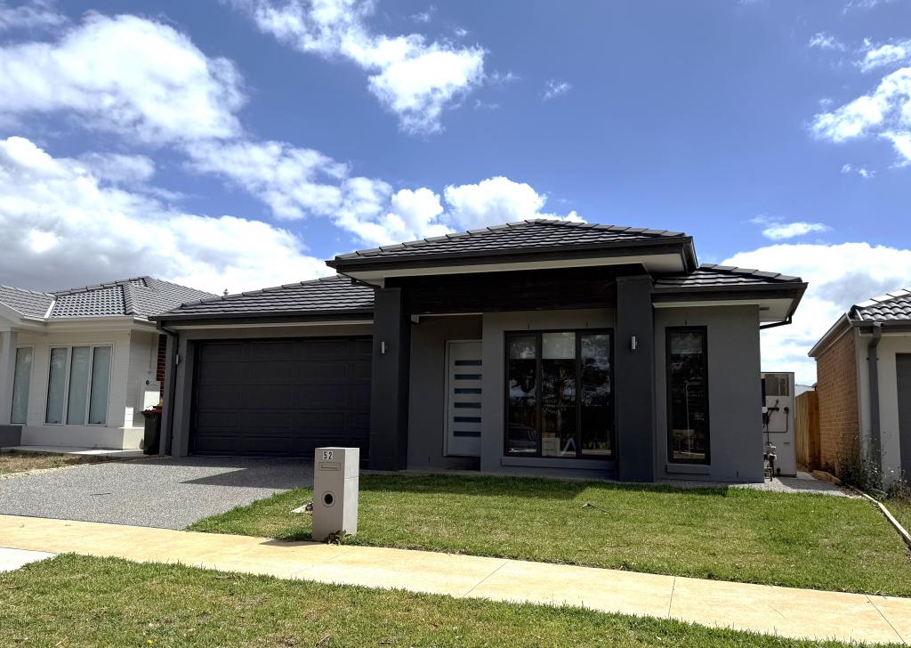
172 Copelands RoadWarragul VIC 3820
Property Details for 172 Copelands Rd, Warragul
172 Copelands Rd, Warragul is a 3 bedroom, 2 bathroom House and was built in 2012. The property has a land size of 130900m2. While the property is not currently for sale or for rent, it was last sold in March 2026. There are other 3 bedroom House sold in Warragul in the last 12 months.
Last Listing description (June 2026)
APPLY NOW: We invite prospective renters to apply prior to viewing for rental properties by filling out our digital application form at: https://www.2apply.com.au/agency?n=BPBerwick
Set within a larger acreage farm, this beautifully presented three bedroom plus study home offers space, privacy and a lifestyle feel that is hard to find. Positioned on approximately a quarter acre, the home is in incredible condition and has been exceptionally well cared for throughout.
Inside, the spacious front lounge provides a welcoming place to relax, complete with a split system and heater for year-round comfort. The kitchen is well equipped with an electric oven, stove and dishwasher, and overlooks the open plan living area, creating a practical central hub for everyday living.
The master bedroom is generously sized and features a walk-in robe and private ensuite, while the remaining bedrooms include built-in robes and are serviced by a central bathroom and separate toilet. A separate study offers flexibility for those working from home or needing extra space, while the separate laundry adds further convenience.
Additional features include a single lock-up remote garage and the benefit of a peaceful setting with plenty of outdoor space to enjoy.
Set in a peaceful semi-rural pocket of Warragul, this property offers the charm of country-style living while still being within easy reach of the Warragul town centre, local cafes, shops and transport options. The wider area is well connected, with local bus services running via Copelands Road and links through to Warragul Station, making it a rare opportunity to enjoy space, presentation and convenience in one appealing package
*access to the shed and farm is not included in the tenancy.
Property History for 172 Copelands Rd, Warragul, VIC 3820
- 22 May 2026Listed for Rent $560 / week
- 18 Mar 2026Sold
- 18 Sep 2025Listed for Sale $2,800,000

Recent sales nearby
See more recent sales nearby
Similar properties For Sale nearby
See more properties for sale nearby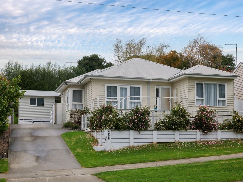 0
0 0
0
 0
0Similar properties For Rent nearby
See more properties for rent nearby 0
0

 0
0 0
0About Warragul 3820
The size of Warragul is approximately 55.0 square kilometres. There are 43 parks, covering nearly 4.4% of the total area. The population of Warragul in 2016 was 15757 people. By 2021 the population was 19856 showing a population growth of 26.0% in the area during that time. The predominant age group in Warragul is 30-39 years. Households in Warragul are primarily childless couples and are likely to be repaying $1400 - $1799 per month on mortgage repayments. In general, people in Warragul work in a professional occupation.In 2021, 74.70% of the homes in Warragul were owner-occupied compared with 72.70% in 2016.
Warragul has 13,153 properties. Over the last 5 years, Houses in Warragul have seen a 21.44% increase in median value, while Units have seen a 28.02% increase. As at 31 May 2026:
- The median value for Houses in Warragul is $733,227 while the median value for Units is $449,029.
- Houses have a median rent of $573 while Units have a median rent of $415.
Suburb Insights for Warragul 3820
Market Insights
Warragul Trends for Houses
N/A
N/A
View TrendN/A
N/A
Warragul Trends for Units
N/A
N/A
View TrendN/A
N/A
Neighbourhood Insights
© Copyright 2026. RP Data Pty Ltd trading as Cotality (Cotality). All rights reserved. No reproduction, distribution, or transmission of the copyrighted materials is permitted. The information is deemed reliable but not guaranteed.
While Cotality uses commercially reasonable efforts to ensure the Cotality Data is current, Cotality does not warrant the accuracy, currency or completeness of the Cotality Data and to the full extent permitted by law excludes all loss or damage howsoever arising (including through negligence) in connection with the Cotality Data.
This product uses cookies and other similar technologies to improve and customise your browsing experience, to tailor content and adverts, and for analytics and metrics regarding visitor usage on this product and other media. We may share cookie and analytics information with third parties for the purposes of advertising. By continuing to use our website, you consent to cookies being used. View our Privacy Policy here.
X