
26/789 Malvern RoadToorak VIC 3142
Property Details for 26/789 Malvern Rd, Toorak
26/789 Malvern Rd, Toorak is a 2 bedroom, 1 bathroom Unit with 1 parking spaces and was built in 1970. The property has a land size of 1658m2 and floor size of 65m2. While the property is not currently for sale or for rent, it was last sold in May 2025. There are other 2 bedroom Unit sold in Toorak in the last 12 months.
Last Listing description (July 2025)
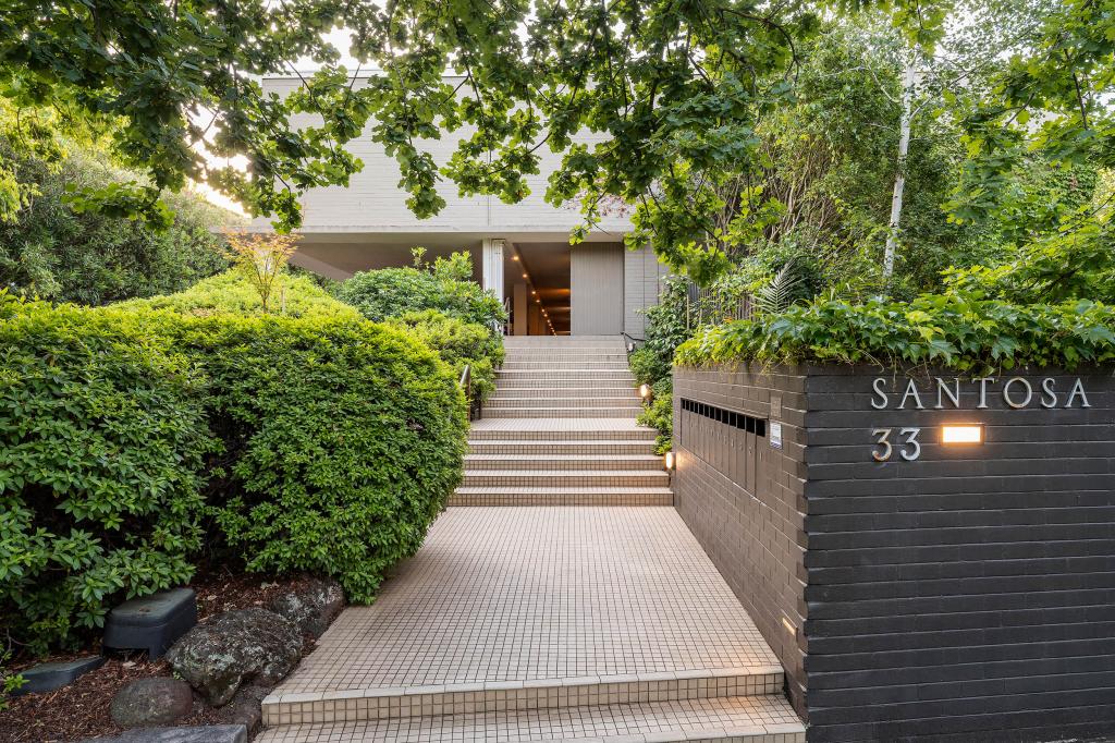
Tucked away in one of Toorak's most desirable pockets, this beautiful two-bedroom apartment combines privacy, practicality and an unbeatable location. Just moments from the boutique charm of Hawksburn Village, High Street, Armadale and Toorak Village, this inviting home offers a great, open outlook and secure off-street parking - the perfect inner-city sanctuary or investment opportunity.
The sizable kitchen connects to the dining and living area via a handy servery window. Large windows offers an abundance of northern natural light. Both bedrooms feature built in robes. The central bathroom has a shower over bath, great storage and separate WC.
Additional features include intercom entry, shared laundry facilities and off-street parking.
Enjoy easy access to vibrant cafes, fine dining, boutique shopping and lively bars with trams along Malvern Road and Toorak train station nearby ensuring a stress-free commute.
Whether you're seeking a serene home base or a solid investment, this apartment delivers on every front.
Property History for 26/789 Malvern Rd, Toorak, VIC 3142
- 29 May 2025Sold for $505,000
- 01 May 2025Listed for Sale Not Disclosed
- 25 Aug 2016Listed for Rent - Price not available

Recent sales nearby
See more recent sales nearbySimilar properties For Sale nearby
See more properties for sale nearby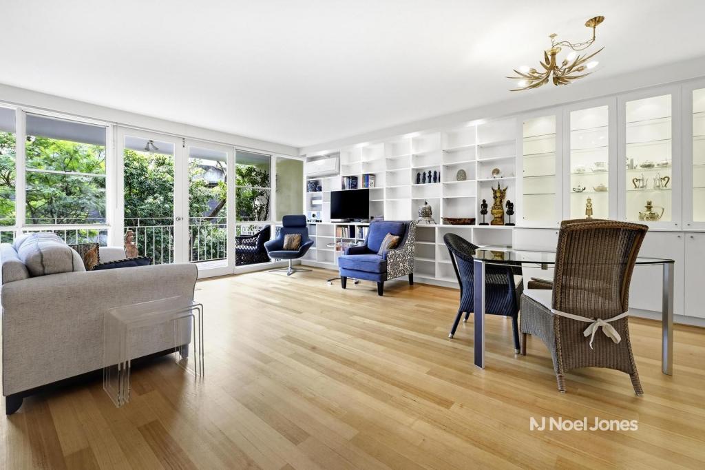 0
0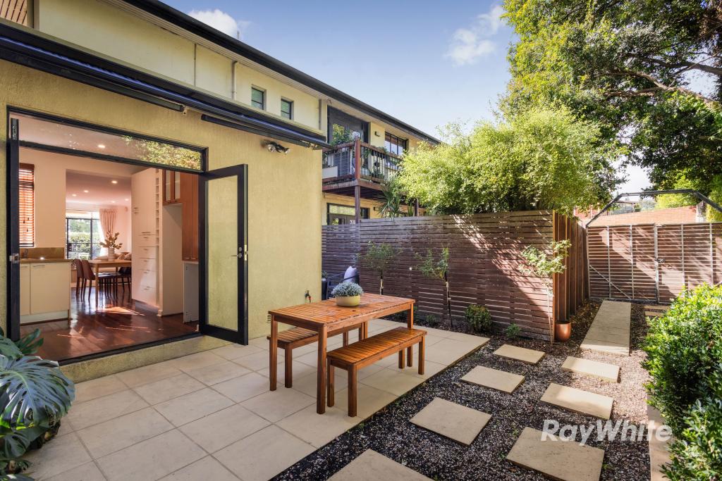 0
0
 0
0Similar properties For Rent nearby
See more properties for rent nearby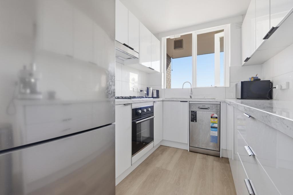 0
0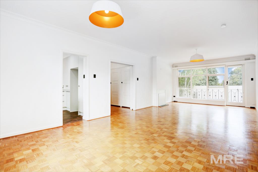 0
0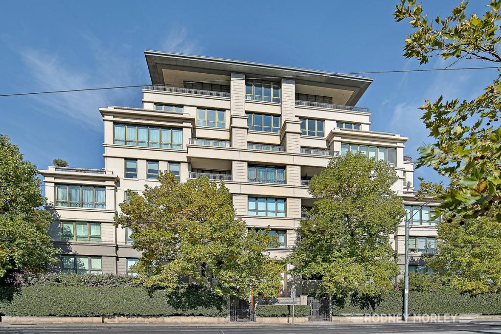 0
0About Toorak 3142
The size of Toorak is approximately 4.3 square kilometres. It has 10 parks covering nearly 3.1% of total area. The population of Toorak in 2016 was 12909 people. By 2021 the population was 12817 showing a population decline of 0.7% in the area during that time. The predominant age group in Toorak is 20-29 years. Households in Toorak are primarily childless couples and are likely to be repaying over $4000 per month on mortgage repayments. In general, people in Toorak work in a professional occupation.In 2021, 65.20% of the homes in Toorak were owner-occupied compared with 61.70% in 2016.
Toorak has 9,315 properties. Over the last 5 years, Houses in Toorak have seen a -11.69% decrease in median value, while Units have seen a 4.35% increase. As at 30 April 2026:
- The median value for Houses in Toorak is $4,401,350 while the median value for Units is $1,095,755.
- Houses have a median rent of $1,700 while Units have a median rent of $650.
Suburb Insights for Toorak 3142
Market Insights
Toorak Trends for Houses
N/A
N/A
View TrendN/A
N/A
Toorak Trends for Units
N/A
N/A
View TrendN/A
N/A
Neighbourhood Insights
© Copyright 2026. RP Data Pty Ltd trading as Cotality (Cotality). All rights reserved. No reproduction, distribution, or transmission of the copyrighted materials is permitted. The information is deemed reliable but not guaranteed.
While Cotality uses commercially reasonable efforts to ensure the Cotality Data is current, Cotality does not warrant the accuracy, currency or completeness of the Cotality Data and to the full extent permitted by law excludes all loss or damage howsoever arising (including through negligence) in connection with the Cotality Data.
This product uses cookies and other similar technologies to improve and customise your browsing experience, to tailor content and adverts, and for analytics and metrics regarding visitor usage on this product and other media. We may share cookie and analytics information with third parties for the purposes of advertising. By continuing to use our website, you consent to cookies being used. View our Privacy Policy here.
X