
6 Pine StreetThomastown VIC 3074

Property Details for 6 Pine St, Thomastown
6 Pine St, Thomastown is a 3 bedroom, 2 bathroom House with 4 parking spaces. The property has a land size of 643m2. While the property is not currently for sale or for rent, it was last sold in March 2026. There are other 3 bedroom House sold in Thomastown in the last 12 months.
Last Listing description (March 2026)
Positioned in an established pocket of Thomastown, this well-maintained residence offers generous proportions, multiple living zones and outstanding flexibility for families, first home buyers or investors.
Set on a substantial 643m2 (approx.) allotment, the home provides exceptional space both inside and out, with ample scope for future enhancement, extension or redevelopment subject to council approval.
The functional floorplan comprises three well sized bedrooms, including an oversized main bedroom with built in wardrobes. A central bathroom with bathtub services the home, while the practical layout ensures comfortable everyday living.
A spacious living room with open fireplace in working condition flows through to the adjoining dining area, creating a warm and inviting setting for relaxing or entertaining. The kitchen provides ample bench space and storage, positioned conveniently to service both dining and outdoor zones.
Hardwood floorboards throughout enhance the character of the home, while ducted heating and evaporative cooling ensure year-round comfort.
Step outside to discover a pergola area ideal for year-round gatherings, complemented by a double garage or workshop, additional carport, and separate shed, offering exceptional storage and workspace options across the expansive rear yard.
Property Features:
* Three spacious bedrooms, all with built in wardrobes
* Oversized main bedroom
* Central bathroom with bathtub
* Large living room with open fireplace in working condition
* Separate dining area adjoining kitchen
* Well-proportioned kitchen with ample storage
* Hardwood floorboards throughout
* Ducted heating and evaporative cooling throughout
* Full laundry with second shower
* Light filled atrium
* Pergola for outdoor entertaining
* Double garage or workshop plus carport
* Additional shed for storage
* Generous 643m2 (approx.) allotment
Extras You'll Love:
* Multiple indoor and outdoor living zones
* Excellent garage and workshop space for trades or hobbies
* Functional floorplan with clearly defined living areas
* Established residential setting
Location Benefits:
* Close to local schools and childcare facilities
* Moments to shops, cafes and everyday amenities
* Easy access to public transport options
* Convenient access to major road arterials
Whether you are looking to move straight in, renovate, or invest, 6 Pine Street presents an outstanding opportunity in a consistently sought after location.
Due diligence checklist - for home and residential property buyers
http://www.consumer.vic.gov.au/duediligencechecklist
Property History for 6 Pine St, Thomastown, VIC 3074
- 28 Mar 2026Sold for $770,000
- 27 Feb 2026Listed for Sale Contact Agent
- 05 Jan 2008Sold for $307,000

Recent sales nearby
See more recent sales nearbySimilar properties For Sale nearby
See more properties for sale nearby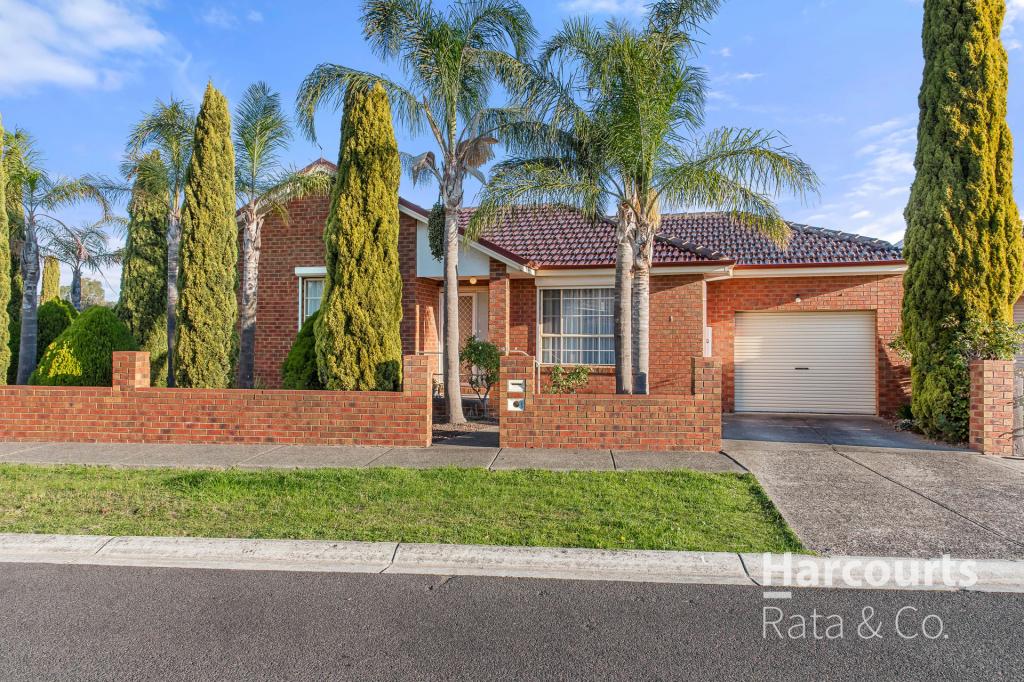 0
0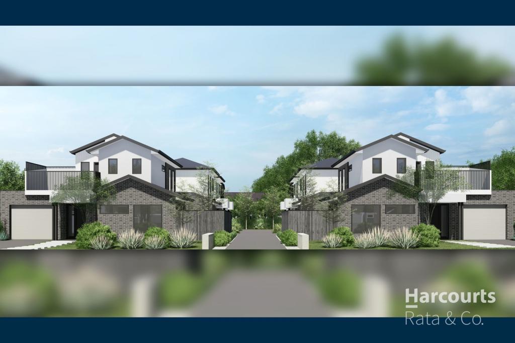 0
0
 0
0Similar properties For Rent nearby
See more properties for rent nearby 0
0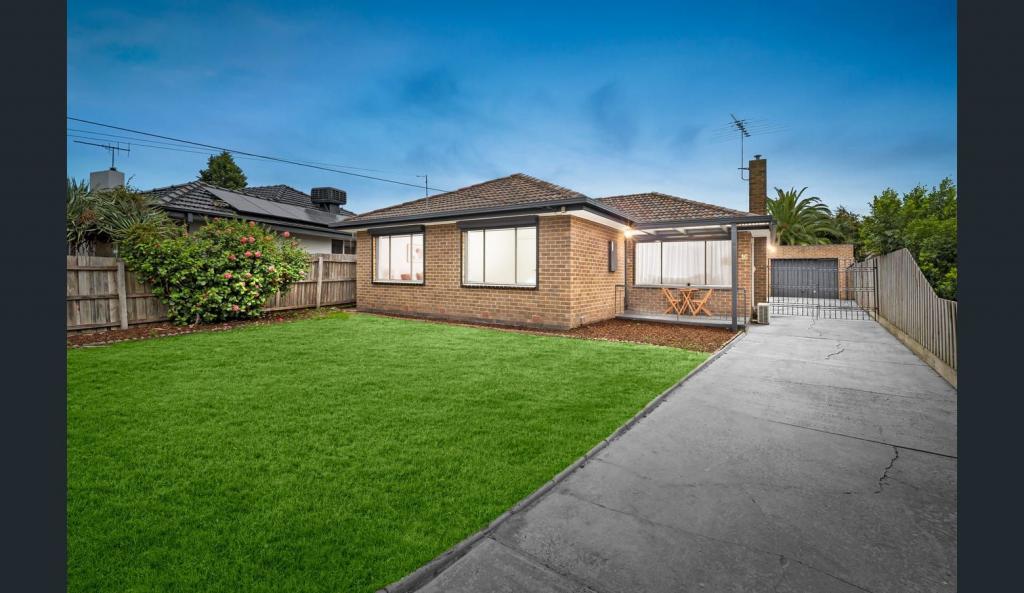 0
0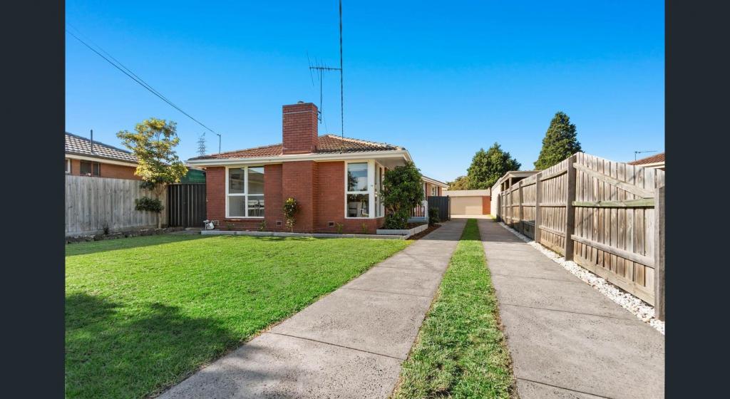 0
0About Thomastown 3074
The size of Thomastown is approximately 14.7 square kilometres. There are 23 parks, covering nearly 4.0% of the total area. The population of Thomastown in 2016 was 20523 people. By 2021 the population was 20234 showing a population decline of 1.4% in the area during that time. The predominant age group in Thomastown is 30-39 years. Households in Thomastown are primarily couples with children and are likely to be repaying $1800 - $2399 per month on mortgage repayments. In general, people in Thomastown work in a trades occupation.In 2021, 67.80% of the homes in Thomastown were owner-occupied compared with 68.50% in 2016.
Thomastown has 12,115 properties. Over the last 5 years, Houses in Thomastown have seen a 14.66% increase in median value, while Units have seen a 18.43% increase. As at 31 May 2026:
- The median value for Houses in Thomastown is $791,273 while the median value for Units is $541,486.
- Houses have a median rent of $530 while Units have a median rent of $483.
Suburb Insights for Thomastown 3074
Market Insights
Thomastown Trends for Houses
N/A
N/A
View TrendN/A
N/A
Thomastown Trends for Units
N/A
N/A
View TrendN/A
N/A
Neighbourhood Insights
© Copyright 2026. RP Data Pty Ltd trading as Cotality (Cotality). All rights reserved. No reproduction, distribution, or transmission of the copyrighted materials is permitted. The information is deemed reliable but not guaranteed.
While Cotality uses commercially reasonable efforts to ensure the Cotality Data is current, Cotality does not warrant the accuracy, currency or completeness of the Cotality Data and to the full extent permitted by law excludes all loss or damage howsoever arising (including through negligence) in connection with the Cotality Data.
This product uses cookies and other similar technologies to improve and customise your browsing experience, to tailor content and adverts, and for analytics and metrics regarding visitor usage on this product and other media. We may share cookie and analytics information with third parties for the purposes of advertising. By continuing to use our website, you consent to cookies being used. View our Privacy Policy here.
X