
36-38 Seachange WaySt Leonards VIC 3223
Property Details for 36-38 Seachange Way, St Leonards
Last Listing description (May 2022)
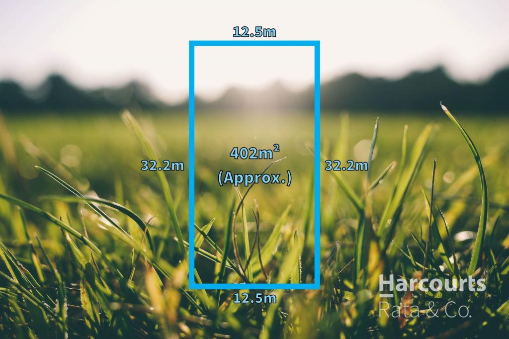
Dare to live your dream lifestyle and purchase this fantastic allotment located within the 'original' Seachange Estate. Boasting a 37.9m frontage and 19.5m depth, blocks this large are rarely seen in modern times and highly sought-after, so be sure to act fast.
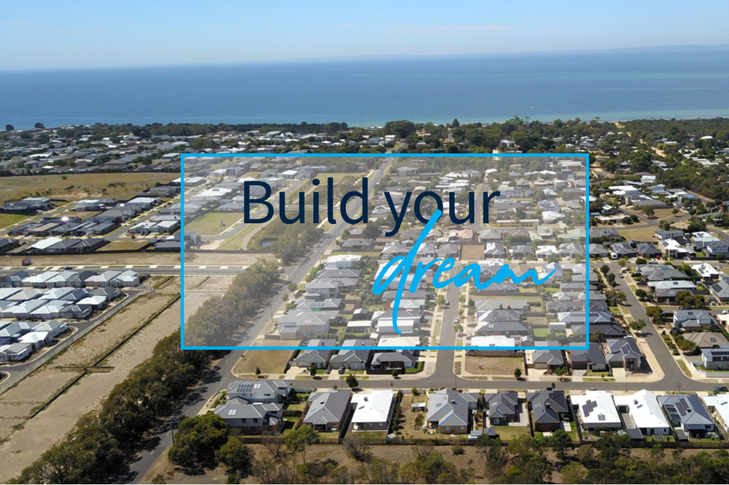
Located less than 550m walk to the sparkling beaches of Port Phillip Bay and a short drive to the idyllic township of St Leonards this block offers the ideal location for your beach home or permanent residence by the coast.
This stellar allotment is titled and ready to build. A double storey build could potentially take in views of the picturesque bay across existing houses and with 740m2 (approx.) of build space you will have plenty of room to move.
Vacant allotments situated in the early stages of Seachange Estate are becoming rare so be sure to inquire today.
Property History for 36-38 Seachange Way, St Leonards, VIC 3223
- 10 May 2022Sold for $710,000
- 17 Mar 2022Listed for Sale UNDER OFFER
- 22 Oct 2010Listed for Sale 250000
Recent sales nearby
See more recent sales nearbySimilar properties For Sale nearby
See more properties for sale nearby
 0
0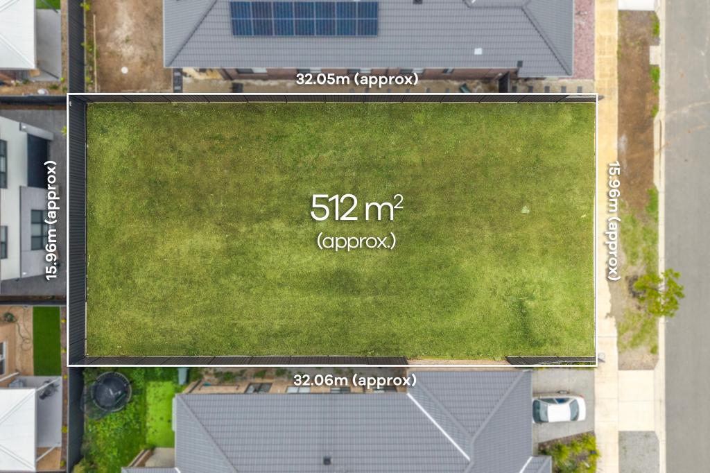 0
0
 0
0
Similar properties For Rent nearby
See more properties for rent nearby 0
0 0
0About St Leonards 3223
The size of St Leonards is approximately 28.5 square kilometres. There are 13 parks, covering nearly 9.9% of the total area. The population of St Leonards in 2016 was 2480 people. By 2021 the population was 3542 showing a population growth of 42.8% in the area during that time. The predominant age group in St Leonards is 60-69 years. Households in St Leonards are primarily childless couples and are likely to be repaying $1400 - $1799 per month on mortgage repayments. In general, people in St Leonards work in a professional occupation.In 2021, 73.30% of the homes in St Leonards were owner-occupied compared with 71.60% in 2016.
St Leonards has 5,628 properties. Over the last 5 years, Houses in St Leonards have seen a 13.09% increase in median value, while Units have seen a -3.43% decrease. As at 31 May 2026:
- The median value for Houses in St Leonards is $791,410 while the median value for Units is $513,583.
- Houses have a median rent of $530 while Units have a median rent of $430.
Suburb Insights for St Leonards 3223
Market Insights
St Leonards Trends for Houses
N/A
N/A
View TrendN/A
N/A
St Leonards Trends for Units
N/A
N/A
View TrendN/A
N/A
Neighbourhood Insights
© Copyright 2026. RP Data Pty Ltd trading as Cotality (Cotality). All rights reserved. No reproduction, distribution, or transmission of the copyrighted materials is permitted. The information is deemed reliable but not guaranteed.
While Cotality uses commercially reasonable efforts to ensure the Cotality Data is current, Cotality does not warrant the accuracy, currency or completeness of the Cotality Data and to the full extent permitted by law excludes all loss or damage howsoever arising (including through negligence) in connection with the Cotality Data.
This product uses cookies and other similar technologies to improve and customise your browsing experience, to tailor content and adverts, and for analytics and metrics regarding visitor usage on this product and other media. We may share cookie and analytics information with third parties for the purposes of advertising. By continuing to use our website, you consent to cookies being used. View our Privacy Policy here.
X