
6 Kennington RiseGisborne VIC 3437
Property Details for 6 Kennington Rise, Gisborne
6 Kennington Rise, Gisborne is a 6 bedroom, 4 bathroom House with 3 parking spaces and was built in 2006. The property has a land size of 2242m2 and floor size of 345m2. While the property is not currently for sale or for rent, it was last sold in May 2023.
Last Listing description (June 2023)
This single level 6 bedroom plus study home sits proudly on its 2,241 square metres (approx.) in a delightful location. The design is clever, offering a big family loads of privacy, yet ease of connection with its big western wing and its smaller, but practical and inter-connected eastern wing.
Everything is here excellent garaging for 3 cars, timber flooring, BIR's, ceiling fans, gas ducted heating, split systems, a range of bathrooms, two fine kitchens, quality fittings and fixtures, peaceful and private places within, lovely decks overlooking the pretty landscaped gardens, a covered al fresco area, marvellous enclosed swimming pool complex and excellent storage for a caravan or boat.
This home suits a big family or perhaps, a family considering an independent dual living arrangement or indeed, a B&B (STCA). This design is one of a kind and simply put, would satisfy discerning buyers seeking a relaxed holiday-style future.
Property History for 6 Kennington Rise, Gisborne, VIC 3437
- 30 May 2023Sold for $1,485,000
- 19 Jun 2021Sold for $600,000
- 18 Sep 2020Sold for $1,150,000

Recent sales nearby
See more recent sales nearby
Similar properties For Sale nearby
See more properties for sale nearby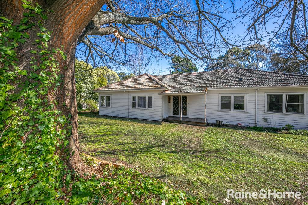 0
0
 0
0
 0
0
Similar properties For Rent nearby
See more properties for rent nearby 0
0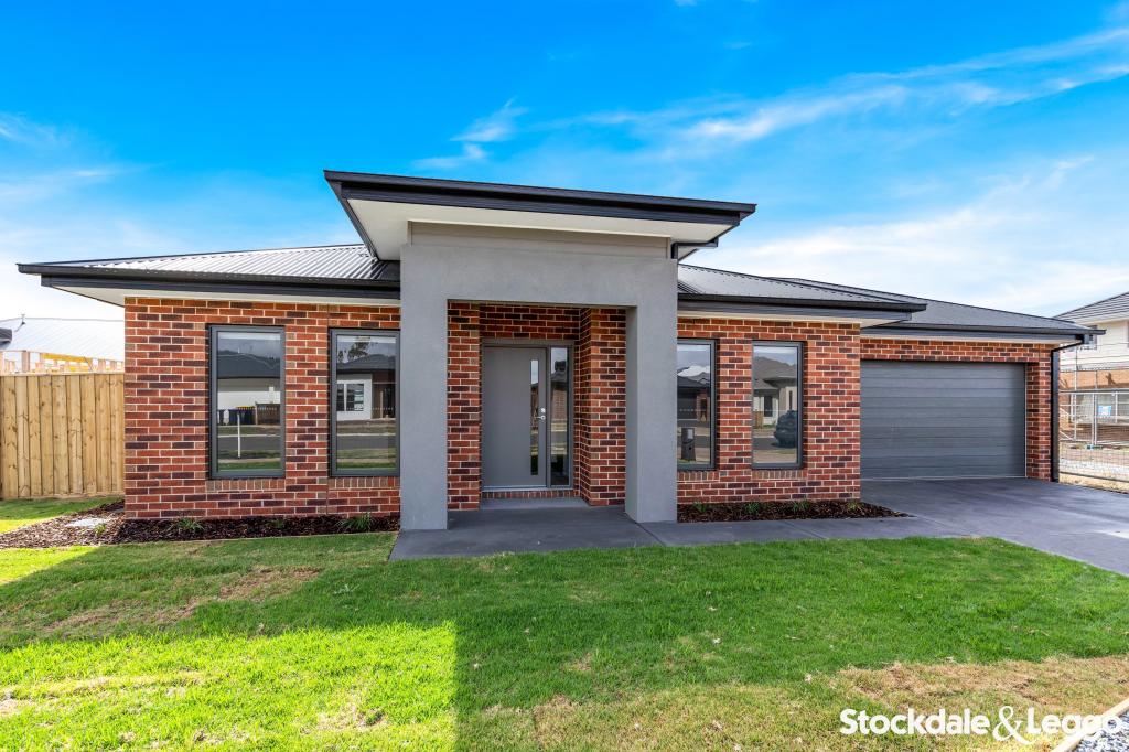 0
0
 0
0About Gisborne 3437
The size of Gisborne is approximately 96.4 square kilometres. It has 33 parks covering nearly 38.2% of total area. The population of Gisborne in 2016 was 8999 people. By 2021 the population was 10142 showing a population growth of 12.7% in the area during that time. The predominant age group in Gisborne is 40-49 years. Households in Gisborne are primarily couples with children and are likely to be repaying $1800 - $2399 per month on mortgage repayments. In general, people in Gisborne work in a professional occupation.In 2021, 82.20% of the homes in Gisborne were owner-occupied compared with 80.20% in 2016.
Gisborne has 6,048 properties. Over the last 5 years, Houses in Gisborne have seen a 19.92% increase in median value, while Units have seen a 9.22% increase. As at 31 December 2025:
- The median value for Houses in Gisborne is $1,040,145 while the median value for Units is $608,657.
- Houses have a median rent of $650 while Units have a median rent of $495.
Suburb Insights for Gisborne 3437
Market Insights
Gisborne Trends for Houses
N/A
N/A
View TrendN/A
N/A
Gisborne Trends for Units
N/A
N/A
View TrendN/A
N/A
Neighbourhood Insights
© Copyright 2026. RP Data Pty Ltd trading as Cotality (Cotality). All rights reserved. No reproduction, distribution, or transmission of the copyrighted materials is permitted. The information is deemed reliable but not guaranteed.
While Cotality uses commercially reasonable efforts to ensure the Cotality Data is current, Cotality does not warrant the accuracy, currency or completeness of the Cotality Data and to the full extent permitted by law excludes all loss or damage howsoever arising (including through negligence) in connection with the Cotality Data.
This product uses cookies and other similar technologies to improve and customise your browsing experience, to tailor content and adverts, and for analytics and metrics regarding visitor usage on this product and other media. We may share cookie and analytics information with third parties for the purposes of advertising. By continuing to use our website, you consent to cookies being used. View our Privacy Policy here.
X