
11 Punt RoadCobram VIC 3644
Property Details for 11 Punt Rd, Cobram
11 Punt Rd, Cobram is a 3 bedroom, 2 bathroom House with 2 parking spaces. The property has a land size of 749m2 and floor size of 164m2. While the property is not currently for sale or for rent, it was last sold in May 2011.
Last Listing description (July 2011)
For Sale Now Or By Auction - Saturday 9th April, 2011 - 11am On Site
For Sale Now Or By Auction
* Well located lifestyle home
* All bedrooms are spacious with built in robes
* Main with ensuite & large walk in robe
* Well appointed kitchen with quality appliances
* Spacious open plan family living area
* Ducted gas heating & ducted cooling
* Magnificent resort style backyard with heated pool & spa set amongst beautiful palms & ferns in a very private setting
* Auto sprinkler system
* Double carport
* A must to inspect ...
General Features:
- Property Type: House
- Bedrooms: 4
- Bathrooms: 2
Indoor Features:
- Ensuite: 1
- Toilets: 2
- Alarm System
- Ducted Vacuum System
- Workshop
- Built-in Wardrobes
- Air Conditioning
- Gas Heating
- Ducted Heating
- Ducted Cooling
Outdoor Features:
- Carport Spaces: 2
- Swimming Pool - Inground
- Outdoor Entertaining Area
- Fully Fenced
- Outside Spa
Property History for 11 Punt Rd, Cobram, VIC 3644
- 16 May 2011Sold for $240,000
- 25 Jul 2010Listed for Rent - Price not available
- 20 Feb 2010Listed for Sale Not Disclosed

Recent sales nearby
See more recent sales nearbySimilar properties For Sale nearby
See more properties for sale nearby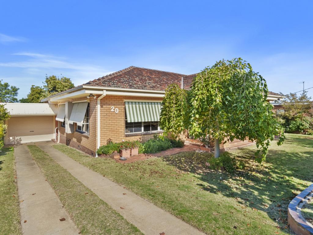 0
0 0
0 0
0Similar properties For Rent nearby
See more properties for rent nearby 0
0 0
0 0
0About Cobram 3644
The size of Cobram is approximately 83.0 square kilometres. There are 15 parks, covering nearly 4.9% of the total area. The population of Cobram in 2016 was 6014 people. By 2021 the population was 6148 showing a population growth of 2.2% in the area during that time. The predominant age group in Cobram is 60-69 years. Households in Cobram are primarily childless couples and are likely to be repaying $1000 - $1399 per month on mortgage repayments. In general, people in Cobram work in a labourer occupation.In 2021, 67.10% of the homes in Cobram were owner-occupied compared with 65.80% in 2016.
Cobram has 4,263 properties. Over the last 5 years, Houses in Cobram have seen a 54.23% increase in median value, while Units have seen a 30.61% increase. As at 31 May 2026:
- The median value for Houses in Cobram is $494,093 while the median value for Units is $312,922.
- Houses have a median rent of $480 while Units have a median rent of $350.
Suburb Insights for Cobram 3644
Market Insights
Cobram Trends for Houses
N/A
N/A
View TrendN/A
N/A
Cobram Trends for Units
N/A
N/A
View TrendN/A
N/A
Neighbourhood Insights
© Copyright 2026. RP Data Pty Ltd trading as Cotality (Cotality). All rights reserved. No reproduction, distribution, or transmission of the copyrighted materials is permitted. The information is deemed reliable but not guaranteed.
While Cotality uses commercially reasonable efforts to ensure the Cotality Data is current, Cotality does not warrant the accuracy, currency or completeness of the Cotality Data and to the full extent permitted by law excludes all loss or damage howsoever arising (including through negligence) in connection with the Cotality Data.
This product uses cookies and other similar technologies to improve and customise your browsing experience, to tailor content and adverts, and for analytics and metrics regarding visitor usage on this product and other media. We may share cookie and analytics information with third parties for the purposes of advertising. By continuing to use our website, you consent to cookies being used. View our Privacy Policy here.
X