
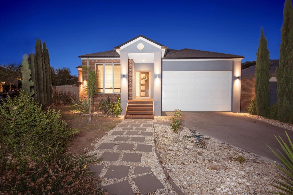
28 Stanthorp StreetBurnside Heights VIC 3023
Property Details for 28 Stanthorp St, Burnside Heights
28 Stanthorp St, Burnside Heights is a 4 bedroom, 2 bathroom House with 2 parking spaces and was built in 2008. The property has a land size of 600m2 and floor size of 171m2. While the property is not currently for sale or for rent, it was last sold in May 2025.
Last Listing description (September 2025)
This light filled home is filled with warmth & flexibility and built for a family lifestyle of convenience & comfort on approx 615m2 of prime land.
Ideally located near Kororoit Creek Primary School, Inglewood park, public transport & within close proximity to all amenities Burnside Heights & surrounds has to offer including; Gilson College, sporting grounds, parklands, Water Vale shopping precinct, local cafe's, restaurants, medical facilities, West Waters Hotel & dining precinct making this property a priority to inspect!
Providing a great opportunity to purchase an established home in a high demand area.
- Comprising of 4 bedrooms, master suite with double vanity ensuite & walk in robe.
- Well-appointed kitchen with stone bench tops, quality appliances, 900mm electric oven with gas cooktop, rangehood, dishwasher.
- Adjoining meals & generous family area.
- Separate retreat/study/office area.
- Double remote garage with internal access.
- Side access for boats, caravans & trailers.
- Enclosed alfresco & entertaining area, ideal for outdoor dining with family & friends
- Large grassed area, established trees.
Extra features include: 4 split systems for heating/ cooling), approx 6.6kw (18 panels) solar power, security system with alarm & cameras, floorboards & so much more!
PHOTO ID REQUIRED
Due diligence checklist - consumer.vic.gov.au/duediligencechecklist
Privacy Policy and Privacy Collection Notice - rataandco.com.au/privacy-policy
Material Facts - please refer to the contract of sale and vendor statement for material facts.
Land size sourced from land.vic.gov.au. This document has been prepared to assist solely in the marketing of this property.
While all care has been taken to ensure the information provided herein is correct, Harcourts Rata & Co takes no responsibility for any inaccuracies.
Accordingly all interested parties should make their own enquiries to verify the information, including and not limited to land size.
Property History for 28 Stanthorp St, Burnside Heights, VIC 3023
- 26 May 2025Sold for $870,000
- 15 Apr 2025Listed for Sale Private Sale - By Negotiation
- 09 Oct 2017Listed for Rent $460 / week

Recent sales nearby
See more recent sales nearbySimilar properties For Sale nearby
See more properties for sale nearby 0
0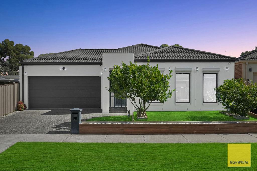 0
0 0
0
Similar properties For Rent nearby
See more properties for rent nearby 0
0 0
0
 0
0About Burnside Heights 3023
The size of Burnside Heights is approximately 2.0 square kilometres. There are 9 parks, covering nearly 27.1% of the total area. The population of Burnside Heights in 2016 was 6072 people. By 2021 the population was 6377 showing a population growth of 5.0% in the area during that time. The predominant age group in Burnside Heights is 0-9 years. Households in Burnside Heights are primarily couples with children and are likely to be repaying $1800 - $2399 per month on mortgage repayments. In general, people in Burnside Heights work in a professional occupation.In 2021, 79.90% of the homes in Burnside Heights were owner-occupied compared with 78.10% in 2016.
Burnside Heights has 1,896 properties. Over the last 5 years, Houses in Burnside Heights have seen a 16.52% increase in median value, while Units have seen a 21.23% increase. As at 31 May 2026:
- The median value for Houses in Burnside Heights is $829,128 while the median value for Units is $627,337.
- Houses have a median rent of $570 while Units have a median rent of $580.
Suburb Insights for Burnside Heights 3023
Market Insights
Burnside Heights Trends for Houses
N/A
N/A
View TrendN/A
N/A
Burnside Heights Trends for Units
N/A
N/A
View TrendN/A
N/A
Neighbourhood Insights
© Copyright 2026. RP Data Pty Ltd trading as Cotality (Cotality). All rights reserved. No reproduction, distribution, or transmission of the copyrighted materials is permitted. The information is deemed reliable but not guaranteed.
While Cotality uses commercially reasonable efforts to ensure the Cotality Data is current, Cotality does not warrant the accuracy, currency or completeness of the Cotality Data and to the full extent permitted by law excludes all loss or damage howsoever arising (including through negligence) in connection with the Cotality Data.
This product uses cookies and other similar technologies to improve and customise your browsing experience, to tailor content and adverts, and for analytics and metrics regarding visitor usage on this product and other media. We may share cookie and analytics information with third parties for the purposes of advertising. By continuing to use our website, you consent to cookies being used. View our Privacy Policy here.
X