
283 Wyre Forest RoadMolesworth TAS 7140
Property Details for 283 Wyre Forest Rd, Molesworth
Last Listing description (May 2023)
This stunning property is being offered to the market which is approximately 12.1 hectares of both pasture and bushland. Located at the end of Wyre Forest Road, Molesworth where you can build your dream home. There are some excellent building sites, two dams, a running creek through winter, an abundance of wildlife, walking tracks, and excellent fertile soil.
The property, situated on 2 lots all on 1 title, also offers power, a flushing toilet on a septic, a wood heater, a shower, and a kitchen, you could utilise this area while planning your new build. Three of the boundaries are boarded by Crown land, giving you excellent privacy and tranquillity. There is good fencing, with some repairs needed. This property is also located an easy drive to both the town of New Norfolk and Glenorchy. For more information, please give me a call.
Roberts Real Estate have obtained all information in this document from sources considered to be reliable; however, we cannot guarantee its accuracy.
Property History for 283 Wyre Forest Rd, Molesworth, TAS 7140
- 19 Jan 2023Sold for $325,000
- 17 Oct 2022Listed for Sale Expressions of Interest above $355,000
- 08 Feb 2018Sold for $30,000
Recent sales nearby
See more recent sales nearbySimilar properties For Sale nearby
See more properties for sale nearby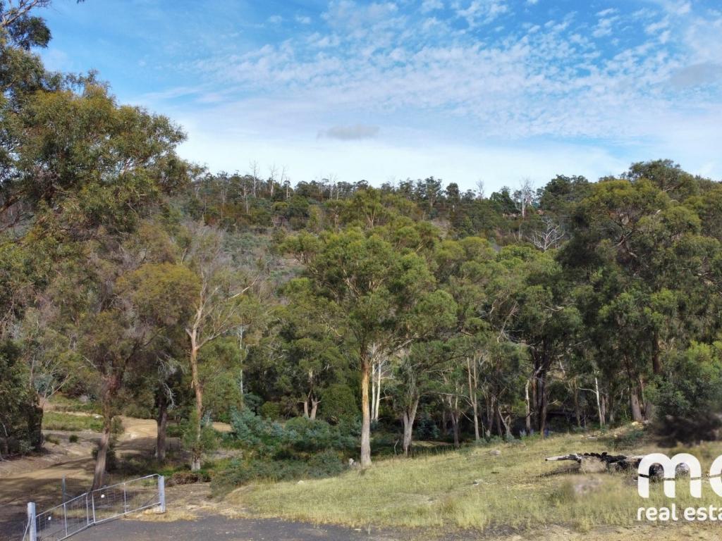 0
0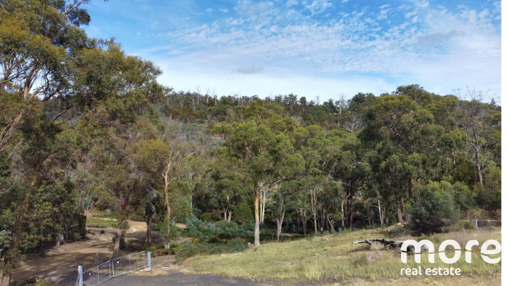 0
0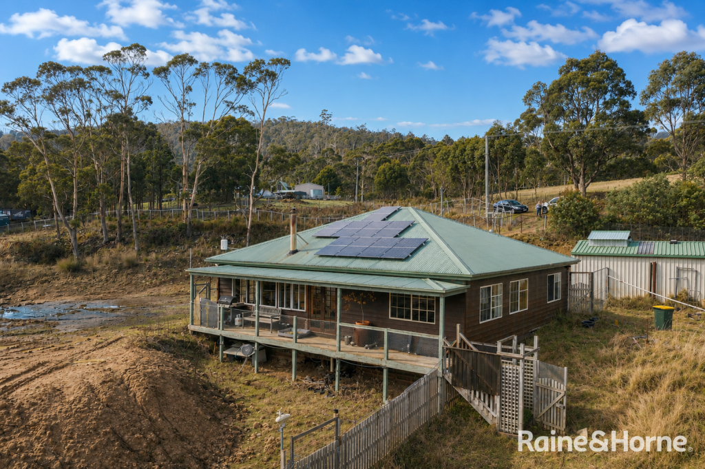 0
0 0
0About Molesworth 7140
The size of Molesworth is approximately 34.7 square kilometres. There are 4 parks, covering nearly 12.0% of the total area. The population of Molesworth in 2016 was 633 people. By 2021 the population was 683 showing a population growth of 7.9% in the area during that time. The predominant age group in Molesworth is 50-59 years. Households in Molesworth are primarily childless couples and are likely to be repaying $1400 - $1799 per month on mortgage repayments. In general, people in Molesworth work in a trades occupation.In 2021, 88.90% of the homes in Molesworth were owner-occupied compared with 88.90% in 2016.
Molesworth has 331 properties. Over the last 5 years, Houses in Molesworth have seen a 50.25% increase in median value. As at 30 June 2026:
- The median value for Houses in Molesworth is $750,251 while the median value for Units is $379,028.
Suburb Insights for Molesworth 7140
Market Insights
Molesworth Trends for Houses
N/A
N/A
View TrendN/A
N/A
Molesworth Trends for Units
N/A
N/A
View TrendN/A
N/A
Neighbourhood Insights
© Copyright 2026. RP Data Pty Ltd trading as Cotality (Cotality). All rights reserved. No reproduction, distribution, or transmission of the copyrighted materials is permitted. The information is deemed reliable but not guaranteed.
While Cotality uses commercially reasonable efforts to ensure the Cotality Data is current, Cotality does not warrant the accuracy, currency or completeness of the Cotality Data and to the full extent permitted by law excludes all loss or damage howsoever arising (including through negligence) in connection with the Cotality Data.
This product uses cookies and other similar technologies to improve and customise your browsing experience, to tailor content and adverts, and for analytics and metrics regarding visitor usage on this product and other media. We may share cookie and analytics information with third parties for the purposes of advertising. By continuing to use our website, you consent to cookies being used. View our Privacy Policy here.
X