110 Sartoris RoadLymwood TAS 7256
Property Details for 110 Sartoris Rd, Lymwood
Last Listing description (October 2016)
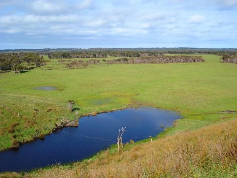
316 Acres (128 Ha) situated 8km from Currie on the Old Grassy Road. Old Grassy Road & Satoris Road form two of the boundaries.
Comprising mainly of sandy loam soils with improved pastures and has fenced shelter belts.
Subdivided into 15 paddocks with mains electric fencing and wallaby/Roo proof fencing around the boundary of improved pasture.
Reticulated water supply from large spring fed dam through 32mm water pipe to 2500 litre water troughs( one in each paddock and 1000 litre trough in stock yards).
The small area of coastal country includes a lime sand pit tested at 60 - 65%. Used for liming property and some sales.
This is good carrying country with an excellent 1200mm (48 inch) annual rainfall.
Excellent building sites if required(S.T.C.A).
Property currently leased out with annual review. Lessee would be happy to continue.
Property History for 110 Sartoris Rd, Lymwood, TAS 7256
- 05 Jun 2019Sold for $1,750,000
- 14 May 2018Sold for $3,500,000
- 27 Apr 2015Listed for Sale $825000
 0
0

About Lymwood 7256
The size of Lymwood is approximately 126.0 square kilometres. There are 4 parks, covering nearly 10.1% of the total area. The population of Lymwood in 2016 was 114 people. By 2021 the population was 105 showing a population decline of 7.9% in the area during that time. The predominant age group in Lymwood is 40-49 years. Households in Lymwood are primarily couples with children and are likely to be repaying not stated per month on mortgage repayments. In general, people in Lymwood work in a managers occupation.In 2021, 83.00% of the homes in Lymwood were owner-occupied compared with 73.90% in 2016.
Lymwood has 94 properties. Over the last 5 years, Houses in Lymwood have seen a 95.57% increase in median value. As at 30 September 2026:
- The median value for Houses in Lymwood is $544,755 while the median value for Units is $582,317.
Suburb Insights for Lymwood 7256
Market Insights
Lymwood Trends for Houses
N/A
N/A
View TrendN/A
N/A
Lymwood Trends for Units
N/A
N/A
View TrendN/A
N/A
Neighbourhood Insights
© Copyright 2026. RP Data Pty Ltd trading as Cotality (Cotality). All rights reserved. No reproduction, distribution, or transmission of the copyrighted materials is permitted. The information is deemed reliable but not guaranteed.
While Cotality uses commercially reasonable efforts to ensure the Cotality Data is current, Cotality does not warrant the accuracy, currency or completeness of the Cotality Data and to the full extent permitted by law excludes all loss or damage howsoever arising (including through negligence) in connection with the Cotality Data.
This product uses cookies and other similar technologies to improve and customise your browsing experience, to tailor content and adverts, and for analytics and metrics regarding visitor usage on this product and other media. We may share cookie and analytics information with third parties for the purposes of advertising. By continuing to use our website, you consent to cookies being used. View our Privacy Policy here.
X