
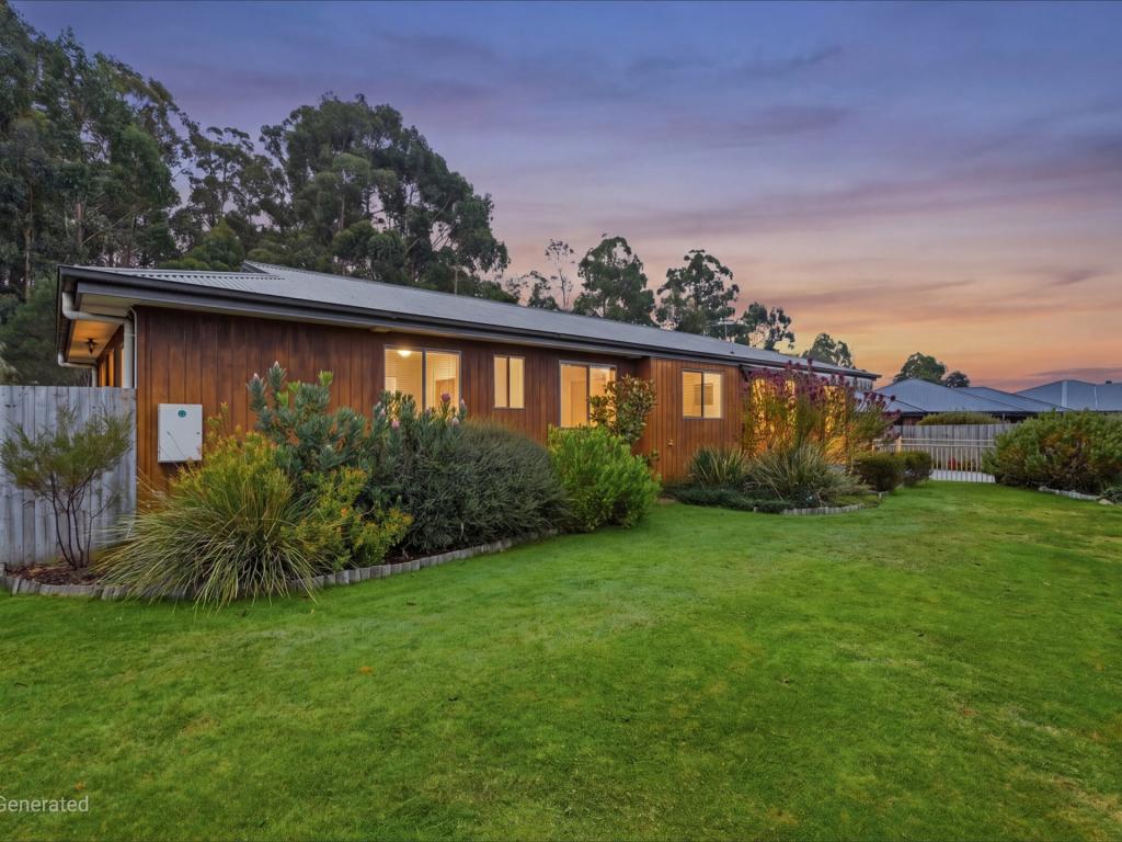
60 Davies RoadLower Snug TAS 7054
Property Details for 60 Davies Rd, Lower Snug
60 Davies Rd, Lower Snug is a 3 bedroom, 2 bathroom House with 4 parking spaces and was built in 1991. The property has a land size of 2272m2 and floor size of 163m2. While the property is not currently for sale or for rent, it was last sold in October 2021.
Last Listing description (October 2021)
Situated in a tranquil bush setting with breathtaking water and mountain views, this superb three-bedroom home is close to local amenities and an easy commute to the city - offering country living with convenience.
An open plan living, dining and kitchen area with pitched timber ceiling creates a light, spacious and welcoming ambience, and multiple French doors optimise the magnificent views of the North West Bay and Kunanyi/Mt wellington. Enjoy the sun streaming into the lounge and dining area, whilst taking in the sparkling sea or snow-capped mountain in comfort.
There is a reverse cycle air conditioner and a cosy wood fire to ensure a pleasant atmosphere throughout the seasons; and the kitchen offers lovely timber cabinetry, plus plenty of bench and storage space.
Easy access to the wide front deck via the French doors creates a smooth flow from indoors to outside. Imagine outdoor family dining on warm evenings, relaxed entertaining with friends or just enjoying a few moments alone in the idyllic surroundings.
The three generously sized bedrooms all have built-in storage, one also with external access. There is a sizeable family bathroom with bath, shower, large vanity and toilet; as well as an ensuite accessed by one of the bedrooms.
Situated on a generous 2,200 sqm parcel of land, with Coningham Nature Recreation Area at the rear of the property and rambling low maintenance gardens full of native species to attract wildlife, the grounds offer a perfect setting to enjoy the beautiful natural environment.
There is a single carport, and plenty of space for parking additional cars, a caravan or boat, as well as room under the house for a workshop or storage space.
The small country township of Snug has so much to offer; everyday services close at hand (including a supermarket, petrol station, chemist, butcher, pub and bistro), highly regarded Snug Primary School, local sports clubs, as well as a strong and supportive sense of community. There are a number of sheltered beaches in the area that are popular with local families; as well as opportunities to explore walking and cycling tracks around the town, along the Snug to Margate Shared Path, Snug Falls Track, or the neighbouring reserve.
A 15-minute drive will take you to Kingston, where you will find extensive shopping and services, and central Hobart is approximately 30 minutes away by car. There is also a daily bus service to Hobart just down the road.
Peaceful and private, with captivating views, and ideally located in one of Southern Tasmania's most popular areas - this property is one of a kind. Be sure to contact Warwick at your earliest convenience to arrange a viewing, as this delightful property will not stay on the market for long!
"We have obtained all information in this document from sources we believe to be reliable; however, we cannot guarantee its accuracy. Prospective purchasers are advised to carry out their own investigations".
Property History for 60 Davies Rd, Lower Snug, TAS 7054
- 04 Oct 2021Sold for $860,000
- 27 Sep 2021Listed for Sale Offers Over $730,000
- 28 Dec 1989Sold for $25,000

Recent sales nearby
See more recent sales nearby
Similar properties For Sale nearby
See more properties for sale nearby
 0
0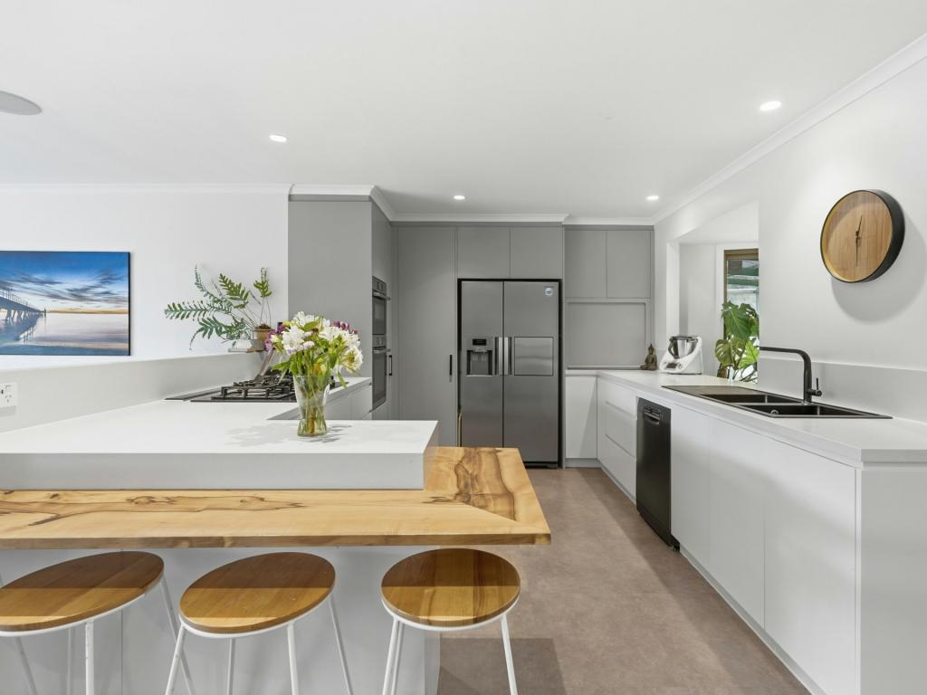 0
0 0
0
 0
0About Lower Snug 7054
The size of Lower Snug is approximately 8.3 square kilometres. There is 1 park, covering nearly 6.4% of the total area. The population of Lower Snug in 2016 was 442 people. By 2021 the population was 460 showing a population growth of 4.1% in the area during that time. The predominant age group in Lower Snug is 50-59 years. Households in Lower Snug are primarily childless couples and are likely to be repaying $1800 - $2399 per month on mortgage repayments. In general, people in Lower Snug work in a professional occupation.In 2021, 92.70% of the homes in Lower Snug were owner-occupied compared with 86.90% in 2016.
Lower Snug has 208 properties. Over the last 5 years, Houses in Lower Snug have seen a 26.86% increase in median value. As at 30 June 2026:
- The median value for Houses in Lower Snug is $871,373 while the median value for Units is $638,128.
Suburb Insights for Lower Snug 7054
Market Insights
Lower Snug Trends for Houses
N/A
N/A
View TrendN/A
N/A
Lower Snug Trends for Units
N/A
N/A
View TrendN/A
N/A
Neighbourhood Insights
© Copyright 2026. RP Data Pty Ltd trading as Cotality (Cotality). All rights reserved. No reproduction, distribution, or transmission of the copyrighted materials is permitted. The information is deemed reliable but not guaranteed.
While Cotality uses commercially reasonable efforts to ensure the Cotality Data is current, Cotality does not warrant the accuracy, currency or completeness of the Cotality Data and to the full extent permitted by law excludes all loss or damage howsoever arising (including through negligence) in connection with the Cotality Data.
This product uses cookies and other similar technologies to improve and customise your browsing experience, to tailor content and adverts, and for analytics and metrics regarding visitor usage on this product and other media. We may share cookie and analytics information with third parties for the purposes of advertising. By continuing to use our website, you consent to cookies being used. View our Privacy Policy here.
X