
1/1 Netherby RoadCurrie TAS 7256
Property Details for 1/1 Netherby Rd, Currie
1/1 Netherby Rd, Currie is a 0 bedroom, 0 bathroom House. The property has a land size of 10760m2.
Last Listing description (September 2025)
Situated 2.5km south of Currie along Netherby Road, this elevated block of approx. 1.076 hectare overlooks King Island's famous British Admiral beach. This is a truly magic property just minutes from Currie, the main town on the island, with British Admiral beach, a family and surfing hotspot on the island just 500m further down Netherby Road.
The hard work has already been done for you, with it being cleared and a track constructed to the impressive high point of the block now also with an approved DA.
Property History for 1/1 Netherby Rd, Currie, TAS 7256
- 18 Sep 2025Listed for Sale $320,000
- 24 Sep 2024Listed for Sale $320,000
- 03 Nov 2023Listed for Sale $320,000

Recent sales nearby
See more recent sales nearbySimilar properties For Sale nearby
See more properties for sale nearby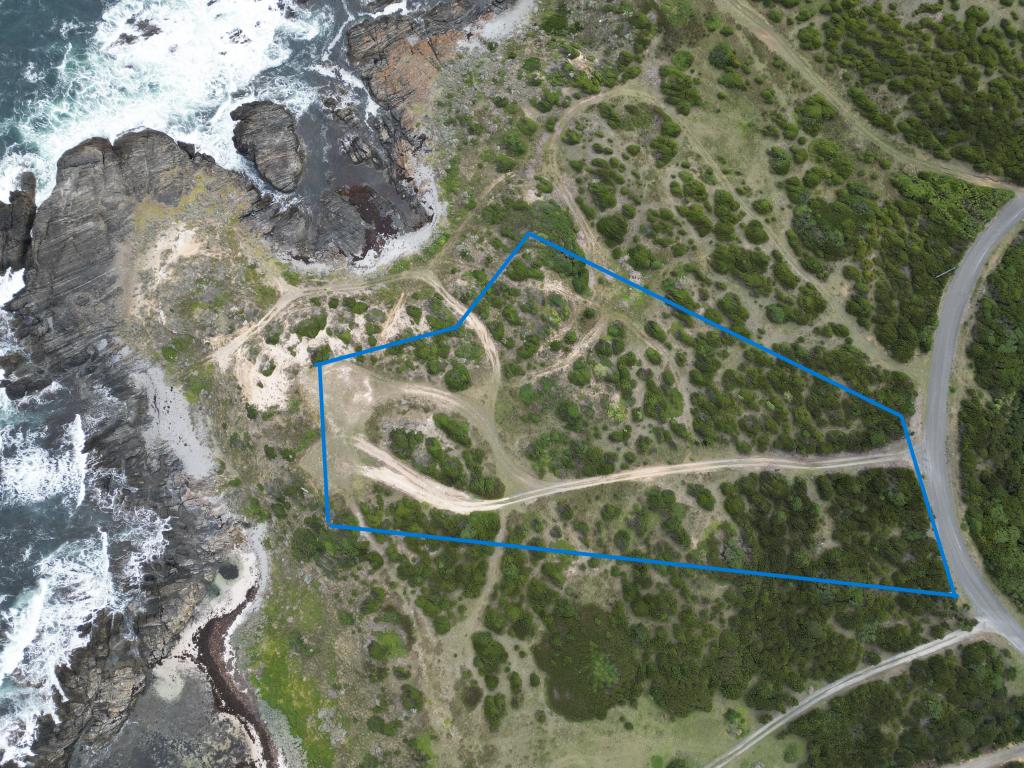 0
0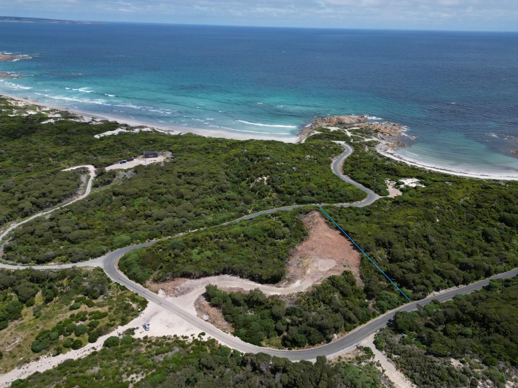 0
0 0
0About Currie 7256
The size of Currie is approximately 11.9 square kilometres. There are 2 parks, covering nearly 3.5% of the total area. The population of Currie in 2016 was 768 people. By 2021 the population was 766 showing a population decline of 0.3% in the area during that time. The predominant age group in Currie is 60-69 years. Households in Currie are primarily childless couples and are likely to be repaying $1000 - $1399 per month on mortgage repayments. In general, people in Currie work in a labourer occupation.In 2021, 64.80% of the homes in Currie were owner-occupied compared with 59.20% in 2016.
Currie has 592 properties. Over the last 5 years, Houses in Currie have seen a 46.91% increase in median value, while Units have seen a -63.68% decrease. As at 31 May 2026:
- The median value for Houses in Currie is $443,092 while the median value for Units is $327,875.
Suburb Insights for Currie 7256
Market Insights
Currie Trends for Houses
N/A
N/A
View TrendN/A
N/A
Currie Trends for Units
N/A
N/A
View TrendN/A
N/A
Neighbourhood Insights
© Copyright 2026. RP Data Pty Ltd trading as Cotality (Cotality). All rights reserved. No reproduction, distribution, or transmission of the copyrighted materials is permitted. The information is deemed reliable but not guaranteed.
While Cotality uses commercially reasonable efforts to ensure the Cotality Data is current, Cotality does not warrant the accuracy, currency or completeness of the Cotality Data and to the full extent permitted by law excludes all loss or damage howsoever arising (including through negligence) in connection with the Cotality Data.
This product uses cookies and other similar technologies to improve and customise your browsing experience, to tailor content and adverts, and for analytics and metrics regarding visitor usage on this product and other media. We may share cookie and analytics information with third parties for the purposes of advertising. By continuing to use our website, you consent to cookies being used. View our Privacy Policy here.
X