
478 Upper Skilly RoadWatervale SA 5452
Property Details for 478 Upper Skilly Rd, Watervale
Last Listing description (February 2017)
'Big Hill' contains 244.4hectares (approx. 604 acres) and has boundaries to the Upper Skilly and Skillogalee Creek Roads. The land is slightly undulating to hill grazing, with soils being red brown sandy loam over clay, with areas of rocky outcrops mainly on the hills. Average rainfall in this very productive area is 625-650 mm.
'Big Hills' consists of approx. 61ha (161 acres) of excellent cropping and approx. 179ha (440acres) of strong grazing country. Grazing country includes pastures of mixed clovers and native grasses.
This property is located near to Dublin markets, making it an ideal parcel of land for livestock production.
'Big Hill' is fenced into 12 paddocks. Fencing is generally in good condition. Fences vary in type but consist of cyclone barb, plain wires, pine posts, star droppers and suspension fences.
10% deposit on signing of contract.
Balance at settlement 10th day of February 2017 or such other date as mutually agreed upon by both the Vendor and Purchaser when vacant possession will be given or by mutual consent by the parties.
Property History for 478 Upper Skilly Rd, Watervale, SA 5452
- 25 Aug 2016Listed for Sale Auction
Recent sales nearby
See more recent sales nearbySimilar properties For Sale nearby
See more properties for sale nearby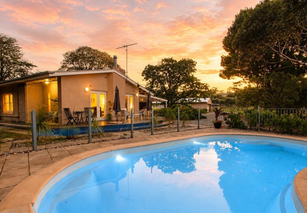 0
0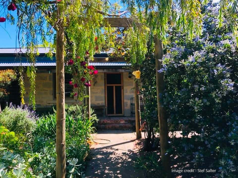 0
0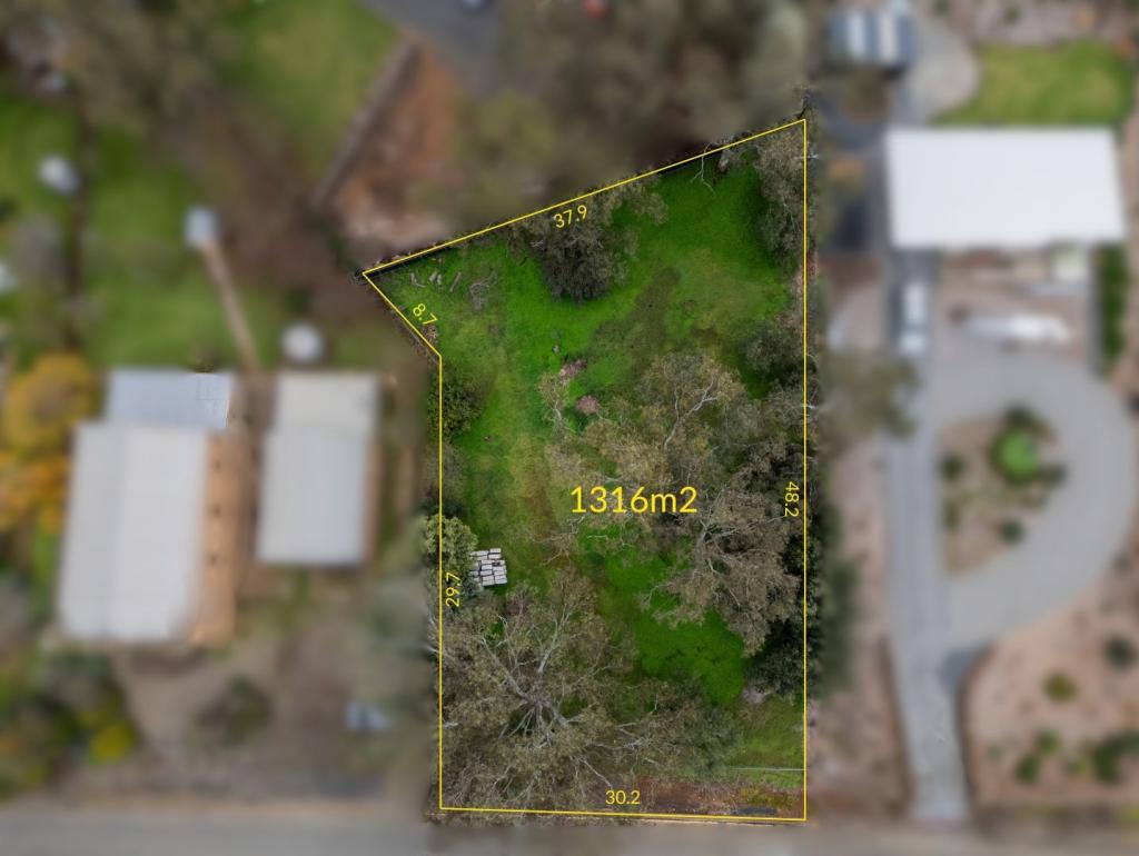 0
0About Watervale 5452
The size of Watervale is approximately 59.1 square kilometres. The population of Watervale in 2016 was 326 people. By 2021 the population was 338 showing a population growth of 3.7% in the area during that time. The predominant age group in Watervale is 60-69 years. Households in Watervale are primarily childless couples and are likely to be repaying $1000 - $1399 per month on mortgage repayments. In general, people in Watervale work in a managers occupation.In 2021, 82.10% of the homes in Watervale were owner-occupied compared with 82.70% in 2016.
Watervale has 262 properties. Over the last 5 years, Houses in Watervale have seen a 97.38% increase in median value. As at 30 June 2026:
- The median value for Houses in Watervale is $587,641.
Suburb Insights for Watervale 5452
Market Insights
Watervale Trends for Houses
N/A
N/A
View TrendN/A
N/A
Watervale Trends for Units
N/A
N/A
View TrendN/A
N/A
Neighbourhood Insights
© Copyright 2026. RP Data Pty Ltd trading as Cotality (Cotality). All rights reserved. No reproduction, distribution, or transmission of the copyrighted materials is permitted. The information is deemed reliable but not guaranteed.
While Cotality uses commercially reasonable efforts to ensure the Cotality Data is current, Cotality does not warrant the accuracy, currency or completeness of the Cotality Data and to the full extent permitted by law excludes all loss or damage howsoever arising (including through negligence) in connection with the Cotality Data.
This product uses cookies and other similar technologies to improve and customise your browsing experience, to tailor content and adverts, and for analytics and metrics regarding visitor usage on this product and other media. We may share cookie and analytics information with third parties for the purposes of advertising. By continuing to use our website, you consent to cookies being used. View our Privacy Policy here.
X