
33/5 Duncan StreetWest End QLD 4101
Property Details for 33/5 Duncan St, West End
33/5 Duncan St, West End is a 2 bedroom, 2 bathroom Unit with 2 parking spaces and was built in 2003. The property has a land size of 138m2 and floor size of 89m2. While the property is not currently for sale or for rent, it was last sold in October 2005.
Last Listing description (December 2024)
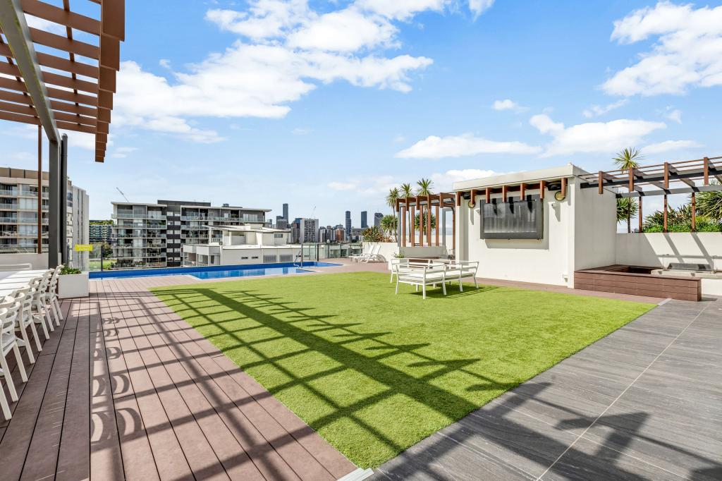
Discover the ultimate urban lifestyle with this modern 2-bedroom apartment at Regatta Apartments, ideally located in the heart of West End's vibrant riverside community. With direct access to the pool and just a short walk to the West End Ferry, bus stops, the popular West End Markets, Aldi, Woolworths, and the Montague Hotel, everything you need is right at your doorstep. Plus, enjoy being within the highly sought-after Brisbane State High School catchment.
This stylish apartment features:
? Two spacious balconies ? perfect for enjoying the outdoors
? Master bedroom with ensuite & walk-in robe ? a private retreat
? Air-conditioning ? for year-round comfort
? Modern kitchen with Bosch appliances & dishwasher ? making meal prep a breeze
? Secure undercover carpark ? convenience and peace of mind
? 18-metre swimming pool ? right at your doorstep
? Brisbane State High School catchment ? ensuring top educational options
? Walking distance to West End Markets, supermarkets, parks, restaurants, and the arts precinct
This is a rare opportunity to live in a modern apartment in a prime location with everything you need right at your fingertips.
Don't miss out on making 33/5 Duncan Street your new home!
To arrange an inspection, click the 'Book an Inspection Time' button or contact Rebecca Earl at SPACE Property on 07 3846 4333 to register your interest.
Available NOW ? Enquire today!
Property History for 33/5 Duncan St, West End, QLD 4101
- 04 Nov 2024Listed for Rent $850 / week
- 01 Jun 2016Listed for Rent $550 / week
- 11 Apr 2016Listed for Rent $610 / week

Recent sales nearby
See more recent sales nearbySimilar properties For Sale nearby
See more properties for sale nearby 0
0
 0
0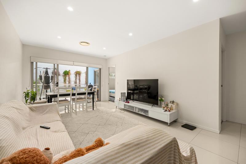 0
0Similar properties For Rent nearby
See more properties for rent nearby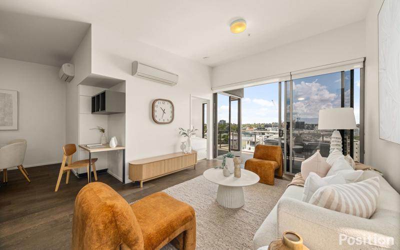 0
0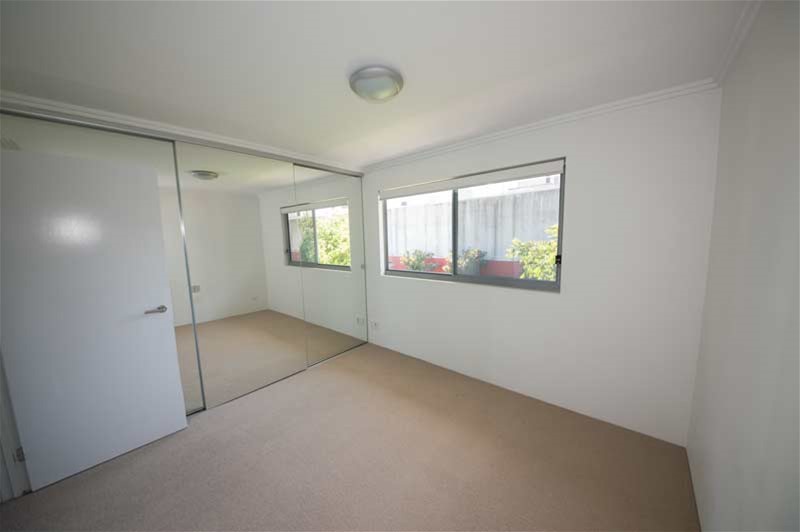 0
0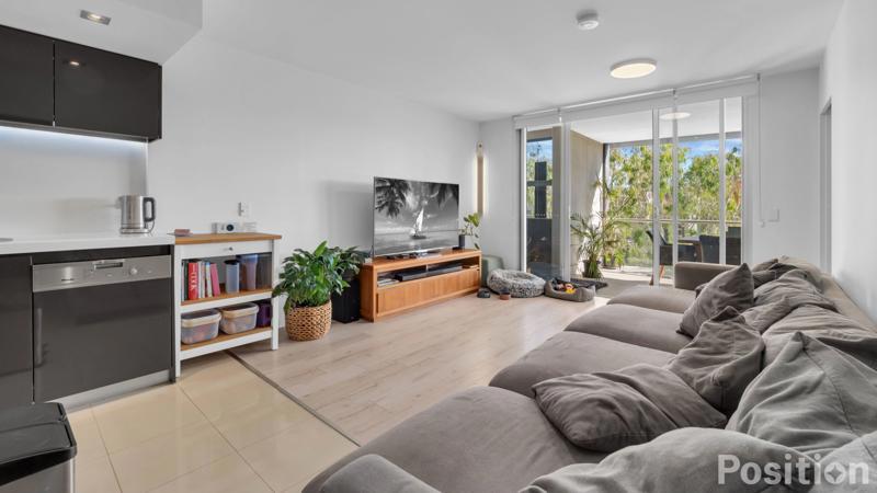 0
0About West End 4101
The size of West End is approximately 2.3 square kilometres. There are 4 parks, covering nearly 6.7% of the total area. The population of West End in 2016 was 9474 people. By 2021 the population was 14730 showing a population growth of 55.5% in the area during that time. The predominant age group in West End is 20-29 years. Households in West End are primarily childless couples and are likely to be repaying $1800 - $2399 per month on mortgage repayments. In general, people in West End work in a professional occupation.In 2021, 39.50% of the homes in West End were owner-occupied compared with 38.70% in 2016.
West End has 9,647 properties. Over the last 5 years, Houses in West End have seen a 67.51% increase in median value, while Units have seen a 95.44% increase. As at 30 April 2026:
- The median value for Houses in West End is $2,200,954 while the median value for Units is $1,061,927.
- Houses have a median rent of $900 while Units have a median rent of $750.
Suburb Insights for West End 4101
Market Insights
West End Trends for Houses
N/A
N/A
View TrendN/A
N/A
West End Trends for Units
N/A
N/A
View TrendN/A
N/A
Neighbourhood Insights
© Copyright 2026. RP Data Pty Ltd trading as Cotality (Cotality). All rights reserved. No reproduction, distribution, or transmission of the copyrighted materials is permitted. The information is deemed reliable but not guaranteed.
While Cotality uses commercially reasonable efforts to ensure the Cotality Data is current, Cotality does not warrant the accuracy, currency or completeness of the Cotality Data and to the full extent permitted by law excludes all loss or damage howsoever arising (including through negligence) in connection with the Cotality Data.
This product uses cookies and other similar technologies to improve and customise your browsing experience, to tailor content and adverts, and for analytics and metrics regarding visitor usage on this product and other media. We may share cookie and analytics information with third parties for the purposes of advertising. By continuing to use our website, you consent to cookies being used. View our Privacy Policy here.
X