
28 Burrowa StreetStafford QLD 4053
Property Details for 28 Burrowa St, Stafford
28 Burrowa St, Stafford is a 4 bedroom, 2 bathroom House with 2 parking spaces. The property has a land size of 422m2 and floor size of 217m2. While the property is not currently for sale or for rent, it was last sold in April 2024.
Last Listing description (May 2024)
Have you been searching for a home with enough space to fit the whole family without having to go through the building process? Then look no further than this stunning 4 year old, 4 bedroom family home in this sought after pocket of Stafford.
Walking upstairs you are greeted by a rumpus area that makes for a perfect teenager's retreat. On the second level there is the spacious master suite including a walk-in robe and an ensuite. There are also three additional bedrooms all with robes and also a perfectly positioned family bathroom. Benefiting from a north-south aspect there is a sense of privacy and space that is hard to find in an inner-city location.
Notable features of the home include.
* Sparkling pool adjoining alfresco entertaining space
* Open plan concept, ideal for families and those looking to entertain
* Three bedrooms, all with built in robes
* Main bedroom with ensuite on upper level
* Study, Media room or 5th bedroom at the front of the home
* Powder rooms on lower level
* Remote, double lock-up garage
* Ducted & zoned air-conditioning throughout
Residents of this tightly held blue-chip pocket love the ease of being close to the tunnel linking you to the airport, Gold Cost or Western Suburbs. Take a short walk or bike ride around the tree lined suburb to the several cafes and local shops including Cole's Kedron, only moments away.
Located only 8km from the CBD, living here you are can easily walk to St Anthony's primary school, Mt Alvernia or Padua College. Within a short drive you also have access to buses traveling to several of the other closely located Private Schools.
Homes finished and ready to move into, at such an elevated standard, are in high demand. Don't let this be the one you missed, contact Adam Stefan or Lucy West to obtain further information.
Property History for 28 Burrowa St, Stafford, QLD 4053
- 10 May 2024Listed for Sale Sold
- 24 Apr 2024Sold for $1,800,000
- 27 Sep 2017Sold for $477,500

Recent sales nearby
See more recent sales nearby
Similar properties For Sale nearby
See more properties for sale nearby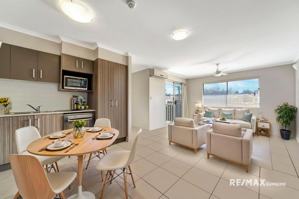 0
0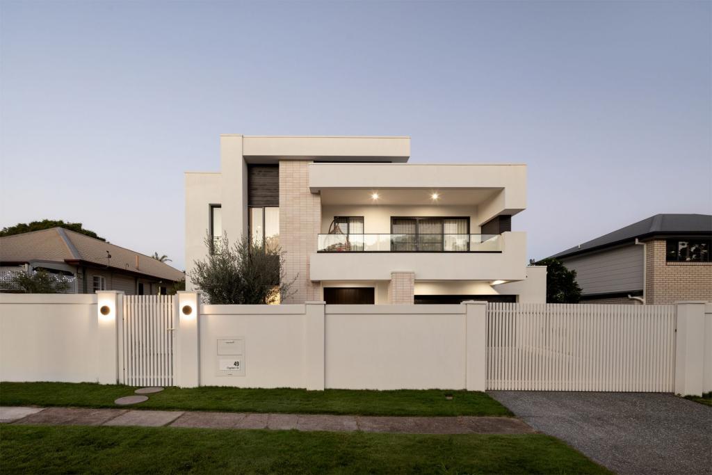 0
0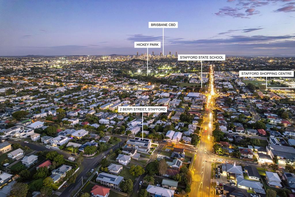 0
0Similar properties For Rent nearby
See more properties for rent nearby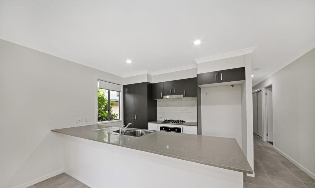 0
0 0
0 0
0About Stafford 4053
The size of Stafford is approximately 3.4 square kilometres. There are 12 parks, covering nearly 20.7% of the total area. The population of Stafford in 2016 was 6561 people. By 2021 the population was 6978 showing a population growth of 6.4% in the area during that time. The predominant age group in Stafford is 30-39 years. Households in Stafford are primarily childless couples and are likely to be repaying $1800 - $2399 per month on mortgage repayments. In general, people in Stafford work in a professional occupation.In 2021, 49.10% of the homes in Stafford were owner-occupied compared with 47.80% in 2016.
Stafford has 3,625 properties. Over the last 5 years, Houses in Stafford have seen a 88.20% increase in median value, while Units have seen a 132.22% increase. As at 31 May 2026:
- The median value for Houses in Stafford is $1,436,918 while the median value for Units is $879,753.
- Houses have a median rent of $685 while Units have a median rent of $660.
Suburb Insights for Stafford 4053
Market Insights
Stafford Trends for Houses
N/A
N/A
View TrendN/A
N/A
Stafford Trends for Units
N/A
N/A
View TrendN/A
N/A
Neighbourhood Insights
© Copyright 2026. RP Data Pty Ltd trading as Cotality (Cotality). All rights reserved. No reproduction, distribution, or transmission of the copyrighted materials is permitted. The information is deemed reliable but not guaranteed.
While Cotality uses commercially reasonable efforts to ensure the Cotality Data is current, Cotality does not warrant the accuracy, currency or completeness of the Cotality Data and to the full extent permitted by law excludes all loss or damage howsoever arising (including through negligence) in connection with the Cotality Data.
This product uses cookies and other similar technologies to improve and customise your browsing experience, to tailor content and adverts, and for analytics and metrics regarding visitor usage on this product and other media. We may share cookie and analytics information with third parties for the purposes of advertising. By continuing to use our website, you consent to cookies being used. View our Privacy Policy here.
X