
178 Macquarie StreetSt Lucia QLD 4067
Property Details for 178 Macquarie St, St Lucia
178 Macquarie St, St Lucia is a 0 bedroom, 0 bathroom House. The property has a land size of 762m2. While the property is not currently for sale or for rent, it was last sold in July 2025. There are other 0 bedroom House sold in St Lucia in the last 12 months.
Last Listing description (May 2026)
RWC Queensland has the pleasure to offer 178-180 Macquarie Street St Lucia in Brisbane, Queensland to the market.
This super-prime riverfront development site is currently improved with two significant riverfront residences, with one featuring an approved pontoon, this property offers multiple opportunities (STCA^) including:
- Build a single iconic Brisbane River trophy home; or
- Land Bank and occupy or lease the existing residences.
178-180 Macquarie Street is situated in the blue-chip residential suburb of St Lucia just 2.5 kilometres* from the Brisbane CBD. This riverside suburb offers unrivalled amenity, access to public transport and world-renowned educational facilities. The site provides an extremely rare opportunity given its St Lucia address and 30 metres* of absolute Brisbane River frontage. Furthermore, the northerly aspect provides for both direct Brisbane CBD views and a 360-degree aspect across Brisbane's Inner South-West.
- Site Area - 1,513m²* (30 metre* street frontage).
- Brisbane River Frontage - 30 metres*.
- Zoned High Density Residential (HDR2).
- 15 storey allowable building height (STCA^).
- Currently improved with two significant riverfront residences with one featuring an approved pontoon.
- In a very quiet enclave on the doorstep of the world-renowned University of Queensland (UQ), offering unrivalled access to sporting facilities and amenities.
- Minutes away from the Toowong Village Shopping Centre and bustling retail and dining precincts of Brisbane's Inner-West.
- A short stroll along the river to the City Cat Ferry terminal (700 metres*).
- Irreplaceable Position.
Don't miss the opportunity to secure this extremely rare opportunity!
For Sale via Offers to Purchase
*Approximately (radial km)
^Subject to Council Approval
Image outlines/labels indicative only
Property History for 178 Macquarie St, St Lucia, QLD 4067
- 05 Jul 2025Listed for Sale For Sale via Offers to Purchase
- 02 Jul 2025Sold for $10,210,000
- 16 Oct 2024Listed for Sale For Sale via Offers to Purchase

Recent sales nearby
See more recent sales nearby
Similar properties For Sale nearby
See more properties for sale nearby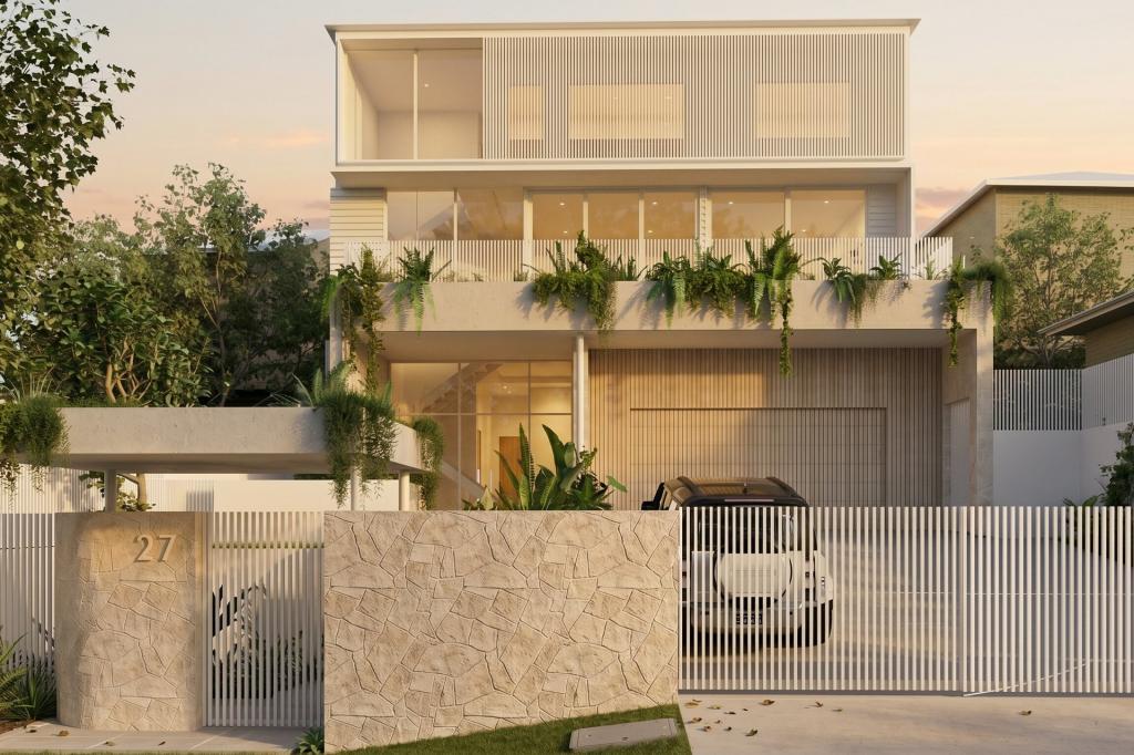 0
0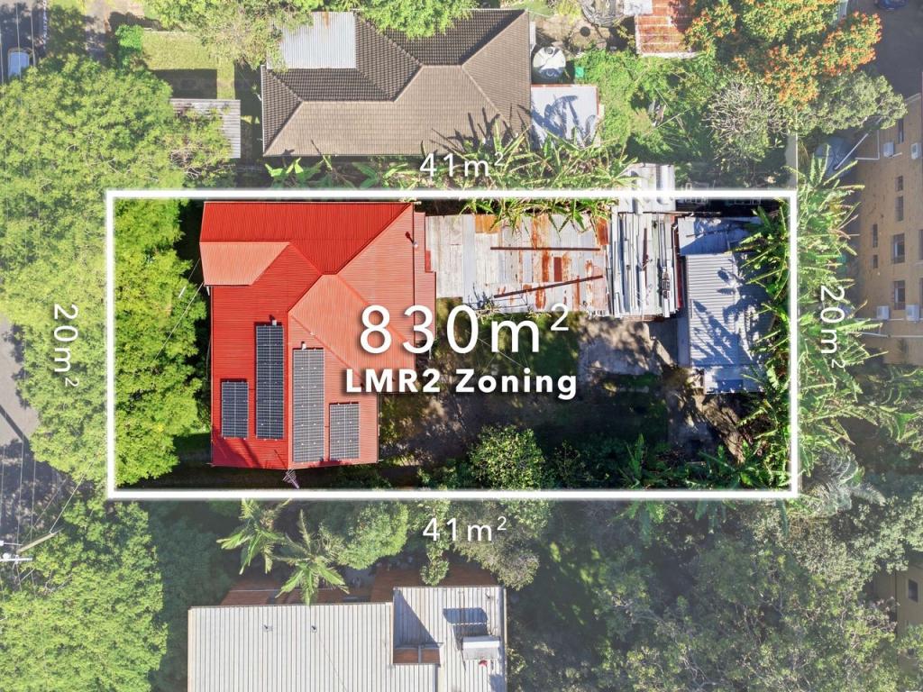 0
0
 0
0
Similar properties For Rent nearby
See more properties for rent nearby 0
0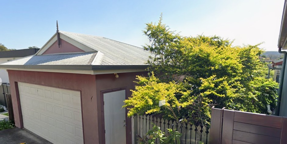 0
0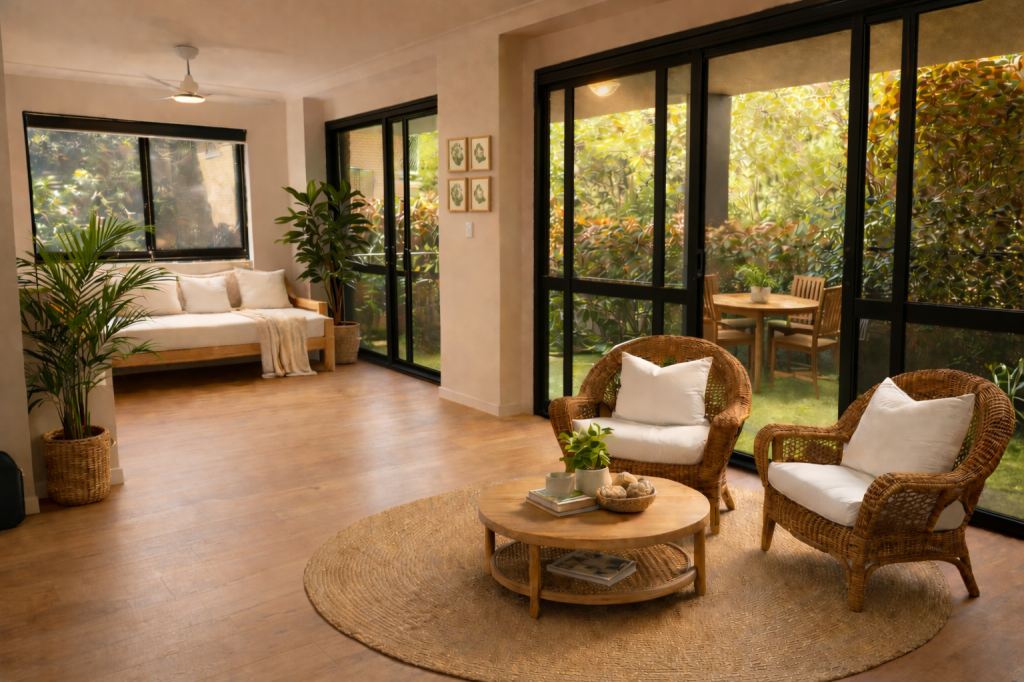 0
0About St Lucia 4067
The size of St Lucia is approximately 4.6 square kilometres. There are 36 parks, covering nearly 19.4% of the total area. The population of St Lucia in 2016 was 12574 people. By 2021 the population was 12220 showing a population decline of 2.8% in the area during that time. The predominant age group in St Lucia is 20-29 years. Households in St Lucia are primarily childless couples and are likely to be repaying over $4000 per month on mortgage repayments. In general, people in St Lucia work in a professional occupation.In 2021, 44.40% of the homes in St Lucia were owner-occupied compared with 41.60% in 2016.
St Lucia has 5,595 properties. Over the last 5 years, Houses in St Lucia have seen a 33.65% increase in median value, while Units have seen a 102.20% increase. As at 31 May 2026:
- The median value for Houses in St Lucia is $2,204,989 while the median value for Units is $1,048,205.
- Houses have a median rent of $820 while Units have a median rent of $695.
Suburb Insights for St Lucia 4067
Market Insights
St Lucia Trends for Houses
N/A
N/A
View TrendN/A
N/A
St Lucia Trends for Units
N/A
N/A
View TrendN/A
N/A
Neighbourhood Insights
© Copyright 2026. RP Data Pty Ltd trading as Cotality (Cotality). All rights reserved. No reproduction, distribution, or transmission of the copyrighted materials is permitted. The information is deemed reliable but not guaranteed.
While Cotality uses commercially reasonable efforts to ensure the Cotality Data is current, Cotality does not warrant the accuracy, currency or completeness of the Cotality Data and to the full extent permitted by law excludes all loss or damage howsoever arising (including through negligence) in connection with the Cotality Data.
This product uses cookies and other similar technologies to improve and customise your browsing experience, to tailor content and adverts, and for analytics and metrics regarding visitor usage on this product and other media. We may share cookie and analytics information with third parties for the purposes of advertising. By continuing to use our website, you consent to cookies being used. View our Privacy Policy here.
X