
2/22 Todds RoadLawnton QLD 4501
Property Details for 2/22 Todds Rd, Lawnton
2/22 Todds Rd, Lawnton is a 2 bedroom, 1 bathroom Unit with 1 parking spaces and was built in 1982. The property has a land size of 104m2 and floor size of 65m2. While the property is not currently for sale or for rent, it was last sold in August 2017.
Last Listing description (August 2025)
If you are looking for a low maintenance, upstairs apartment, have we got a property for you.
Just a hop skip and jump to Lawnton station, you will be able to walk to the train and take advantage of the cheap train fares.
Boast 2 good size bedrooms, both with built in robes, large living area and a well appointed kitchen with loads of cupboard space.
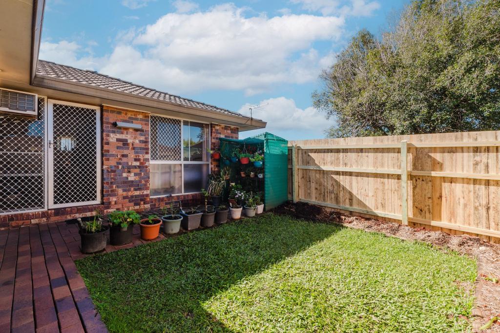
There is a small very at the front to enjoy the afternoon breezes.
This great property is available now and waiting for its new family to move in
Reach out to arrange a personalised inspection
#people #property #priority
Property History for 2/22 Todds Rd, Lawnton, QLD 4501
- 25 Jul 2025Listed for Rent $435 / week
- 04 Jan 2021Listed for Rent $285 / week
- 18 Aug 2017Sold for $199,900

Recent sales nearby
See more recent sales nearbySimilar properties For Sale nearby
See more properties for sale nearby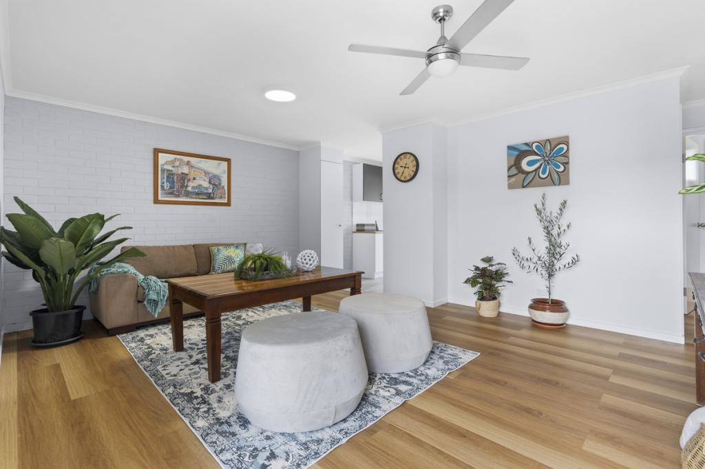 0
0
 0
0 0
0Similar properties For Rent nearby
See more properties for rent nearby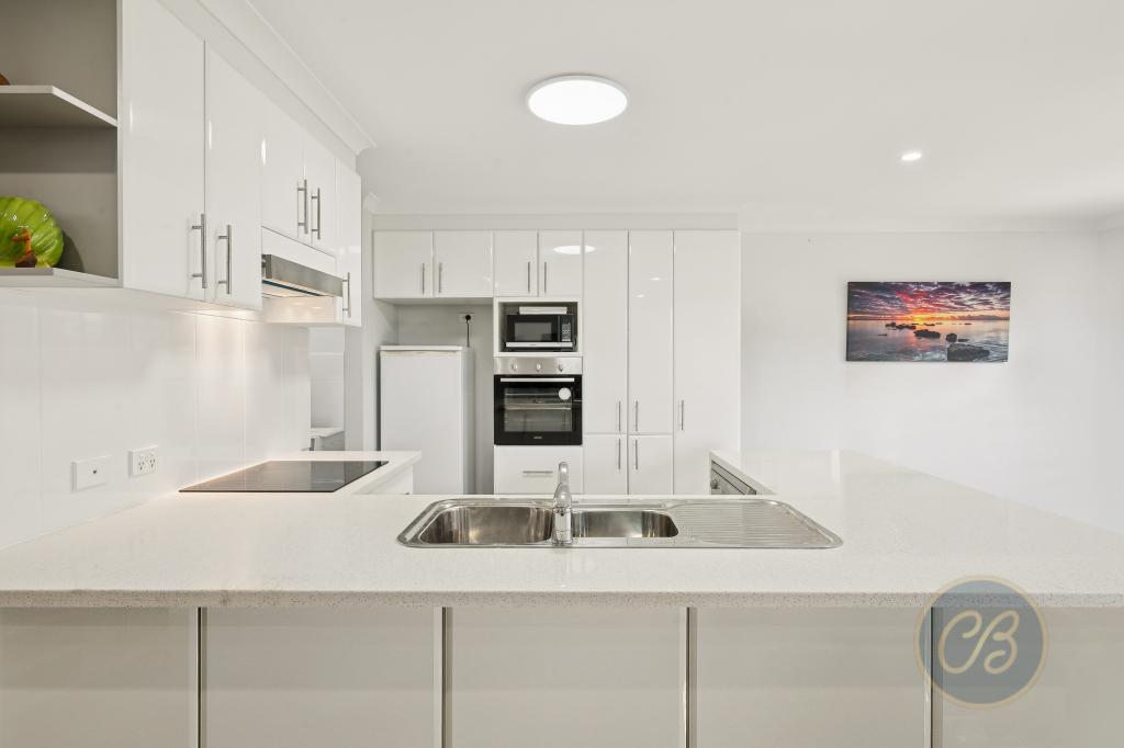 0
0
 0
0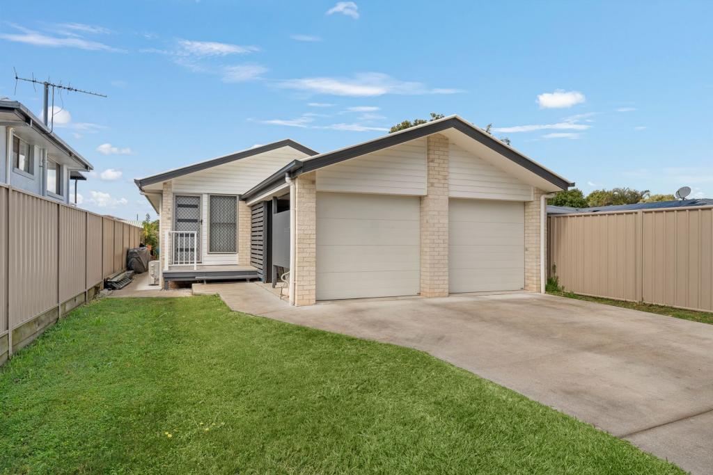 0
0About Lawnton 4501
The size of Lawnton is approximately 8.7 square kilometres. There are 34 parks, covering nearly 7.7% of the total area. The population of Lawnton in 2016 was 5658 people. By 2021 the population was 5905 showing a population growth of 4.4% in the area during that time. The predominant age group in Lawnton is 30-39 years. Households in Lawnton are primarily couples with children and are likely to be repaying $1400 - $1799 per month on mortgage repayments. In general, people in Lawnton work in a trades occupation.In 2021, 56.70% of the homes in Lawnton were owner-occupied compared with 59.70% in 2016.
Lawnton has 3,727 properties. Over the last 5 years, Houses in Lawnton have seen a 95.26% increase in median value, while Units have seen a 160.36% increase. As at 30 June 2026:
- The median value for Houses in Lawnton is $1,010,748 while the median value for Units is $743,116.
- Houses have a median rent of $650 while Units have a median rent of $570.
Suburb Insights for Lawnton 4501
Market Insights
Lawnton Trends for Houses
N/A
N/A
View TrendN/A
N/A
Lawnton Trends for Units
N/A
N/A
View TrendN/A
N/A
Neighbourhood Insights
© Copyright 2026. RP Data Pty Ltd trading as Cotality (Cotality). All rights reserved. No reproduction, distribution, or transmission of the copyrighted materials is permitted. The information is deemed reliable but not guaranteed.
While Cotality uses commercially reasonable efforts to ensure the Cotality Data is current, Cotality does not warrant the accuracy, currency or completeness of the Cotality Data and to the full extent permitted by law excludes all loss or damage howsoever arising (including through negligence) in connection with the Cotality Data.
This product uses cookies and other similar technologies to improve and customise your browsing experience, to tailor content and adverts, and for analytics and metrics regarding visitor usage on this product and other media. We may share cookie and analytics information with third parties for the purposes of advertising. By continuing to use our website, you consent to cookies being used. View our Privacy Policy here.
X