
5 Keith Rudd DriveGilston QLD 4211
Property Details for 5 Keith Rudd Dr, Gilston
5 Keith Rudd Dr, Gilston is a 4 bedroom, 2 bathroom House with 2 parking spaces and was built in 2009. The property has a land size of 730m2 and floor size of 184m2. While the property is not currently for sale or for rent, it was last sold in October 2021.
Last Listing description (January 2022)
Beautiful! A superbly presented spacious modern four bedroom home with a fantastic floor plan that will suit any growing family.
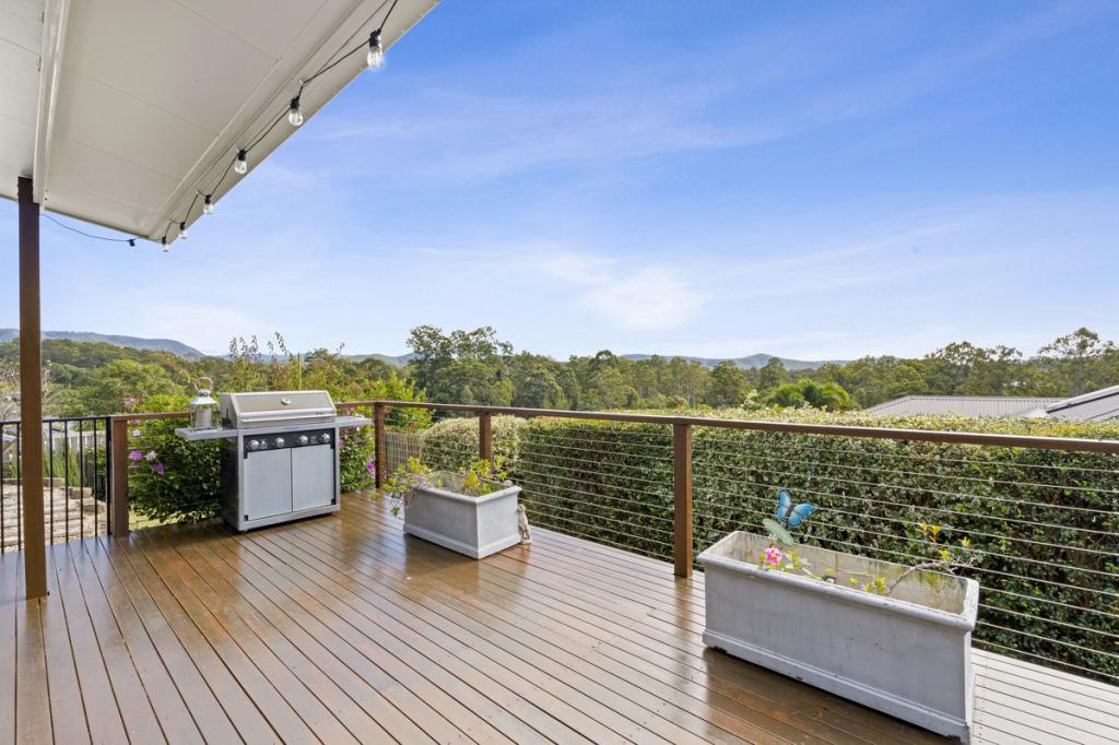
Presented and maintained in as new condition, features include ensuite to main bedroom, well-appointed modern kitchen, open plan living and dining and a delightful covered entertainment area overlooking the hinterland.
Set in popular Gilston Green Estate, only 5 minutes to town and close to schools, restaurants, and local shops.
*Four bedrooms
*Master bedroom with air conditioning, walk in robe plus ensuite
*Modern kitchen with stainless steel appliances
* Expansive open plan living and dining area
*Air conditioning plus ceiling fans
* Covered outdoor entertainment area with hinterland views
* Established gardens
* Water tank for the gardens
* Auto double lock up garage with extra parking for a trailer
* Solar power with 8 panels
* Fully fenced 730m2 block with side access
* 5 minutes to town, close to local schools and shops
Property History for 5 Keith Rudd Dr, Gilston, QLD 4211
- 12 Oct 2021Sold for $855,000
- 05 Oct 2021Listed for Sale Offers Over $799,000
- 02 Apr 2009Sold for $489,000

Recent sales nearby
See more recent sales nearby
Similar properties For Sale nearby
See more properties for sale nearby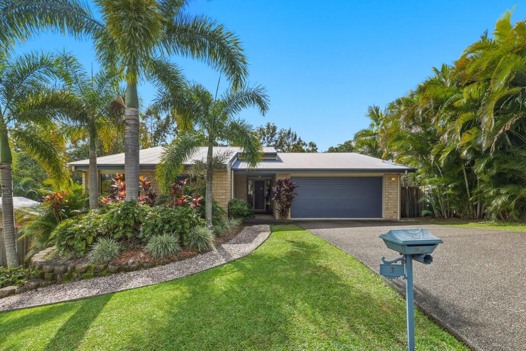 0
0
 0
0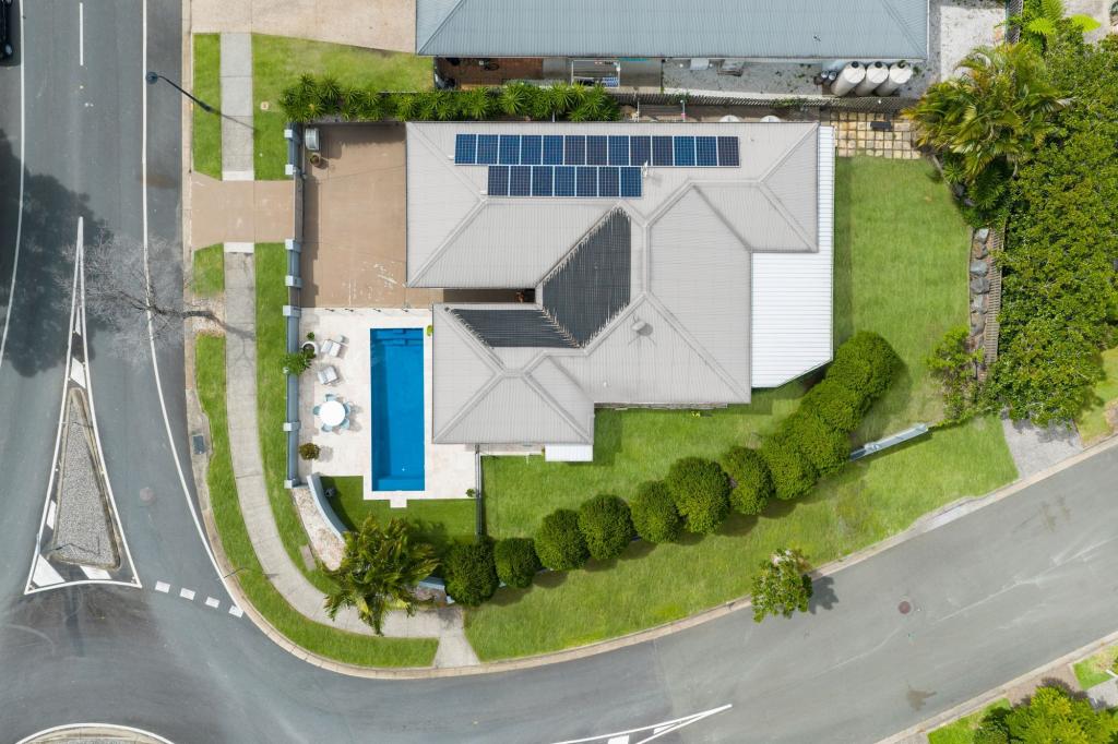 0
0Similar properties For Rent nearby
See more properties for rent nearby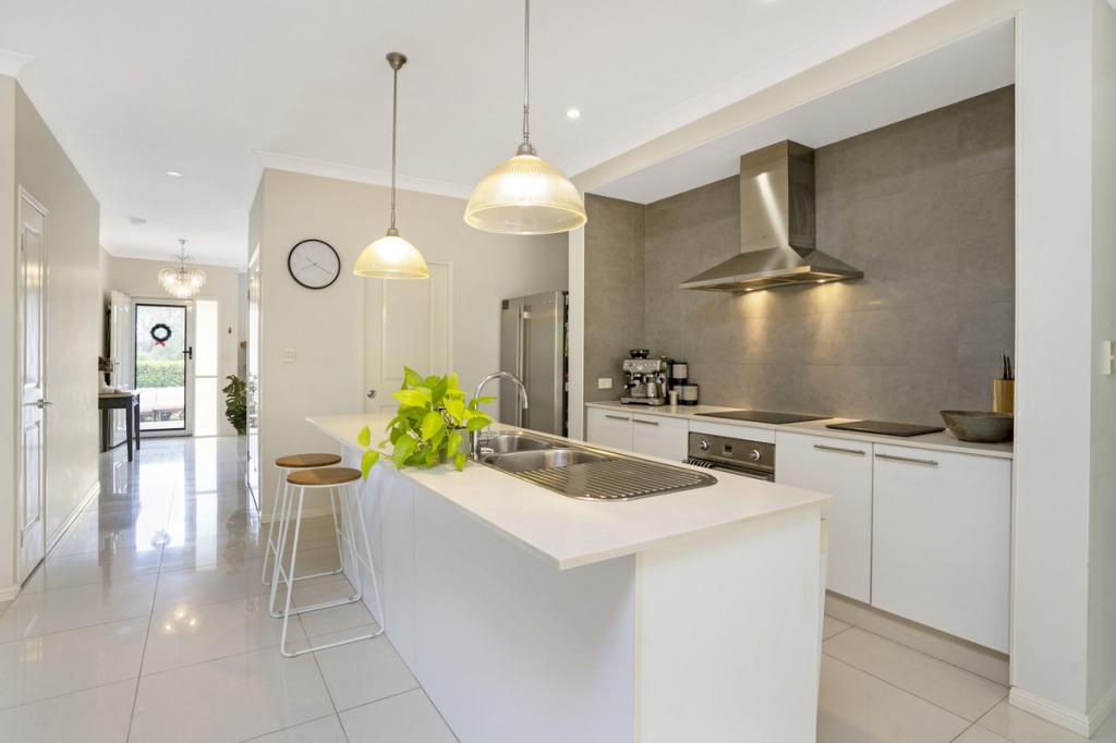 0
0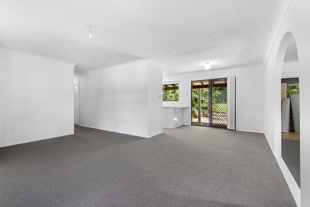 0
0About Gilston 4211
The size of Gilston is approximately 9.5 square kilometres. There are 11 parks, covering nearly 2.5% of the total area. The population of Gilston in 2016 was 2459 people. By 2021 the population was 2669 showing a population growth of 8.5% in the area during that time. The predominant age group in Gilston is 30-39 years. Households in Gilston are primarily couples with children and are likely to be repaying $1800 - $2399 per month on mortgage repayments. In general, people in Gilston work in a professional occupation.In 2021, 81.30% of the homes in Gilston were owner-occupied compared with 77.40% in 2016.
Gilston has 1,010 properties. Over the last 5 years, Houses in Gilston have seen a 81.28% increase in median value, while Units have seen a 79.20% increase. As at 30 June 2026:
- The median value for Houses in Gilston is $1,364,386 while the median value for Units is $785,112.
- Houses have a median rent of $1,000.
Suburb Insights for Gilston 4211
Market Insights
Gilston Trends for Houses
N/A
N/A
View TrendN/A
N/A
Gilston Trends for Units
N/A
N/A
View TrendN/A
N/A
Neighbourhood Insights
© Copyright 2026. RP Data Pty Ltd trading as Cotality (Cotality). All rights reserved. No reproduction, distribution, or transmission of the copyrighted materials is permitted. The information is deemed reliable but not guaranteed.
While Cotality uses commercially reasonable efforts to ensure the Cotality Data is current, Cotality does not warrant the accuracy, currency or completeness of the Cotality Data and to the full extent permitted by law excludes all loss or damage howsoever arising (including through negligence) in connection with the Cotality Data.
This product uses cookies and other similar technologies to improve and customise your browsing experience, to tailor content and adverts, and for analytics and metrics regarding visitor usage on this product and other media. We may share cookie and analytics information with third parties for the purposes of advertising. By continuing to use our website, you consent to cookies being used. View our Privacy Policy here.
X