41 Oleary RoadFairney View QLD 4306
Property Details for 41 Oleary Rd, Fairney View
Last Listing description (August 2025)
Set in the heart of South East Queensland's thriving western growth corridor, this 32.37-hectare (80-acre) landholding* presents a rare opportunity for investors, or land bankers seeking scale, connectivity, and future potential.
Surrounded by several major residential estates such as Honeywood Estate, The Fernvale Estate, and a 129-lot approved subdivision less than 5 minutes away, this property is ideally positioned to benefit from the next wave of urban expansion.
The land itself is flat and usable, with town pressure water (Glamorgan Vale Water) and underground power already connected. An existing ironbark barn with concrete flooring provides durable and secure infrastructure for storage, machinery, or staging, enhancing the site's functionality from day one.
Key Location Highlights:
• 7 minutes to Fernvale shops, cafés, amenities, and supermarket
• 8 minutes to Fernvale State School
• 20 minutes to Ipswich City
• 50 minutes to Brisbane CBD
• Easy access to the Warrego Highway
Whether you're seeking a long-term land bank, agricultural holding, or a future development site (STCA), 41 O'Leary Road is a blue-chip acquisition in a region already experiencing rapid residential growth.
This is the first time this tightly held land has been offered in nearly 40 years, opportunities like this are few and far between.
Contact us today to request further details or arrange a private inspection.
*Approximately
Disclaimer:
The information provided by The Urban Land Queensland is intended solely for the purpose of evaluating a potential purchase of the advertised property and is not to be used for any other purpose or shared with any other party, except where required for that purpose by your advisors or staff, without prior written consent from the vendor.
This information is based on details supplied by the vendor and other sources believed to be reliable, but has not been independently verified. It does not purport to contain all the information necessary to make a fully informed decision regarding the acquisition of the property.
The Urban Land Queensland Pty Ltd and its representatives do not warrant, represent, or guarantee the accuracy, adequacy, or completeness of the information presented, nor its suitability for any particular purpose.
The Urban Land Queensland accepts no liability for any loss or damage (whether caused by negligence or otherwise) resulting from reliance on this information. Prospective purchasers are advised to conduct their own independent investigations and due diligence as they deem necessary.
The vendor is not bound to proceed with any transaction unless and until a formal contract of sale has been executed by all parties. All maps, images, and renderings are for illustrative purposes only and may not accurately reflect the property or its potential.
Property History for 41 Oleary Rd, Fairney View, QLD 4306
- 26 Aug 2025Sold for $1,850,000
- 11 Jun 2025Listed for Sale Contact Agent
- 28 Aug 2024Listed for Sale $1,299,000
Similar properties For Sale nearby
See more properties for sale nearby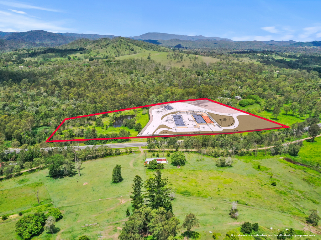 0
0

 0
0

 0
0

About Fairney View 4306
The size of Fairney View is approximately 11.2 square kilometres. The population of Fairney View in 2016 was 223 people. By 2021 the population was 221 showing a population decline of 0.9% in the area during that time. The predominant age group in Fairney View is 50-59 years. Households in Fairney View are primarily childless couples and are likely to be repaying $1400 - $1799 per month on mortgage repayments. In general, people in Fairney View work in a labourer occupation.In 2021, 89.60% of the homes in Fairney View were owner-occupied compared with 82.20% in 2016.
Fairney View has 99 properties. Over the last 5 years, Houses in Fairney View have seen a 103.50% increase in median value, while Units have seen a 205.68% increase. As at 31 July 2026:
- The median value for Houses in Fairney View is $1,202,266 while the median value for Units is $725,744.
Suburb Insights for Fairney View 4306
Market Insights
Fairney View Trends for Houses
N/A
N/A
View TrendN/A
N/A
Fairney View Trends for Units
N/A
N/A
View TrendN/A
N/A
Neighbourhood Insights
© Copyright 2026. RP Data Pty Ltd trading as Cotality (Cotality). All rights reserved. No reproduction, distribution, or transmission of the copyrighted materials is permitted. The information is deemed reliable but not guaranteed.
While Cotality uses commercially reasonable efforts to ensure the Cotality Data is current, Cotality does not warrant the accuracy, currency or completeness of the Cotality Data and to the full extent permitted by law excludes all loss or damage howsoever arising (including through negligence) in connection with the Cotality Data.
This product uses cookies and other similar technologies to improve and customise your browsing experience, to tailor content and adverts, and for analytics and metrics regarding visitor usage on this product and other media. We may share cookie and analytics information with third parties for the purposes of advertising. By continuing to use our website, you consent to cookies being used. View our Privacy Policy here.
X