
82 Edward StreetDalby QLD 4405
Property Details for 82 Edward St, Dalby
82 Edward St, Dalby is a 3 bedroom, 1 bathroom House with 1 parking spaces and was built in 1920. The property has a land size of 691m2 and floor size of 104m2. While the property is not currently for sale or for rent, it was last sold in October 2024.
Last Listing description (January 2026)
Imagine sitting on the front deck, watching the sun set behind a majestic 100-year-old Hilliers Fig tree. Welcome to 82 Edward Street, Dalby.Built in 1920 from quality Queensland hardwoods to exacting standards, this lovingly restored three-bedroom, one-bathroom workers' cottage has truly stood the test of time, seamlessly blending old-world charm with modern convenience.The home features high cathedral ceilings, classic VJ walls throughout, polished timber floors, and a tiled kitchen and bathroom. Built-in wardrobes and abundant natural light fill the bedrooms, while the open-plan kitchen and living area create a relaxed and inviting family space. All bedrooms are air-conditioned, and the private front verandah provides an ideal setting for quiet outdoor entertaining. The high-set home is positioned on a large corner block and effortlessly captures Dalby's cooling natural breezes.Set on a fully fenced allotment, the property includes a dual garage and a generous backyard with ample room to accommodate a granny flat, an in-ground swimming pool, or both (STCA). Thoughtfully landscaped and located in one of Dalby's most prestigious and tightly held streets, surrounded by similarly restored character homes, the property also enjoys walking distance to local schools and everyday amenities, while maintaining a peaceful, established neighbourhood feel.The property is currently leased to long-standing tenants at $580 per week, with a new 12-month lease secured through to January 2027, delivering immediate income and long-term security.Offers over $590,000 represent exceptional value and a strong, stable rental return in the current market.For further information or to arrange an inspection, contact Courtney Walsh at One Property Centre.
Property History for 82 Edward St, Dalby, QLD 4405
- 15 Dec 2025Listed for Sale Offers Over $590,000
- 08 Jan 2025Listed for Rent $580 / week
- 31 Oct 2024Sold for $415,000

Recent sales nearby
See more recent sales nearbySimilar properties For Sale nearby
See more properties for sale nearby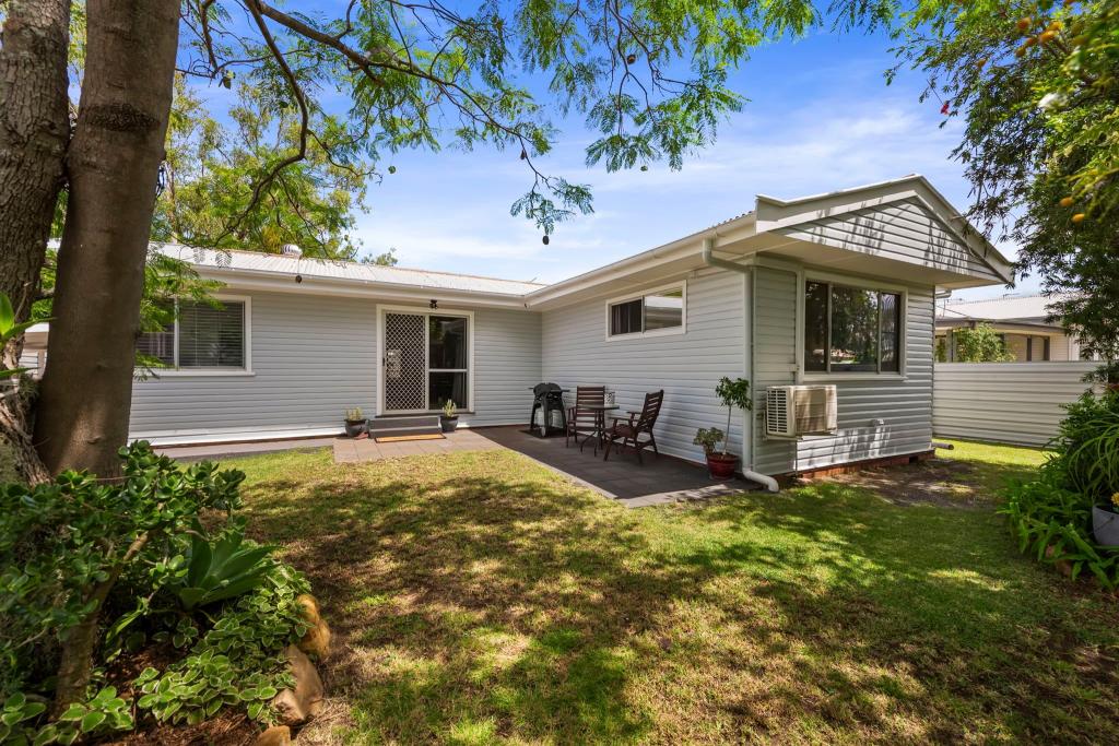 0
0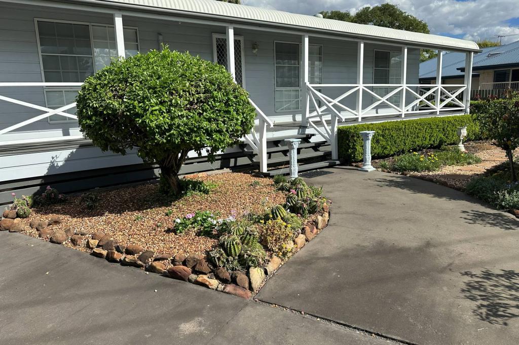 0
0 0
0Similar properties For Rent nearby
See more properties for rent nearby 0
0 0
0 0
0About Dalby 4405
The size of Dalby is approximately 323.8 square kilometres. It has 23 parks covering nearly 0.8% of total area. The population of Dalby in 2016 was 12719 people. By 2021 the population was 12758 showing a population growth of 0.3% in the area during that time. The predominant age group in Dalby is 10-19 years. Households in Dalby are primarily couples with children and are likely to be repaying $1000 - $1399 per month on mortgage repayments. In general, people in Dalby work in a trades occupation.In 2021, 62.70% of the homes in Dalby were owner-occupied compared with 59.40% in 2016.
Dalby has 6,450 properties. Over the last 5 years, Houses in Dalby have seen a 136.59% increase in median value, while Units have seen a 125.68% increase. As at 31 March 2026:
- The median value for Houses in Dalby is $527,889 while the median value for Units is $437,833.
- Houses have a median rent of $520 while Units have a median rent of $365.
Suburb Insights for Dalby 4405
Market Insights
Dalby Trends for Houses
N/A
N/A
View TrendN/A
N/A
Dalby Trends for Units
N/A
N/A
View TrendN/A
N/A
Neighbourhood Insights
© Copyright 2026. RP Data Pty Ltd trading as Cotality (Cotality). All rights reserved. No reproduction, distribution, or transmission of the copyrighted materials is permitted. The information is deemed reliable but not guaranteed.
While Cotality uses commercially reasonable efforts to ensure the Cotality Data is current, Cotality does not warrant the accuracy, currency or completeness of the Cotality Data and to the full extent permitted by law excludes all loss or damage howsoever arising (including through negligence) in connection with the Cotality Data.
This product uses cookies and other similar technologies to improve and customise your browsing experience, to tailor content and adverts, and for analytics and metrics regarding visitor usage on this product and other media. We may share cookie and analytics information with third parties for the purposes of advertising. By continuing to use our website, you consent to cookies being used. View our Privacy Policy here.
X