
Property Details for 1 Anglia St, Aspley
1 Anglia St, Aspley is a 4 bedroom, 2 bathroom House with 1 parking spaces and was built in 1975. While the property is not currently for sale or for rent, it was last sold in October 2023.
Last Listing description (November 2023)
Value Packed Buying In Aspley
Discover an incredible opportunity for those in search of a well-maintained 4-bedroom residence with an ensuite, ideally situated in a prime location near Chermside Shopping Centre, and Marchant Park.
This property effortlessly checks all the boxes for exceptional value, prime location, comfortable living, and generous space.
This home is move-in ready, yet it offers boundless potential for value enhancement. The quality of this location is unmatched, placing you within close proximity to reputable schools, transportation options, Westfield Chermside, Marchant Park, and the well-established Robinson Road shopping centre.
Seize this opportunity to invest in this highly sought-after Northside neighbourhood before it's too late. You'll be pleasantly surprised by the multitude of offerings this property brings to the table.
Features:
Sturdy construction featuring hardwood frame, chamferboard, and terra-cotta tile roof
Polished timber floors
Expansive lounge and dining area that leads to a charming front verandah
Four bedrooms, complete with a master suite featuring an ensuite
An inviting entertainment area, perfect for relaxation or hosting gatherings
Single lock-up garage with ample off-street parking space, including convenient access for a boat, caravan, or trailer
A generous 610m2 block of land
Location:
150m to Rainbow Lorikeet Park
400m to St Dympna's Primary School
800m to Marchant Park
1km to the Little Fox Lane Cafe, chemist and specialty shops
1.1km to the nearest Shopping Centre
1.8km to Chermside Shopping Centre
12km to Brisbane City
. .
Property History for 1 Anglia St, Aspley, QLD 4034
- 10 Nov 2023Sold for $990,000
- 03 Oct 2023Listed for Sale For Sale
- 29 May 2008Listed for Sale 435000

Recent sales nearby
See more recent sales nearby
Similar properties For Sale nearby
See more properties for sale nearby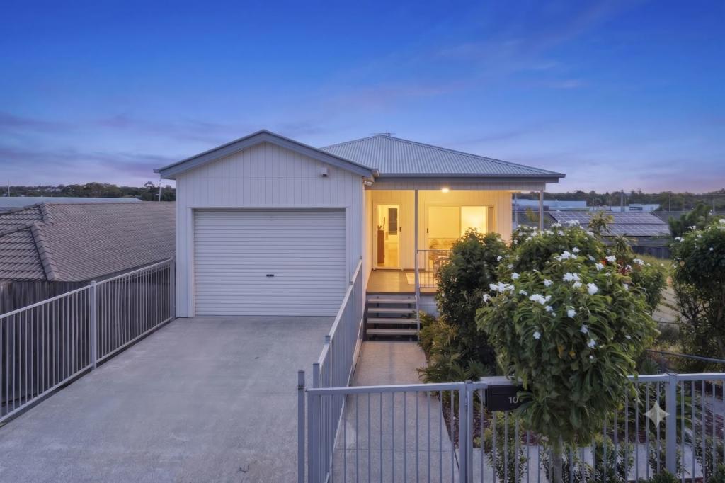 0
0 0
0 0
0Similar properties For Rent nearby
See more properties for rent nearby 0
0 0
0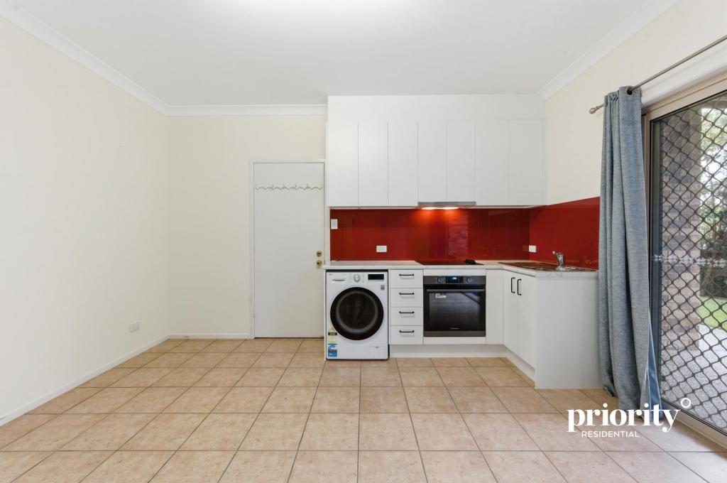 0
0About Aspley 4034
The size of Aspley is approximately 6.5 square kilometres. There are 17 parks, covering nearly 13.8% of the total area. The population of Aspley in 2016 was 12108 people. By 2021 the population was 12871 showing a population growth of 6.3% in the area during that time. The predominant age group in Aspley is 40-49 years. Households in Aspley are primarily couples with children and are likely to be repaying $1800 - $2399 per month on mortgage repayments. In general, people in Aspley work in a professional occupation.In 2021, 69.30% of the homes in Aspley were owner-occupied compared with 69.50% in 2016.
Aspley has 5,575 properties. Over the last 5 years, Houses in Aspley have seen a 94.23% increase in median value, while Units have seen a 115.70% increase. As at 30 April 2026:
- The median value for Houses in Aspley is $1,369,377 while the median value for Units is $903,796.
- Houses have a median rent of $750 while Units have a median rent of $623.
Suburb Insights for Aspley 4034
Market Insights
Aspley Trends for Houses
N/A
N/A
View TrendN/A
N/A
Aspley Trends for Units
N/A
N/A
View TrendN/A
N/A
Neighbourhood Insights
© Copyright 2026. RP Data Pty Ltd trading as Cotality (Cotality). All rights reserved. No reproduction, distribution, or transmission of the copyrighted materials is permitted. The information is deemed reliable but not guaranteed.
While Cotality uses commercially reasonable efforts to ensure the Cotality Data is current, Cotality does not warrant the accuracy, currency or completeness of the Cotality Data and to the full extent permitted by law excludes all loss or damage howsoever arising (including through negligence) in connection with the Cotality Data.
This product uses cookies and other similar technologies to improve and customise your browsing experience, to tailor content and adverts, and for analytics and metrics regarding visitor usage on this product and other media. We may share cookie and analytics information with third parties for the purposes of advertising. By continuing to use our website, you consent to cookies being used. View our Privacy Policy here.
X