
9 Whiptail PlaceAdvancetown QLD 4211
Property Details for 9 Whiptail Pl, Advancetown
9 Whiptail Pl, Advancetown is a 5 bedroom, 5 bathroom House with 2 parking spaces and was built in 2017. The property has a land size of 4992m2. While the property is not currently for sale or for rent, it was last sold in June 2014.
Last Listing description (June 2021)
Have the peace and tranquility of a country lifestyle, yet only minutes drive to Nerang Cinemas, Shopping Centres, the M1 and, 20-25 mins from the city centre of the Gold Coast, This home has dual living, perfect for the extended family all under one roof and is situated among other quality homes.
Features include:
- Ceiling fans throughout
- Ducted air conditioning throughout
- Massive open plan living off the kitchen
- Media/rumpus room downstairs and upstairs
- Downstairs study nook
- Covered balcony off upstairs media room
- Large kitchen with gas cooktop and butlers pantry
- Large double lock up garage with room for parking around driveway
- Separate laundry
- Downstairs powder room
-Leased to 23/08/2021, rent is $950/week
Please register your details via email to arrange an inspection, do not miss out on this property!
Disclaimer: Details and finishes shown in artist impressions and photography are indicative only. We have in preparing these information used our best endeavors to ensure that contained herein is true and accurate but accept no responsibility and disclaim all liability in respect of any errors, omissions,inaccuracies or misstatements that may occur. Prospective vendors, purchasers & tenants should make their own enquiries to verify the information contained herein.
Property History for 9 Whiptail Pl, Advancetown, QLD 4211
- 30 Jan 2020Listed for Sale $1,450,000
- 23 May 2019Listed for Sale Not Disclosed
- 12 Jun 2014Sold for $335,000

Recent sales nearby
See more recent sales nearby
Similar properties For Sale nearby
See more properties for sale nearby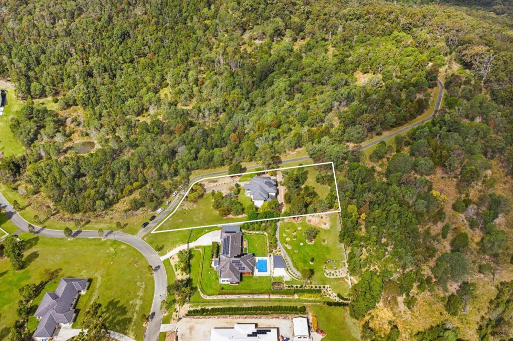 0
0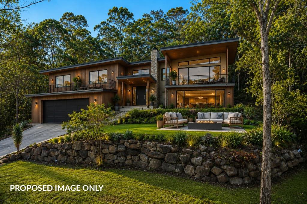 0
0 0
0
Similar properties For Rent nearby
See more properties for rent nearby 0
0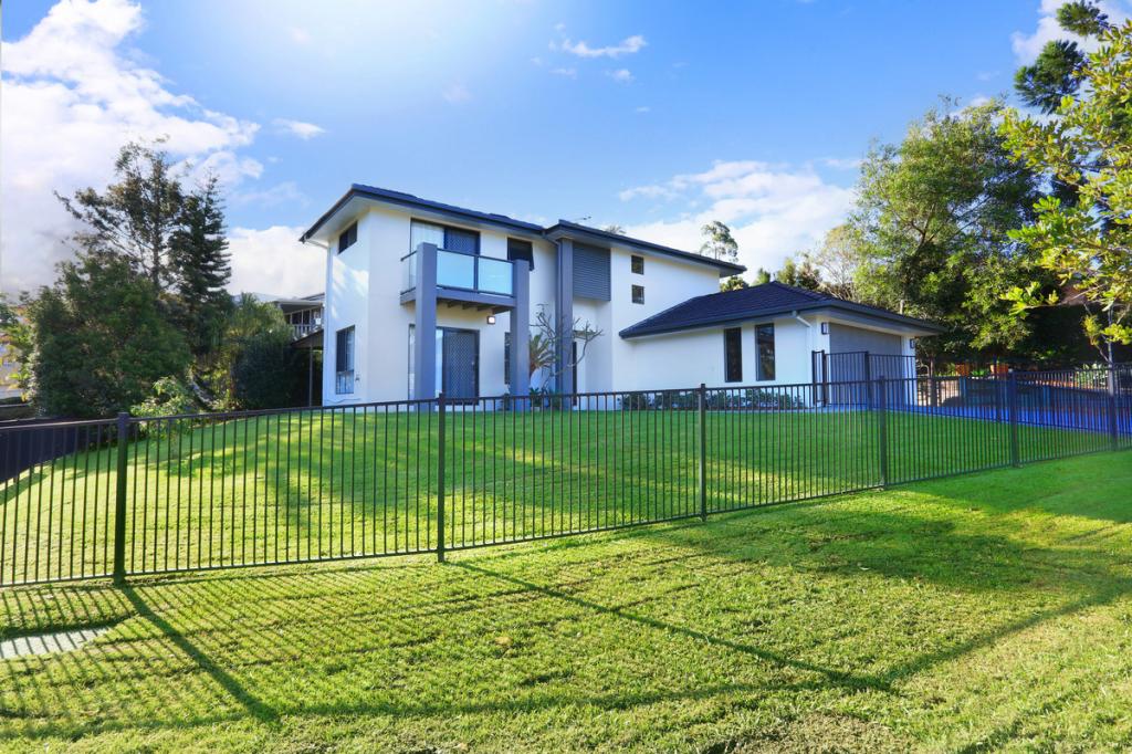 0
0About Advancetown 4211
The size of Advancetown is approximately 63.6 square kilometres. There are 10 parks, covering nearly 6.2% of the total area. The population of Advancetown in 2016 was 482 people. By 2021 the population was 528 showing a population growth of 9.5% in the area during that time. The predominant age group in Advancetown is 50-59 years. Households in Advancetown are primarily childless couples and are likely to be repaying $1800 - $2399 per month on mortgage repayments. In general, people in Advancetown work in a managers occupation.In 2021, 77.20% of the homes in Advancetown were owner-occupied compared with 72.20% in 2016.
Advancetown has 226 properties. Over the last 5 years, Houses in Advancetown have seen a 81.42% increase in median value, while Units have seen a 104.23% increase. As at 31 May 2026:
- The median value for Houses in Advancetown is $1,746,895 while the median value for Units is $1,289,884.
Suburb Insights for Advancetown 4211
Market Insights
Advancetown Trends for Houses
N/A
N/A
View TrendN/A
N/A
Advancetown Trends for Units
N/A
N/A
View TrendN/A
N/A
Neighbourhood Insights
© Copyright 2026. RP Data Pty Ltd trading as Cotality (Cotality). All rights reserved. No reproduction, distribution, or transmission of the copyrighted materials is permitted. The information is deemed reliable but not guaranteed.
While Cotality uses commercially reasonable efforts to ensure the Cotality Data is current, Cotality does not warrant the accuracy, currency or completeness of the Cotality Data and to the full extent permitted by law excludes all loss or damage howsoever arising (including through negligence) in connection with the Cotality Data.
This product uses cookies and other similar technologies to improve and customise your browsing experience, to tailor content and adverts, and for analytics and metrics regarding visitor usage on this product and other media. We may share cookie and analytics information with third parties for the purposes of advertising. By continuing to use our website, you consent to cookies being used. View our Privacy Policy here.
X