
13 Hang Gong AvenueDriver NT 0830
Property Details for 13 Hang Gong Ave, Driver
13 Hang Gong Ave, Driver is a 3 bedroom, 1 bathroom House with 2 parking spaces and was built in 1990. The property has a land size of 470m2.
Last Listing description (July 2025)
Let your creative spirit run wild in this unique atrium-style home, perfect for the homebuyer seeking a project in this convenient Palmerston setting. Featuring abundant natural light, with banks of breezy louvre windows and an abundant sense of space with soaring high ceilings.
Wonderfully light and bright split-level atrium-style home
Unique design boasts generous living and sleep space
Fantastic alfresco framed by easy-care yard and lush landscaping
Great study, laundry with WC and storage also on ground level
Timber floors through three well-proportioned bedrooms upstairs
Walk-in robe to master, flowing out to balcony and leafy outlook
Renovated bathroom features bath, shower and separate WC
Cooling breezes through louvres, assisted by AC throughout
Double carport with lockup storeroom at front of home
Just waiting for the right buyer to come along and create something truly special, this lovely home sells itself with its fabulous character, excellent bones and handy location, which is moments from Palmerston CBD's every essential and the gorgeous greens of Palmerston Golf Course.
As soon as you step inside, you can't help but fall in love with its effortless sense of space. Framing up verdant views while catching cooling breezes, banks of louvres work to flood the interior with natural light, as soaring vaulted ceilings and a unique layout only add to its appeal.
Tiled through the ground level, this is made up of generous open-plan living, which connects seamlessly with both the kitchen and adjoining alfresco. A dream come true for entertainers, the covered verandah is another major highlight here, framed by an easy-care, private backyard.
Back inside, take note of the sizeable study, great storage and enclosed 2nd toilet in the laundry, before heading upstairs to check out the three bedrooms. Featuring richly toned timber floors, this upper-level impresses further with an airy master boasting a walk-in robe and balcony enjoying leafy neighbourhood views.
Completing the interior is a tastefully renovated bathroom with bath, shower and separate toilet, while outside, there is a double carport with lockup storeroom.
This is one you need to see in person! Call us to arrange your inspection today.
Council Rates: $1,948.00 per annum
Property History for 13 Hang Gong Ave, Driver, NT 0830
- 04 Jun 2025Listed for Sale SOLD

Recent sales nearby
See more recent sales nearbySimilar properties For Sale nearby
See more properties for sale nearby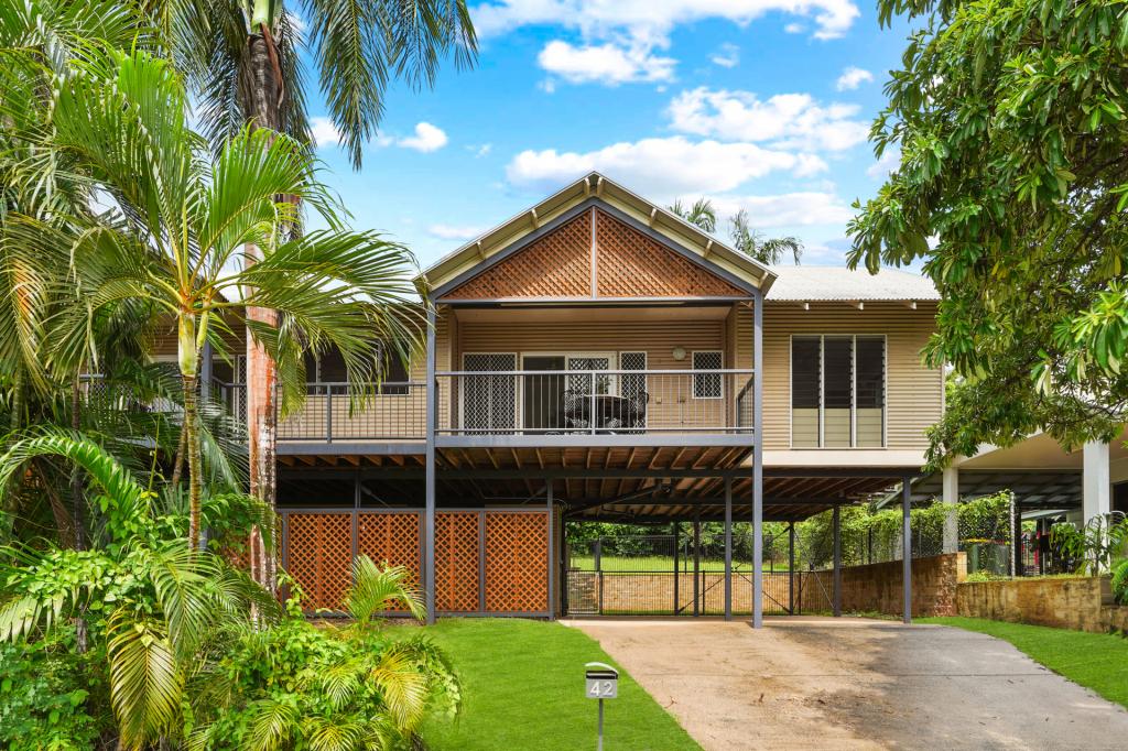 0
0 0
0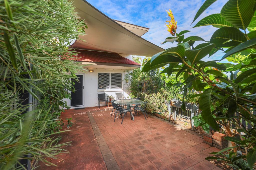 0
0Similar properties For Rent nearby
See more properties for rent nearby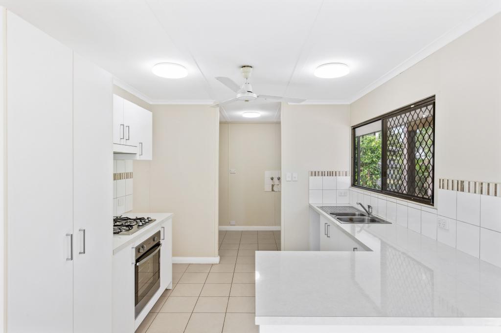 0
0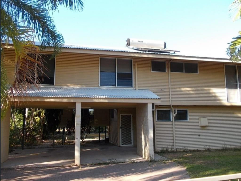 0
0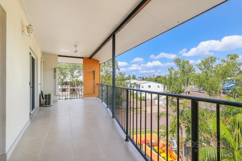 0
0About Driver 0830
The size of Driver is approximately 1.7 square kilometres. There are 16 parks, covering nearly 30.2% of the total area. The population of Driver in 2016 was 2884 people. By 2021 the population was 2747 showing a population decline of 4.8% in the area during that time. The predominant age group in Driver is 30-39 years. Households in Driver are primarily couples with children and are likely to be repaying $1800 - $2399 per month on mortgage repayments. In general, people in Driver work in a trades occupation.In 2021, 51.50% of the homes in Driver were owner-occupied compared with 52.10% in 2016.
Driver has 1,225 properties. Over the last 5 years, Houses in Driver have seen a 36.93% increase in median value, while Units have seen a 37.40% increase. As at 31 May 2026:
- The median value for Houses in Driver is $629,814 while the median value for Units is $407,535.
- Houses have a median rent of $650 while Units have a median rent of $550.
Suburb Insights for Driver 0830
Market Insights
Driver Trends for Houses
N/A
N/A
View TrendN/A
N/A
Driver Trends for Units
N/A
N/A
View TrendN/A
N/A
Neighbourhood Insights
© Copyright 2026. RP Data Pty Ltd trading as Cotality (Cotality). All rights reserved. No reproduction, distribution, or transmission of the copyrighted materials is permitted. The information is deemed reliable but not guaranteed.
While Cotality uses commercially reasonable efforts to ensure the Cotality Data is current, Cotality does not warrant the accuracy, currency or completeness of the Cotality Data and to the full extent permitted by law excludes all loss or damage howsoever arising (including through negligence) in connection with the Cotality Data.
This product uses cookies and other similar technologies to improve and customise your browsing experience, to tailor content and adverts, and for analytics and metrics regarding visitor usage on this product and other media. We may share cookie and analytics information with third parties for the purposes of advertising. By continuing to use our website, you consent to cookies being used. View our Privacy Policy here.
X