
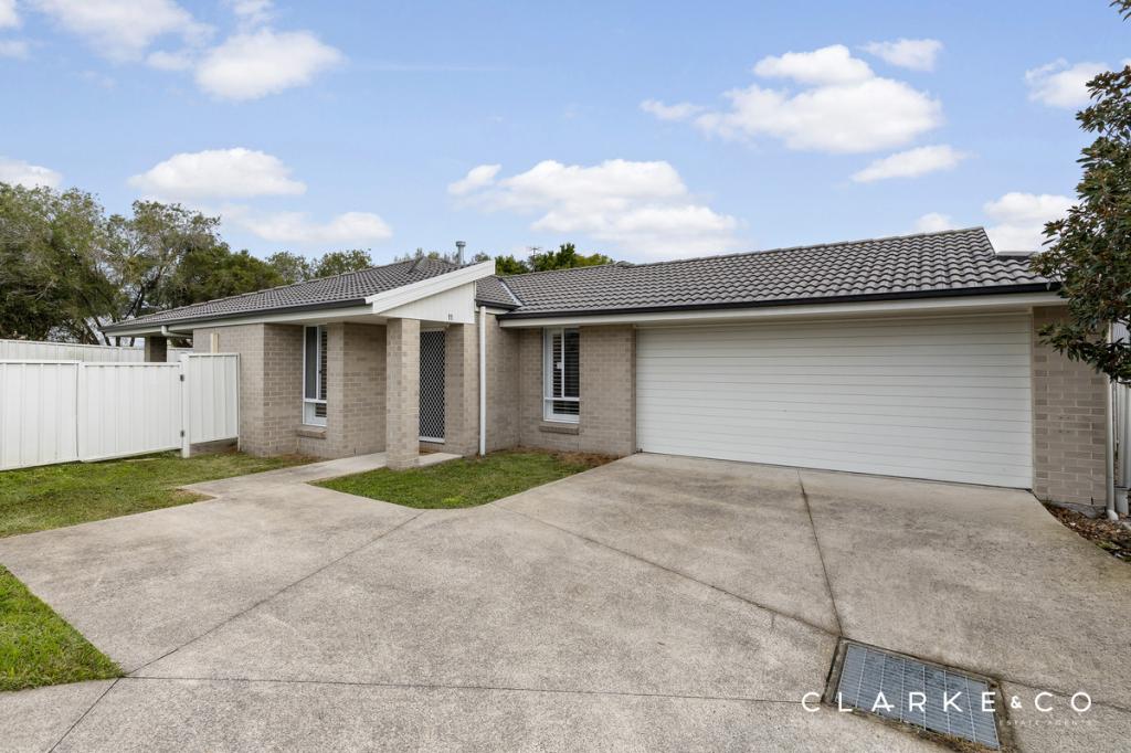
1/28 Croft CloseThornton NSW 2322
Property Details for 1/28 Croft Cl, Thornton
1/28 Croft Cl, Thornton is a 3 bedroom, 2 bathroom Unit with 1 parking spaces and was built in 2018. While the property is not currently for sale or for rent, it was last sold in February 2026. There are other 3 bedroom Unit sold in Thornton in the last 12 months.
Last Listing description (February 2026)
INVESTMENT OPPORTUNITY - TENANT IN PLACE
With a tenant locked in until 27/10/2026 paying $610.00 per week if your looking for a solid investment you have found it. A functional floor plan offers easy living. A light filled lounge room is located off the entry and separates two bedrooms with built ins. These are conveniently located to the main bathroom and separate toilet. Further down the hallway you walk into the open plan combined air conditioned living / dining that incorporates the well appointed kitchen. This space leads out to a private alfresco for morning coffees and afternoon bbq's. The master bedroom is air conditioned with an ensuite and built in robe. Single garage provides internal access. Located close to transport and shopping.
Whilst all care has been taken preparing this advertisement and the information contained herein has been obtained from sources, we believe to be reliable, PRDnationwide Hunter Valley does not warrant, represent, or guarantee the accuracy, adequacy, or completeness of the information. PRDnationwide Hunter Valley accepts no liability for any loss or damage (whether caused by negligence or not) resulting from reliance on this information, and potential purchasers should make their own investigations before purchasing.
Property History for 1/28 Croft Cl, Thornton, NSW 2322
- 02 Feb 2026Sold for $705,000
- 21 Jan 2026Listed for Sale GUIDE $660,000-$690,000
- 07 Nov 2022Listed for Rent $500

Recent sales nearby
See more recent sales nearbySimilar properties For Sale nearby
See more properties for sale nearby
 0
0 0
0 0
0Similar properties For Rent nearby
See more properties for rent nearby 0
0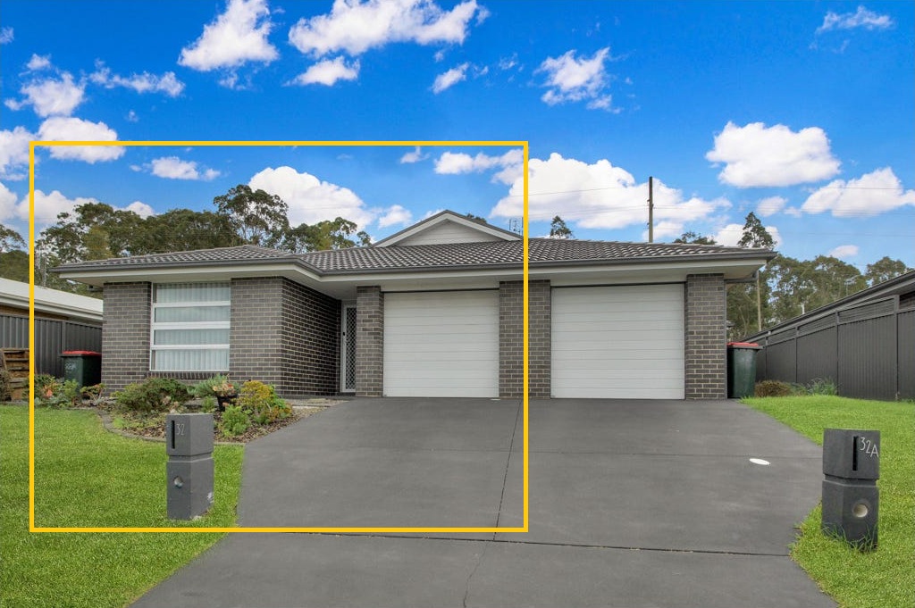 0
0 0
0About Thornton 2322
The size of Thornton is approximately 16.6 square kilometres. There are 6 parks, covering nearly 1.2% of the total area. The population of Thornton in 2016 was 8062 people. By 2021 the population was 10690 showing a population growth of 32.6% in the area during that time. The predominant age group in Thornton is 20-29 years. Households in Thornton are primarily couples with children and are likely to be repaying $1800 - $2399 per month on mortgage repayments. In general, people in Thornton work in a trades occupation.In 2021, 64.30% of the homes in Thornton were owner-occupied compared with 77.30% in 2016.
Thornton has 5,273 properties. Over the last 5 years, Houses in Thornton have seen a 35.59% increase in median value, while Units have seen a 64.88% increase. As at 30 June 2026:
- The median value for Houses in Thornton is $914,274 while the median value for Units is $671,704.
- Houses have a median rent of $670 while Units have a median rent of $610.
Suburb Insights for Thornton 2322
Market Insights
Thornton Trends for Houses
N/A
N/A
View TrendN/A
N/A
Thornton Trends for Units
N/A
N/A
View TrendN/A
N/A
Neighbourhood Insights
© Copyright 2026. RP Data Pty Ltd trading as Cotality (Cotality). All rights reserved. No reproduction, distribution, or transmission of the copyrighted materials is permitted. The information is deemed reliable but not guaranteed.
While Cotality uses commercially reasonable efforts to ensure the Cotality Data is current, Cotality does not warrant the accuracy, currency or completeness of the Cotality Data and to the full extent permitted by law excludes all loss or damage howsoever arising (including through negligence) in connection with the Cotality Data.
This product uses cookies and other similar technologies to improve and customise your browsing experience, to tailor content and adverts, and for analytics and metrics regarding visitor usage on this product and other media. We may share cookie and analytics information with third parties for the purposes of advertising. By continuing to use our website, you consent to cookies being used. View our Privacy Policy here.
X