
49 Kulgoa RoadPymble NSW 2073
Property Details for 49 Kulgoa Rd, Pymble
49 Kulgoa Rd, Pymble is a 4 bedroom, 2 bathroom House with 2 parking spaces. The property has a land size of 949m2 and floor size of 155m2. While the property is not currently for sale or for rent, it was last sold in November 2024.
Last Listing description (February 2025)
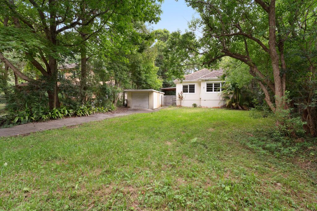
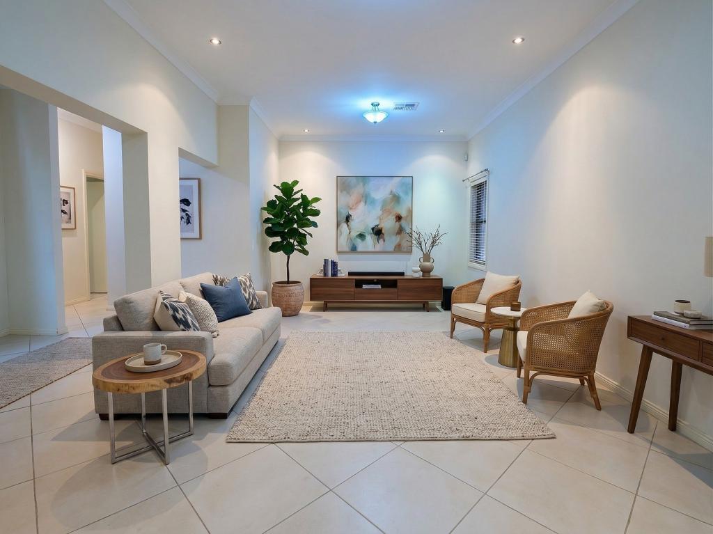
Welcome to 'Cobbadah' - a delightful double-brick residence exuding classic charm. This beautiful home features 4 bedrooms, 2 bathrooms, and a double lock up garage with an additional studio, all situated on a generous 941sqm block. Recently refreshed with new interior paint, a modern kitchen, and new carpet, this home is ready for you to move in and make your own.Perfectly located on the desirable east side, Cobbadah offers convenient access to Pymble and Gordon Stations, along with prestigious schools such as Pymble Ladies' College and Ravenswood. Enjoy the north/west facing backyard that fills the sun-drenched family room with light. The spacious entertaining balcony and expansive sunny backyard provide the ideal setting for both relaxation and entertaining. Spacious sunlit living and dining features oversized windows, original floorboards and wood burning fireplace Charming new kitchen with fresh modern finishes, SMEG gas cooking, dishwasher Family friendly backyard offering privacy & lush level lawns Four large bedrooms and two bathrooms Garden studio and double lock up garageLocation Highlights:- 1.6 km to Pymble Station and village shops- 2.7 km to Pymble Ladies' College- 500 meters to Gordon East Public School- 1.7 km to Gordon Centre shops & Station- 2 km to St Ives Shopping Village- Easy access to top private schools- Within the catchment for St Ives High School and Gordon East Public School- Close to parks, reserves & bush walking tracks- Easy access to the 296 & 297 buses to Macquarie and Metro
Property History for 49 Kulgoa Rd, Pymble, NSW 2073
- 30 Nov 2024Sold for $2,500,000
- 29 Nov 2024Listed for Sale Sold - Contact Agent
- 28 Jun 2023Listed for Sale Not Disclosed

Recent sales nearby
See more recent sales nearbySimilar properties For Sale nearby
See more properties for sale nearby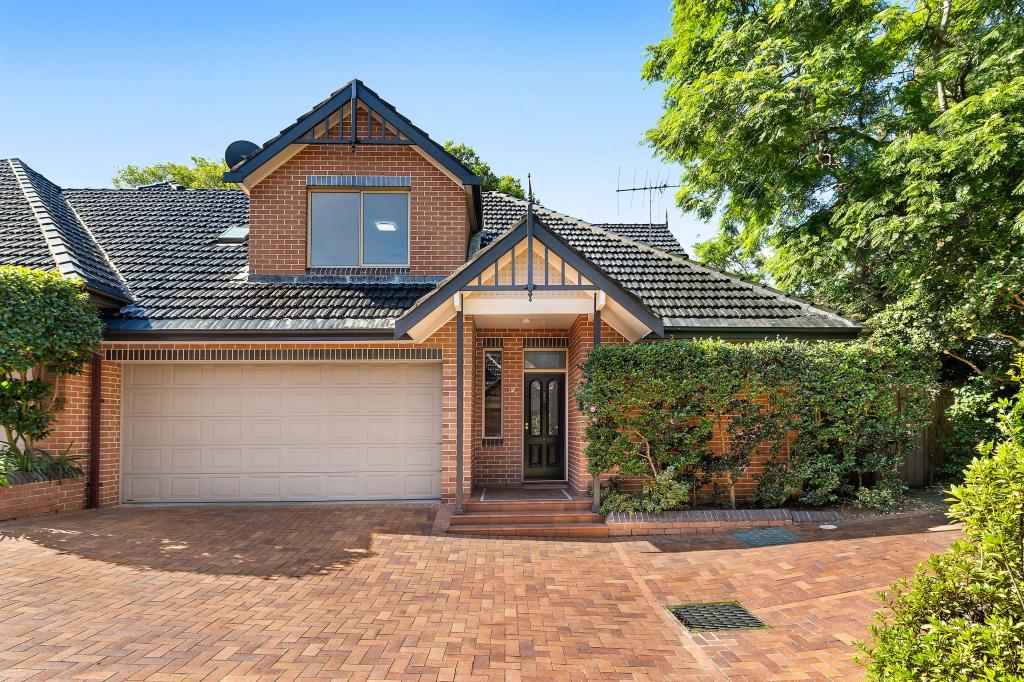 0
0 0
0
 0
0Similar properties For Rent nearby
See more properties for rent nearby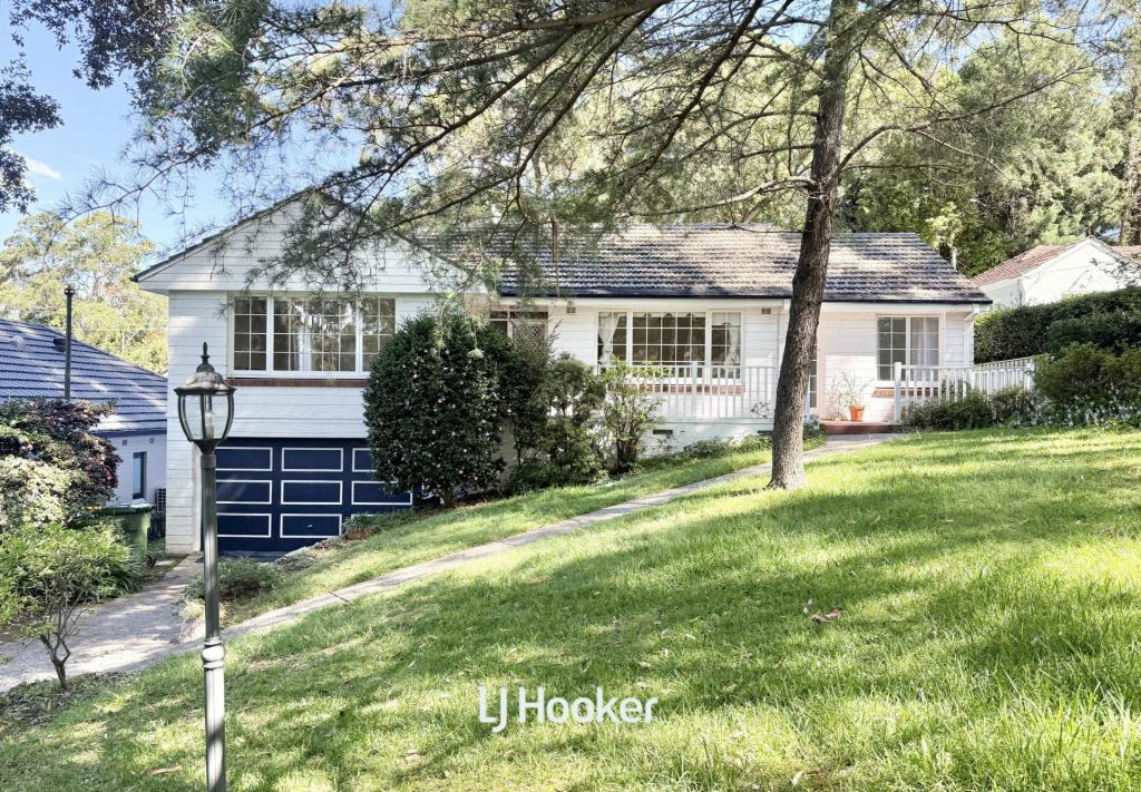 0
0
 0
0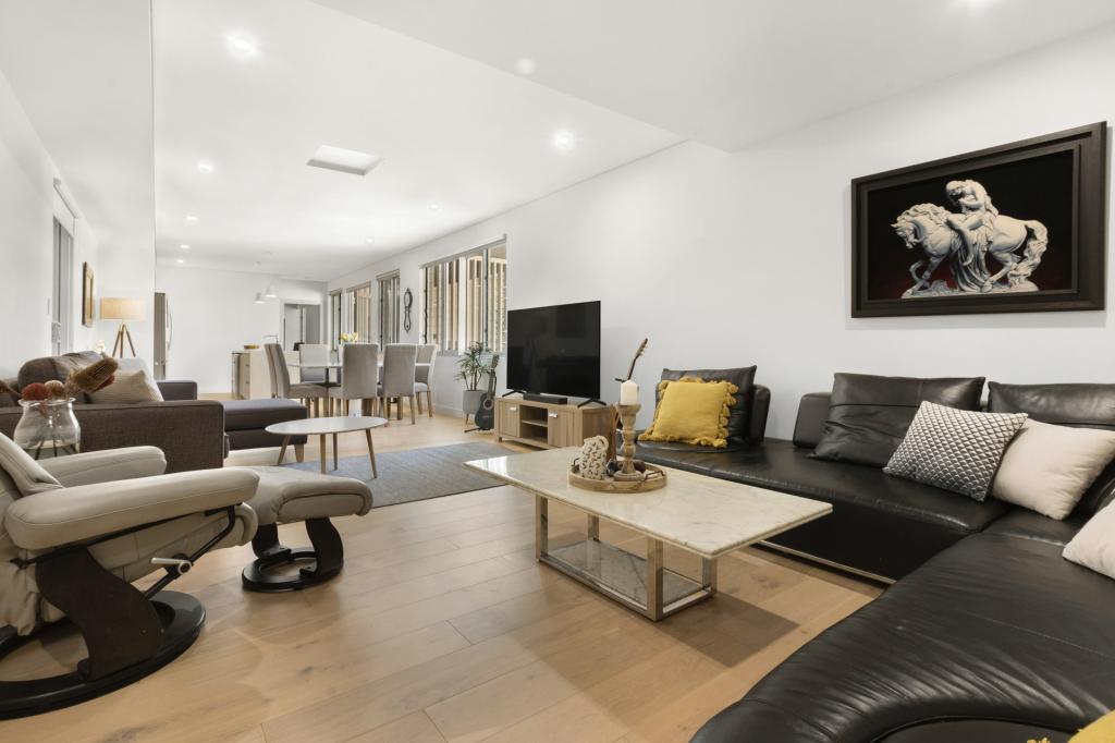 0
0About Pymble 2073
The size of Pymble is approximately 6.5 square kilometres. It has 32 parks covering nearly 15.7% of total area. The population of Pymble in 2016 was 11051 people. By 2021 the population was 11775 showing a population growth of 6.6% in the area during that time. The predominant age group in Pymble is 10-19 years. Households in Pymble are primarily couples with children and are likely to be repaying over $4000 per month on mortgage repayments. In general, people in Pymble work in a professional occupation.In 2021, 77.40% of the homes in Pymble were owner-occupied compared with 80.70% in 2016.
Pymble has 5,051 properties. Over the last 5 years, Houses in Pymble have seen a 31.29% increase in median value, while Units have seen a 9.32% increase. As at 31 March 2026:
- The median value for Houses in Pymble is $3,494,601 while the median value for Units is $1,029,765.
- Houses have a median rent of $1,550 while Units have a median rent of $800.
Suburb Insights for Pymble 2073
Market Insights
Pymble Trends for Houses
N/A
N/A
View TrendN/A
N/A
Pymble Trends for Units
N/A
N/A
View TrendN/A
N/A
Neighbourhood Insights
© Copyright 2026. RP Data Pty Ltd trading as Cotality (Cotality). All rights reserved. No reproduction, distribution, or transmission of the copyrighted materials is permitted. The information is deemed reliable but not guaranteed.
While Cotality uses commercially reasonable efforts to ensure the Cotality Data is current, Cotality does not warrant the accuracy, currency or completeness of the Cotality Data and to the full extent permitted by law excludes all loss or damage howsoever arising (including through negligence) in connection with the Cotality Data.
This product uses cookies and other similar technologies to improve and customise your browsing experience, to tailor content and adverts, and for analytics and metrics regarding visitor usage on this product and other media. We may share cookie and analytics information with third parties for the purposes of advertising. By continuing to use our website, you consent to cookies being used. View our Privacy Policy here.
X