
75 Faraday RoadPadstow NSW 2211
Property Details for 75 Faraday Rd, Padstow
75 Faraday Rd, Padstow is a 3 bedroom, 2 bathroom House with 1 parking spaces. The property has a land size of 379m2. While the property is not currently for sale or for rent, it was last sold in May 2026. There are other 3 bedroom House sold in Padstow in the last 12 months.
Last Listing description (May 2026)
Positioned in a highly convenient and family-friendly pocket of Padstow, this well-presented brick home delivers an easy-care lifestyle just moments from everything you need. With a welcoming street presence and a charming front porch, the home offers a sense of comfort from the moment you arrive. The sun-filled backyard paired with a covered patio creates an inviting setting for relaxed afternoons or casual entertaining. The location is a standout, with shops, schools, parks and transport all within a short stroll, making everyday living effortless. Combining practicality with low-maintenance appeal, this is an opportunity to secure a solid home in a consistently sought-after area. Ideal for downsizers seeking simplicity, growing families looking for space and convenience or savvy investors.
Property Features:
- Spacious living area filled with natural light, creating a comfortable everyday living space
- Three well-proportioned bedrooms, fitted with built-in wardrobes
- Modern kitchen equipped with ample storage, quality appliances and generous bench space
- Well-maintained bathroom featuring a separate bathtub and shower
- Additional sunroom offering flexibility as a second living space, study or retreat
- Internal laundry with added shower and toilet for extra functionality
- Shutter blinds installed throughout, enhancing privacy, light control and style
- Low maintenance backyard with covered patio area, perfect for entertaining or enjoying relaxed outdoor moments
- Covered carport with multiple driveway spaces for additional vehicles
- 700m walk to Padstow Train Station and Padstow shopping precinct
- Approx. 150m to Padstow Park Public School
- 1.8km to Revesby Train Station
- Within close proximity to local Reserves and M5 access
DISCLAIMER: While Ray White Riverwood have taken all care in preparing this information and used their best endeavours to ensure that the information contained therein is true and accurate, but accept no responsibility and disclaim all liability in respect of any errors, inaccuracies or misstatements contained herein. Ray White Riverwood urges prospective purchasers to make their own inquiries to verify the information contained herein.
Property History for 75 Faraday Rd, Padstow, NSW 2211
- 12 May 2026Sold for $1,400,000
- 08 Apr 2026Listed for Sale Sold by Eric Tse
- 27 Aug 2019Listed for Sale $849,000

Recent sales nearby
See more recent sales nearbySimilar properties For Sale nearby
See more properties for sale nearby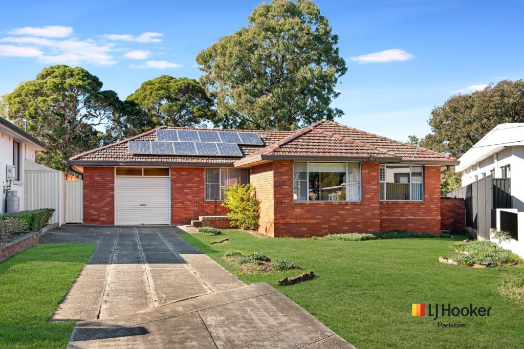 0
0
 0
0
 0
0Similar properties For Rent nearby
See more properties for rent nearby 0
0 0
0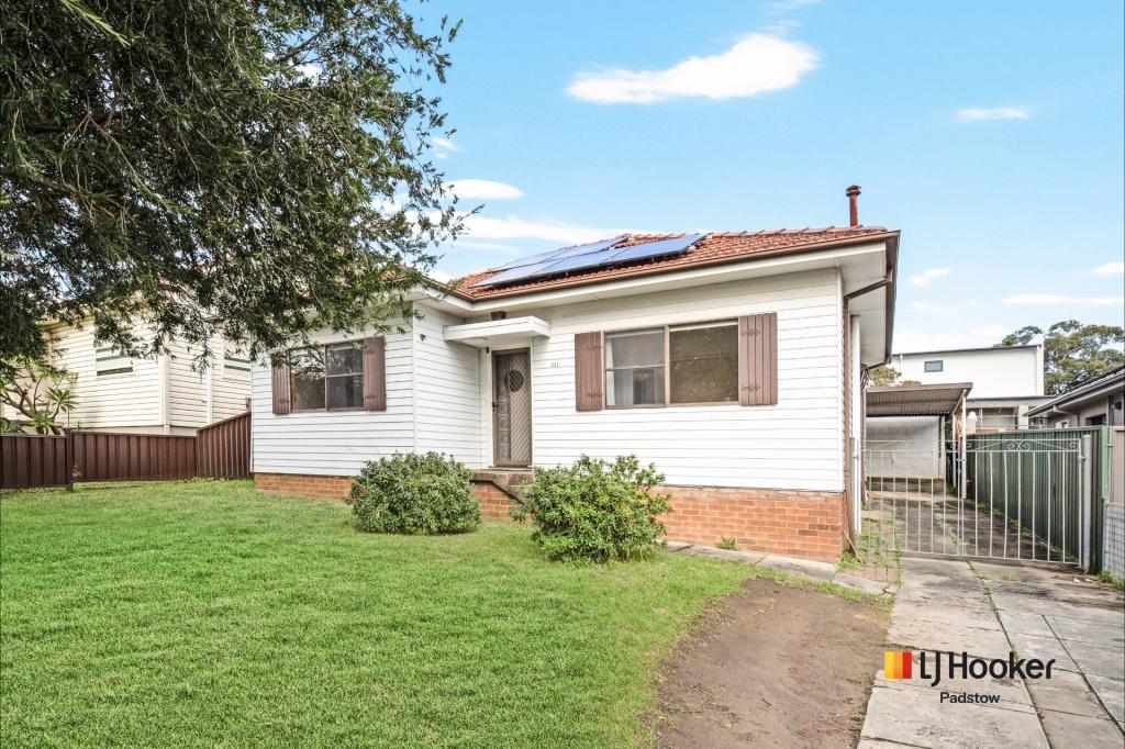 0
0About Padstow 2211
The size of Padstow is approximately 5.5 square kilometres. There are 20 parks, covering nearly 10.9% of the total area. The population of Padstow in 2016 was 13306 people. By 2021 the population was 14017 showing a population growth of 5.3% in the area during that time. The predominant age group in Padstow is 30-39 years. Households in Padstow are primarily couples with children and are likely to be repaying $3000 - $3999 per month on mortgage repayments. In general, people in Padstow work in a professional occupation.In 2021, 64.80% of the homes in Padstow were owner-occupied compared with 67.20% in 2016.
Padstow has 6,451 properties. Over the last 5 years, Houses in Padstow have seen a 37.65% increase in median value, while Units have seen a 34.63% increase. As at 30 June 2026:
- The median value for Houses in Padstow is $1,586,884 while the median value for Units is $1,010,306.
- Houses have a median rent of $850 while Units have a median rent of $650.
Suburb Insights for Padstow 2211
Market Insights
Padstow Trends for Houses
N/A
N/A
View TrendN/A
N/A
Padstow Trends for Units
N/A
N/A
View TrendN/A
N/A
Neighbourhood Insights
© Copyright 2026. RP Data Pty Ltd trading as Cotality (Cotality). All rights reserved. No reproduction, distribution, or transmission of the copyrighted materials is permitted. The information is deemed reliable but not guaranteed.
While Cotality uses commercially reasonable efforts to ensure the Cotality Data is current, Cotality does not warrant the accuracy, currency or completeness of the Cotality Data and to the full extent permitted by law excludes all loss or damage howsoever arising (including through negligence) in connection with the Cotality Data.
This product uses cookies and other similar technologies to improve and customise your browsing experience, to tailor content and adverts, and for analytics and metrics regarding visitor usage on this product and other media. We may share cookie and analytics information with third parties for the purposes of advertising. By continuing to use our website, you consent to cookies being used. View our Privacy Policy here.
X