
22 James CloseMenai NSW 2234
Property Details for 22 James Cl, Menai
22 James Cl, Menai is a 5 bedroom, 3 bathroom House with 3 parking spaces. The property has a land size of 663m2 and floor size of 137m2. While the property is not currently for sale or for rent, it was last sold in December 2020.
Last Listing description (May 2021)
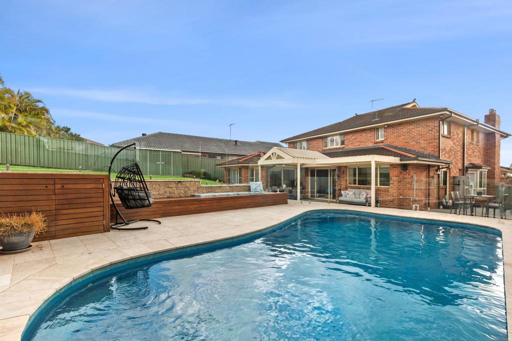
Expansive family living in Menai looks great in this large-sized two-level residence that has been well designed to make it a light filled home of space and quiet privacy with multiple living areas and space for all types of entertaining. This fresh and easycare property also holds a highly convenient setting that's walking distance to Menai Marketplace, local restaurants, Club Menai, schools and public transport.
- A flowing and bright design featuring casual family spaces and formal rooms
- Sheltered entertainment pergola and a sundrenched no-maintenance backyard
- Modern kitchen with quality induction cooktop, dishwasher and pull-out pantry
- Upstairs rumpus room and generous bedrooms, the master has a walk-in and ensuite
- All bathrooms have been recently renovated and include a deluxe main with full bath
- Three-car garage with ample storage plus downstairs billiards room with fitted out bar
- Quality Blackbutt flooring, ducted air-conditioning and ducted vacuum system
REAL VIDEO AVAILABLE FOR YOUR VIEWING
#professionalsshirepartners
Property History for 22 James Cl, Menai, NSW 2234
- 12 Dec 2020Sold for $1,705,000
- 18 Nov 2020Listed for Sale Auction: Contact Agent
- 08 Aug 1998Sold for $234,000

Recent sales nearby
See more recent sales nearbySimilar properties For Sale nearby
See more properties for sale nearby
 0
0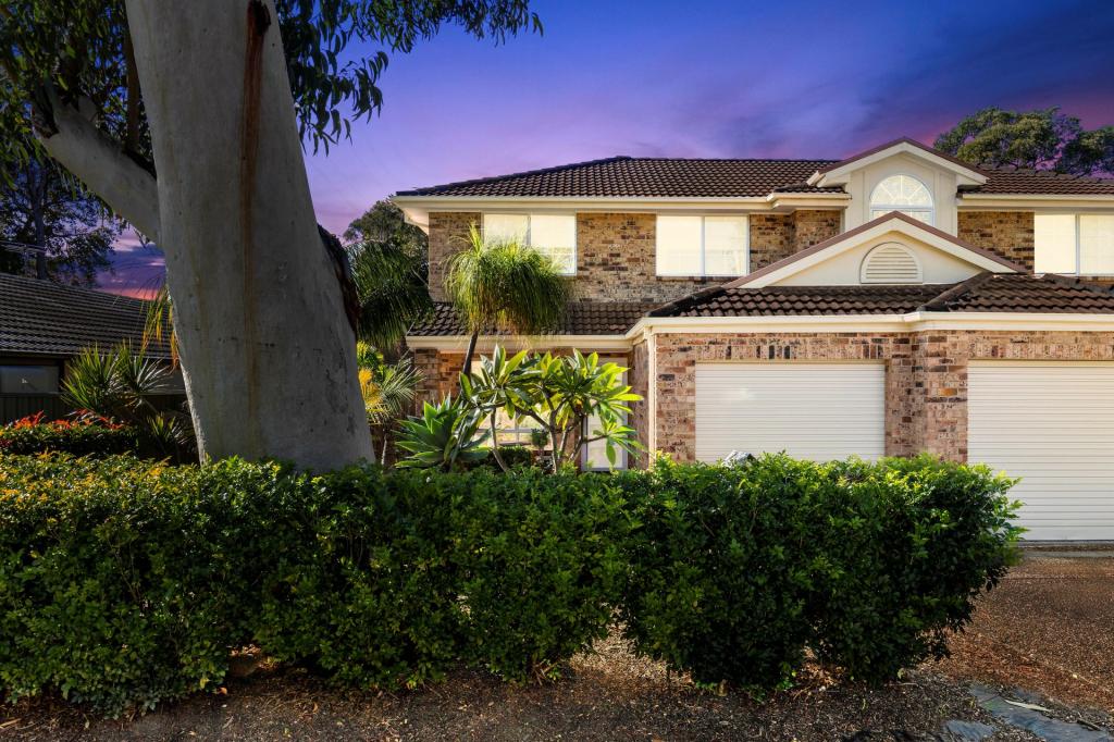 0
0 0
0Similar properties For Rent nearby
See more properties for rent nearby 0
0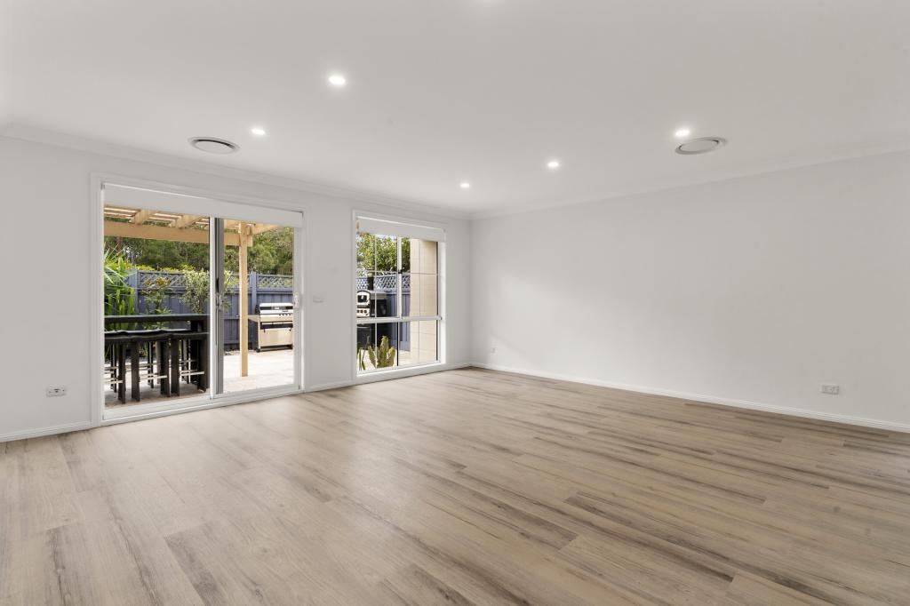 0
0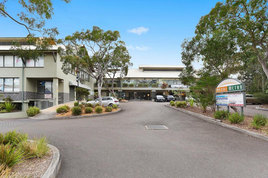 0
0About Menai 2234
The size of Menai is approximately 13.6 square kilometres. There are 24 parks, covering nearly 17.8% of the total area. The population of Menai in 2016 was 10304 people. By 2021 the population was 10419 showing a population growth of 1.1% in the area during that time. The predominant age group in Menai is 50-59 years. Households in Menai are primarily couples with children and are likely to be repaying $3000 - $3999 per month on mortgage repayments. In general, people in Menai work in a professional occupation.In 2021, 83.60% of the homes in Menai were owner-occupied compared with 80.70% in 2016.
Menai has 3,994 properties. Over the last 5 years, Houses in Menai have seen a 30.39% increase in median value, while Units have seen a 34.76% increase. As at 30 June 2026:
- The median value for Houses in Menai is $1,715,341 while the median value for Units is $1,203,421.
- Houses have a median rent of $950 while Units have a median rent of $850.
Suburb Insights for Menai 2234
Market Insights
Menai Trends for Houses
N/A
N/A
View TrendN/A
N/A
Menai Trends for Units
N/A
N/A
View TrendN/A
N/A
Neighbourhood Insights
© Copyright 2026. RP Data Pty Ltd trading as Cotality (Cotality). All rights reserved. No reproduction, distribution, or transmission of the copyrighted materials is permitted. The information is deemed reliable but not guaranteed.
While Cotality uses commercially reasonable efforts to ensure the Cotality Data is current, Cotality does not warrant the accuracy, currency or completeness of the Cotality Data and to the full extent permitted by law excludes all loss or damage howsoever arising (including through negligence) in connection with the Cotality Data.
This product uses cookies and other similar technologies to improve and customise your browsing experience, to tailor content and adverts, and for analytics and metrics regarding visitor usage on this product and other media. We may share cookie and analytics information with third parties for the purposes of advertising. By continuing to use our website, you consent to cookies being used. View our Privacy Policy here.
X