
2 Menzies RoadMarsfield NSW 2122
Property Details for 2 Menzies Rd, Marsfield
2 Menzies Rd, Marsfield is a 4 bedroom, 2 bathroom House with 2 parking spaces. The property has a land size of 500m2 and floor size of 115m2. While the property is not currently for sale or for rent, it was last sold in May 1988.
Last Listing description (February 2023)
Located in the sought-after established neighbourhood of Marsfield, this glamorous two-storey double brick home with spacious and family living. Perfect for the busy young family and multigenerational families needing lifestyle space while being close to all the conveniences that Marsfield has to offer along with its proximity to Sydney's CBD and easy access to transport.
Beautifully appointed throughout, with spacious light-filled rooms, combined lounge and dining with stunning feature wall, this is truly exceptional living. A gorgeous courtyard for your morning coffee and evening drinks provides a private outdoor space, and low maintenance landscaping provides easy-care stress-free weekends!
The location is also excellent with Metro Station, Macquarie Shopping Centre and Macquarie University all within walking distance. Surrounded by parks and nature walks, and only 10min walk to ELS Hall Park for baseball, soccer, rugby, kids' playgrounds and dog park, this stunning luxury home provides exceptional contemporary style along with lifestyle convenience and all that is needed to manage the work life school balance.
Contact: Claire 0434 972 960 Felix 0430 230 916
Property History for 2 Menzies Rd, Marsfield, NSW 2122
- 23 Feb 2023Listed for Sale Contact Agent!
- 25 Mar 1995Listed for Sale Not Disclosed
- 13 May 1988Sold for $215,000

Recent sales nearby
See more recent sales nearbySimilar properties For Sale nearby
See more properties for sale nearby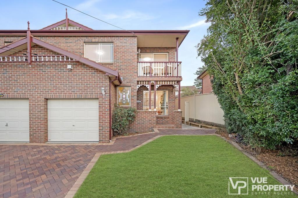 0
0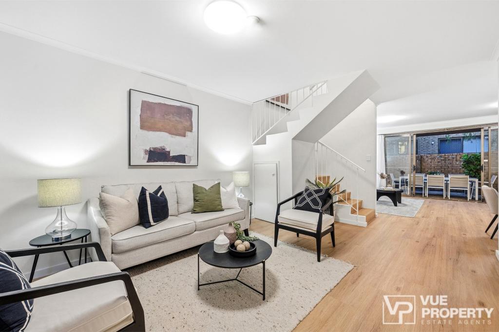 0
0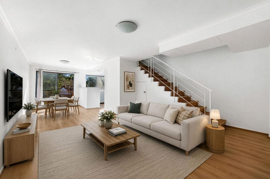 0
0Similar properties For Rent nearby
See more properties for rent nearby 0
0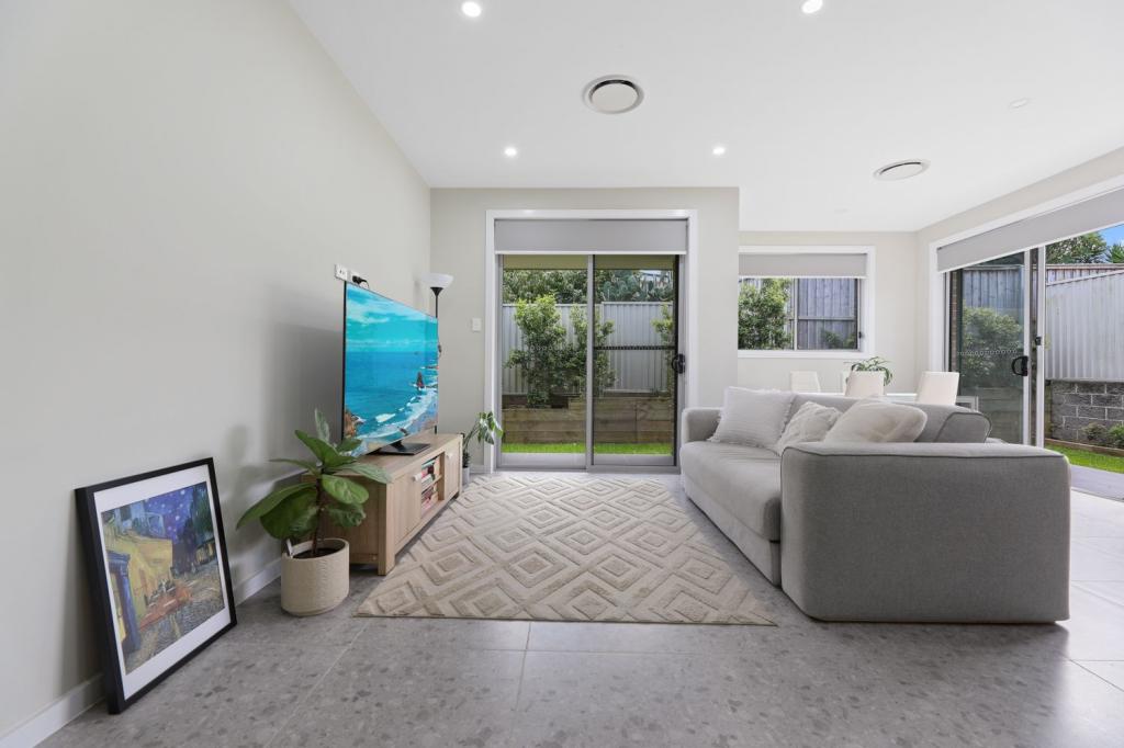 0
0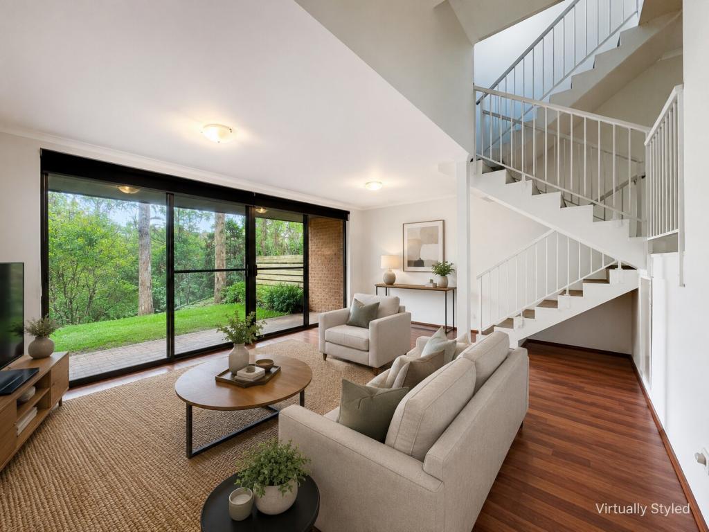 0
0About Marsfield 2122
The size of Marsfield is approximately 3.9 square kilometres. There are 30 parks, covering nearly 24.9% of the total area. The population of Marsfield in 2016 was 13297 people. By 2021 the population was 12492 showing a population decline of 6.0% in the area during that time. The predominant age group in Marsfield is 30-39 years. Households in Marsfield are primarily couples with children and are likely to be repaying $1800 - $2399 per month on mortgage repayments. In general, people in Marsfield work in a professional occupation.In 2021, 56.80% of the homes in Marsfield were owner-occupied compared with 55.40% in 2016.
Marsfield has 5,719 properties. Over the last 5 years, Houses in Marsfield have seen a 14.37% increase in median value, while Units have seen a 16.86% increase. As at 30 June 2026:
- The median value for Houses in Marsfield is $2,339,403 while the median value for Units is $973,101.
- Houses have a median rent of $1,090 while Units have a median rent of $720.
Suburb Insights for Marsfield 2122
Market Insights
Marsfield Trends for Houses
N/A
N/A
View TrendN/A
N/A
Marsfield Trends for Units
N/A
N/A
View TrendN/A
N/A
Neighbourhood Insights
© Copyright 2026. RP Data Pty Ltd trading as Cotality (Cotality). All rights reserved. No reproduction, distribution, or transmission of the copyrighted materials is permitted. The information is deemed reliable but not guaranteed.
While Cotality uses commercially reasonable efforts to ensure the Cotality Data is current, Cotality does not warrant the accuracy, currency or completeness of the Cotality Data and to the full extent permitted by law excludes all loss or damage howsoever arising (including through negligence) in connection with the Cotality Data.
This product uses cookies and other similar technologies to improve and customise your browsing experience, to tailor content and adverts, and for analytics and metrics regarding visitor usage on this product and other media. We may share cookie and analytics information with third parties for the purposes of advertising. By continuing to use our website, you consent to cookies being used. View our Privacy Policy here.
X