6925 Castlereagh HighwayIlford NSW 2850
Property Details for 6925 Castlereagh Hwy, Ilford
Last Listing description (December 2018)
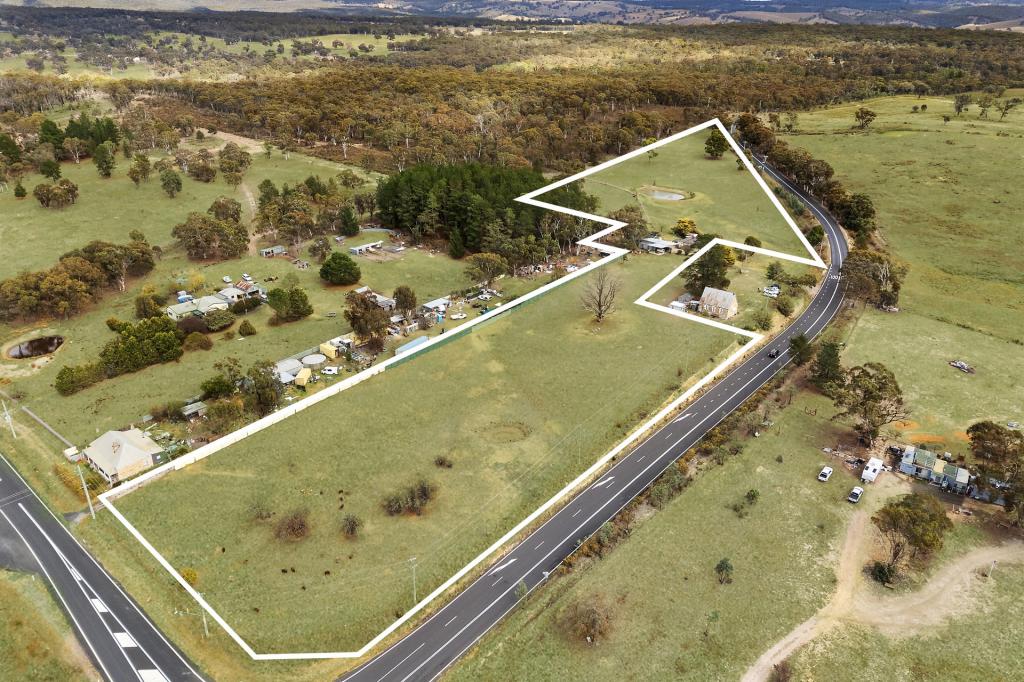
4.03 hectares (10 acres) of land with building entitlement next to the school in the Central Tablelands village of Ilford. Consisting of two lots, this property is on the western or high side of the Castlereagh Highway. It is principally timbered , with a cleared track leading to a cleared area on top of the hill. There are two caravans included with the property in this area, ideal for a weekender or to live in while you build your home. Ilford is located just 56km south of Mudgee, 71km north of Lithgow and under three hours drive from the Sydney CBD. There is a primary school in Ilford, and high school and shopping in Kandos, just 22km east.
Property History for 6925 Castlereagh Hwy, Ilford, NSW 2850
- 20 Nov 2018Sold for $120,000
- 02 Nov 2018Listed for Sale Awaiting Price Guide
- 17 Dec 2008Sold for $65,000
Recent sales nearby
See more recent sales nearby

Similar properties For Sale nearby
See more properties for sale nearby
 0
0
 0
0
 0
0About Ilford 2850
The size of Ilford is approximately 215.7 square kilometres. There is 1 park, covering nearly 1.9% of the total area. The population of Ilford in 2016 was 187 people. By 2021 the population was 165 showing a population decline of 11.8% in the area during that time. The predominant age group in Ilford is 70-79 years. Households in Ilford are primarily childless couples and are likely to be repaying $800 - $999 per month on mortgage repayments. In general, people in Ilford work in a trades occupation.In 2021, 73.90% of the homes in Ilford were owner-occupied compared with 83.10% in 2016.
Ilford has 226 properties. Over the last 5 years, Houses in Ilford have seen a 39.15% increase in median value. As at 31 August 2026:
- The median value for Houses in Ilford is $673,568.
Suburb Insights for Ilford 2850
Market Insights
Ilford Trends for Houses
N/A
N/A
View TrendN/A
N/A
Ilford Trends for Units
N/A
N/A
View TrendN/A
N/A
Neighbourhood Insights
© Copyright 2026. RP Data Pty Ltd trading as Cotality (Cotality). All rights reserved. No reproduction, distribution, or transmission of the copyrighted materials is permitted. The information is deemed reliable but not guaranteed.
While Cotality uses commercially reasonable efforts to ensure the Cotality Data is current, Cotality does not warrant the accuracy, currency or completeness of the Cotality Data and to the full extent permitted by law excludes all loss or damage howsoever arising (including through negligence) in connection with the Cotality Data.
This product uses cookies and other similar technologies to improve and customise your browsing experience, to tailor content and adverts, and for analytics and metrics regarding visitor usage on this product and other media. We may share cookie and analytics information with third parties for the purposes of advertising. By continuing to use our website, you consent to cookies being used. View our Privacy Policy here.
X