
220 Riverside DriveAirds NSW 2560
Property Details for 220 Riverside Dr, Airds
220 Riverside Dr, Airds is a 3 bedroom, 1 bathroom House with 2 parking spaces. The property has a land size of 581m2 and floor size of 95m2. While the property is not currently for sale or for rent, it was last sold in February 2020.
Last Listing description (April 2021)
Ray White Macarthur Group are proud to be working alongside Landcom and NSW Land & Housing Corporation on the Airds renewal project. This exciting opportunity will see the potential of this property evolve as the estate is transformed.
This 3 bedroom brick home with accessibility features is located at 220 Riverside Drive, Airds. There is a large lounge room at the front of the home and the kitchen overlooks the backyard. Internal laundry, tandem carport and a fully fenced yard complete this property. All set on an approximately 582sqm block, this home is sure to impress!
Airds is located within minutes to primary and high schools, and boasts bus stops nearby as well as access to the Campbelltown hub and train station. This home is within close proximity to the Hume Motorway/M31.
Ray White Macarthur Group are excited to present this home which offers a great opportunity to enter the property market or add to your property portfolio. Similar homes currently for sale include 12 Burrundulla Crescent, 216, 218, 222 and 228 Riverside Drive, Airds.
Property History for 220 Riverside Dr, Airds, NSW 2560
- 20 Mar 2020Listed for Rent $370 / week
- 19 Feb 2020Sold for $456,000
- 28 Jan 2020Listed for Sale AUCTION- Price Guide $410,000 - $430,000

Recent sales nearby
See more recent sales nearbySimilar properties For Sale nearby
See more properties for sale nearby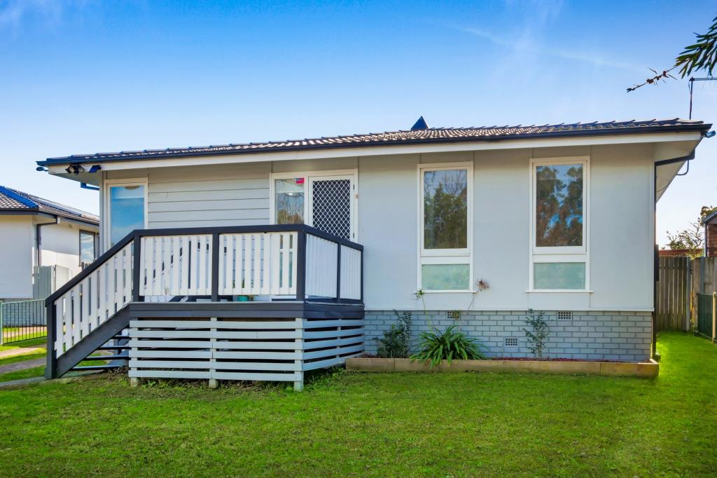 0
0 0
0 0
0Similar properties For Rent nearby
See more properties for rent nearby 0
0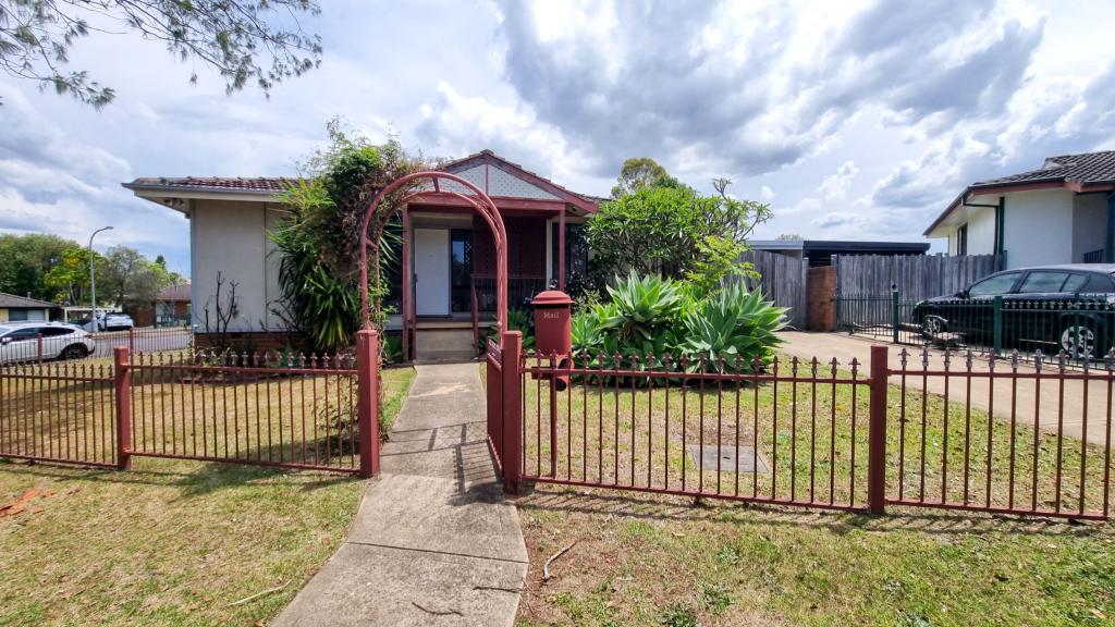 0
0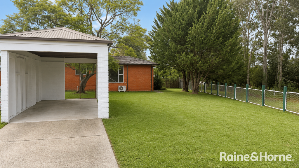 0
0About Airds 2560
The size of Airds is approximately 2.4 square kilometres. There are 18 parks, covering nearly 22.8% of the total area. The population of Airds in 2016 was 2926 people. By 2021 the population was 3265 showing a population growth of 11.6% in the area during that time. The predominant age group in Airds is 10-19 years. Households in Airds are primarily single parents and are likely to be repaying $1800 - $2399 per month on mortgage repayments. In general, people in Airds work in a labourer occupation.In 2021, 19.80% of the homes in Airds were owner-occupied compared with 4.30% in 2016.
Airds has 1,785 properties. Over the last 5 years, Houses in Airds have seen a 52.15% increase in median value. As at 30 June 2026:
- The median value for Houses in Airds is $960,933 while the median value for Units is $658,791.
- Houses have a median rent of $578 while Units have a median rent of $475.
Suburb Insights for Airds 2560
Market Insights
Airds Trends for Houses
N/A
N/A
View TrendN/A
N/A
Airds Trends for Units
N/A
N/A
View TrendN/A
N/A
Neighbourhood Insights
© Copyright 2026. RP Data Pty Ltd trading as Cotality (Cotality). All rights reserved. No reproduction, distribution, or transmission of the copyrighted materials is permitted. The information is deemed reliable but not guaranteed.
While Cotality uses commercially reasonable efforts to ensure the Cotality Data is current, Cotality does not warrant the accuracy, currency or completeness of the Cotality Data and to the full extent permitted by law excludes all loss or damage howsoever arising (including through negligence) in connection with the Cotality Data.
This product uses cookies and other similar technologies to improve and customise your browsing experience, to tailor content and adverts, and for analytics and metrics regarding visitor usage on this product and other media. We may share cookie and analytics information with third parties for the purposes of advertising. By continuing to use our website, you consent to cookies being used. View our Privacy Policy here.
X