
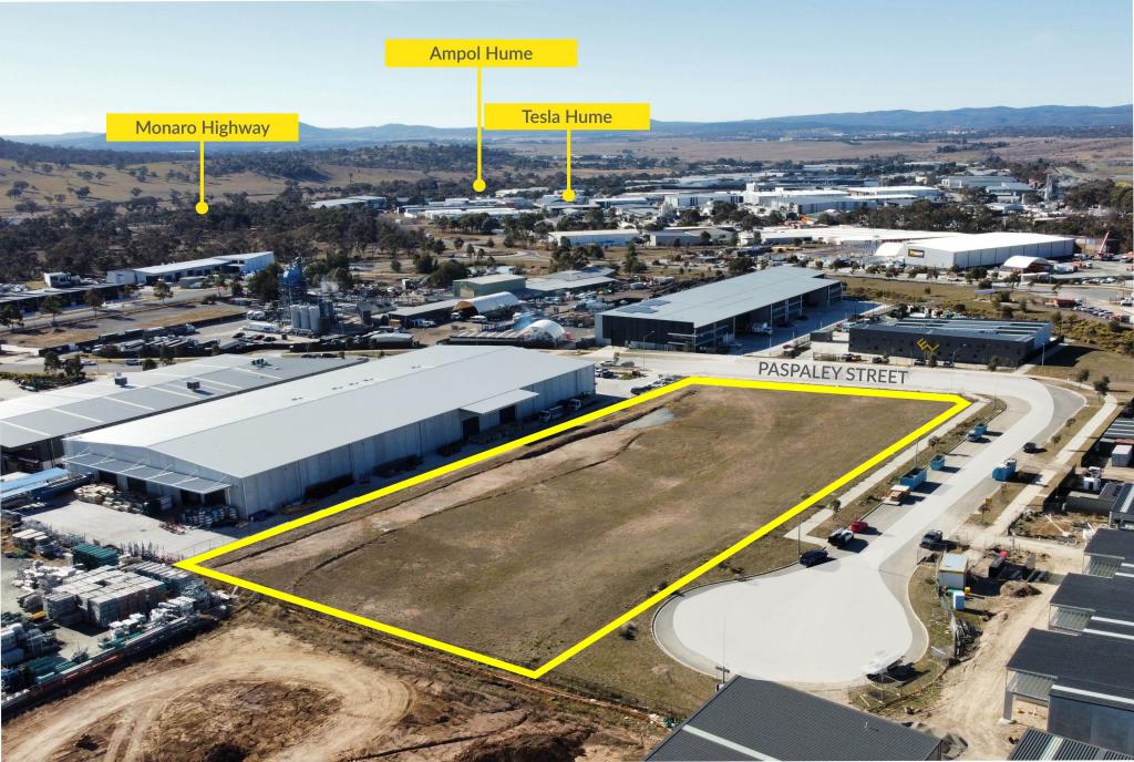
13 Paspaley StreetHume ACT 2620
Property Details for 13 Paspaley St, Hume
Last Listing description (October 2023)
Currently under construction and due for completion in the first quarter of 2024, is a brand new high-end industrial building comprising of 4,378 sqm NLA on a 7,713 sqm block.
13 Paspaley Street is a premium industrial building consisting of four clear-span warehouse compartments with high clearance roller door access, ground floor & level one office spaces, amenities, and allocated onsite parking. The total 4,378 sqm NLA can be leased as a whole or split into four smaller tenancies ranging from 842 sqm to 1,403 sqm.
This premium industrial development is ideally situated in Hume, 15km South of Canberra's CBD & 8km from Queanbeyan, NSW. Hume is identified as one of Canberra's major industrial precincts and benefits from ease of access to the Monaro Highway, linking to Sydney, Melbourne, Cooma, and the Monaro regions in the south.
Features Include:
- Under construction & due for completion at the end of the first quarter of 2024
- IZ1 - General Industry Zoning
- Total NLA of 4,378m2 consisting of 3,327m2 of high clearance warehouse & 1,051m2 of modern office space.
- Unit 1 - 1,053m2 warehouse + 349m2 office space + exclusive access to second driveway off Paspaley Street
- Unit 2 - 613m2 warehouse + 229m2 office space
- Unit 3 - 612m2 warehouse + 236m2 office space
- Unit 4 - 1,050m2 warehouse + 235m2 office space
- External faade: a combination of precast concrete cladding & pre-finished metal cladding
- Internal ceiling height of 10.3m at the highest point & 8.2m at the lowest point
- Multiple 5.5m high electric roller doors
- Roofing: metal roof
- Fully secure complex with electric security gate
- 3-Phase power
- 61 allocated car spaces
This opportunity to lease a brand new warehouse/office in a tightly held market should not be missed. This property would suit a multitude of users including but not limited to storage and distribution, warehousing, manufacturing & logistics.
For more information or to arrange an inspection contact exclusive agents Lenny Haddrill at 0402 565 166 or Andrew Smith at 0409 600 471.
Property History for 13 Paspaley St, Hume, ACT 2620
- 17 Oct 2023Listed for Rent - Price not available
Recent sales nearby
See more recent sales nearbySimilar properties For Sale nearby
See more properties for sale nearby
 0
0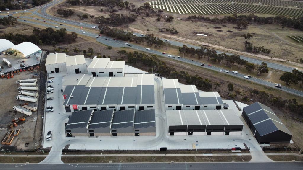 0
0 0
0Similar properties For Rent nearby
See more properties for rent nearby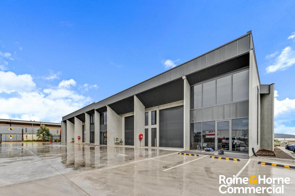 0
0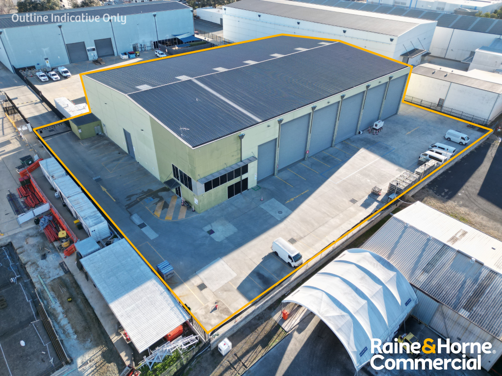 0
0 0
0About Hume 2620
The size of Hume is approximately 8.5 square kilometres. There are 2 parks, covering nearly 23.8% of the total area. The population of Hume in 2016 was 430 people. By 2021 the population was 395 showing a population decline of 8.1% in the area during that time. The predominant age group in Hume is 30-39 years. Households in Hume are primarily single parents and are likely to be repaying $800 - $999 per month on mortgage repayments. In general, people in Hume work in a trades occupation.In 2021, 57.10% of the homes in Hume were owner-occupied compared with 0.00% in 2016.
Hume has 444 properties. As at 30 June 2026:
- The median value for Houses in Hume is $2,277,007.
Suburb Insights for Hume 2620
Market Insights
Hume Trends for Houses
N/A
N/A
View TrendN/A
N/A
Hume Trends for Units
N/A
N/A
View TrendN/A
N/A
Neighbourhood Insights
© Copyright 2026. RP Data Pty Ltd trading as Cotality (Cotality). All rights reserved. No reproduction, distribution, or transmission of the copyrighted materials is permitted. The information is deemed reliable but not guaranteed.
While Cotality uses commercially reasonable efforts to ensure the Cotality Data is current, Cotality does not warrant the accuracy, currency or completeness of the Cotality Data and to the full extent permitted by law excludes all loss or damage howsoever arising (including through negligence) in connection with the Cotality Data.
This product uses cookies and other similar technologies to improve and customise your browsing experience, to tailor content and adverts, and for analytics and metrics regarding visitor usage on this product and other media. We may share cookie and analytics information with third parties for the purposes of advertising. By continuing to use our website, you consent to cookies being used. View our Privacy Policy here.
X