
45/44-46 Macquarie StreetBarton ACT 2600
Property Details for 45/44-46 Macquarie St, Barton
45/44-46 Macquarie St, Barton is a 1 bedroom, 1 bathroom Unit with 1 parking spaces and was built in 2018. The property has a land size of 5467m2 and floor size of 60m2. While the property is not currently for sale or for rent, it was last sold in August 2017.
Last Listing description (January 2023)
Register your interest by clicking on the 'BOOK INSPECTION' button and submit your tenancy application to book an inspection.
If you are feeling unwell, please do not attend any inspections.
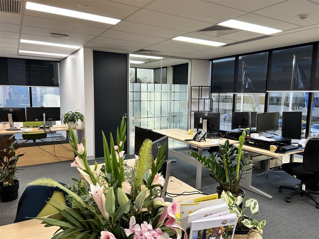
This light filled apartment offers everything one would expect when wanting a home away from home.
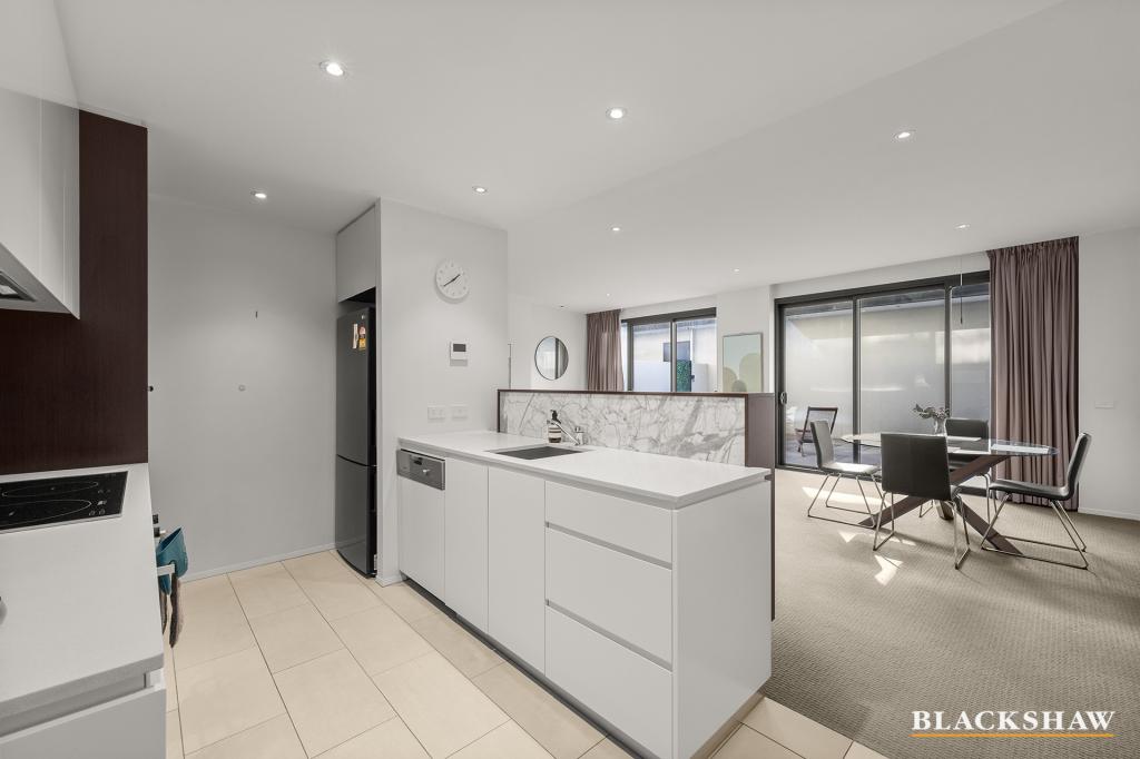
Quality throughout, including designer fixtures and fittings from double glazed doors, plush carpets, beautiful shower recess which all add to the comfort of this Inner South property. Full size kitchen, with dishwasher, refrigerator, kitchenware and more.
This apartment is situated in an ideal location with just moments to the parliament triangle, Defence offices, private and Government offices, local eateries, shopping, transport and City Centre.
Features include:
- One underground car space
- Large full length glass doors
- Balcony
- Heating and cooling
- Designer complex
- Central location
No current EER
Suburb Snapshot
Barton is adjacent to Capital Hill. It contains the Department of Prime Minister and Cabinet, Attorney-General's Department, Department of Foreign Affairs and Trade and several other Commonwealth government departments.
On Kings Avenue is the controversial Edmund Barton Building, which was made a heritage listed building in 2005, but its modernist design has often been criticised.
The boundary of Barton runs along Telopea Park East in the south east. On the east side it surrounds the East Basin of Lake Burley Griffin. In the north east the boundary is Morshead Drive. The boundary continues along Kings Avenue all the way to State Circle. State Circle forms the boundary with Capital Hill to the west. The boundary then extends along the centre of Sydney Avenue, and finally along New South Wales Crescent back to Telopea Park.
Disclaimer:
Please note that while all care has been taken regarding general information and marketing information compiled for this rental advertisement, LJ HOOKER CANBERRA CITY does not accept responsibility and disclaim all liabilities in regard to any errors or inaccuracies contained herein. We encourage prospective tenants to rely on their own investigation and in-person inspections to ensure this property meets their individual needs and circumstances.
PETS:
Please be aware that at all stages of tenancy this property requires consent to be sought from the lessor for the keeping of any pets at the premises. Consent must be provided before any pets are at the premises.
RENTING BOOK:
A copy of The Renting Book can be found at: https://justice.act.gov.au/renting-book
Property History for 45/44-46 Macquarie St, Barton, ACT 2600
- 10 Nov 2022Listed for Rent - Price not available
- 20 Nov 2020Listed for Rent $570 / week
- 20 Mar 2020Listed for Rent $570 / week

Recent sales nearby
See more recent sales nearbySimilar properties For Sale nearby
See more properties for sale nearby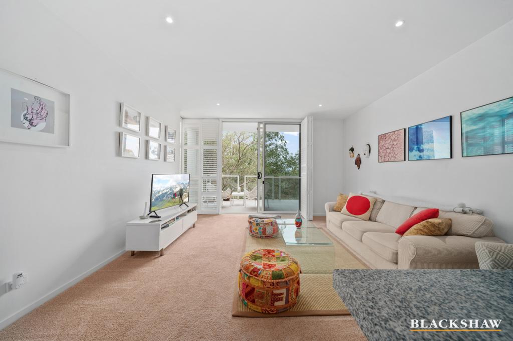 0
0
 0
0 0
0Similar properties For Rent nearby
See more properties for rent nearby 0
0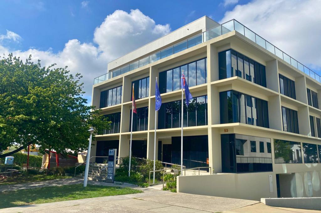 0
0
 0
0About Barton 2600
The size of Barton is approximately 2.1 square kilometres. There are 14 parks, covering nearly 21.5% of the total area. The population of Barton in 2016 was 1439 people. By 2021 the population was 1946 showing a population growth of 35.2% in the area during that time. The predominant age group in Barton is 30-39 years. Households in Barton are primarily childless couples and are likely to be repaying $1800 - $2399 per month on mortgage repayments. In general, people in Barton work in a professional occupation.In 2021, 51.60% of the homes in Barton were owner-occupied compared with 46.10% in 2016.
Barton has 1,443 properties. Over the last 5 years, Houses in Barton have seen a 11.54% increase in median value, while Units have seen a 6.40% increase. As at 30 June 2026:
- The median value for Houses in Barton is $2,430,415 while the median value for Units is $694,158.
- Houses have a median rent of $785 while Units have a median rent of $615.
Suburb Insights for Barton 2600
Market Insights
Barton Trends for Houses
N/A
N/A
View TrendN/A
N/A
Barton Trends for Units
N/A
N/A
View TrendN/A
N/A
Neighbourhood Insights
© Copyright 2026. RP Data Pty Ltd trading as Cotality (Cotality). All rights reserved. No reproduction, distribution, or transmission of the copyrighted materials is permitted. The information is deemed reliable but not guaranteed.
While Cotality uses commercially reasonable efforts to ensure the Cotality Data is current, Cotality does not warrant the accuracy, currency or completeness of the Cotality Data and to the full extent permitted by law excludes all loss or damage howsoever arising (including through negligence) in connection with the Cotality Data.
This product uses cookies and other similar technologies to improve and customise your browsing experience, to tailor content and adverts, and for analytics and metrics regarding visitor usage on this product and other media. We may share cookie and analytics information with third parties for the purposes of advertising. By continuing to use our website, you consent to cookies being used. View our Privacy Policy here.
X