
89 Ferndale RoadUpper Ferntree Gully VIC 3156

Property Details for 89 Ferndale Rd, Upper Ferntree Gully
Last Listing description (September 2025)
Nestled in the heart of nature's embrace, discover an extraordinary opportunity to craft your ideal lifestyle on this remarkable 3.27-acre / 13210m2 vacant block of land. Poised majestically in an elevated position, this land unveils attractive vistas, capturing the sunsets kaleidoscope of colors.
Here, your dream home finds its canvas, where every corner echoes serenity and every window frames nature's masterpiece. Embrace the peaceful rhythm of rural living while still relishing the convenience of urban amenities just moments away.
From this private location you can immerse yourself in a world of exploration, with Gilmour Park oval and lake, and the winding nature trails along Ferny Creek and Glenfern Valley Bushland Reserve all just a stroll from your doorstep.
Electricity, reticulated sewerage and town water are all available to the site. Seize this opportunity to sculpt your sanctuary in the heart of nature's embrace. Your dream lifestyle awaits in this captivating haven.
Proudly marketed by Barry Plant Rowville - 9753 2828
Photo ID Required at all inspections
Property History for 89 Ferndale Rd, Upper Ferntree Gully, VIC 3156
- 28 Aug 2025Sold for $940,000
- 16 Apr 2024Listed for Sale $995,000 - $1,090,000
- 21 Mar 2014Sold for $341,750
Recent sales nearby
See more recent sales nearby
Similar properties For Sale nearby
See more properties for sale nearby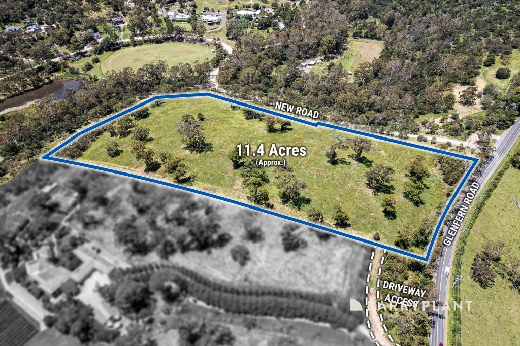 0
0
 0
0 0
0
Similar properties For Rent nearby
See more properties for rent nearby 0
0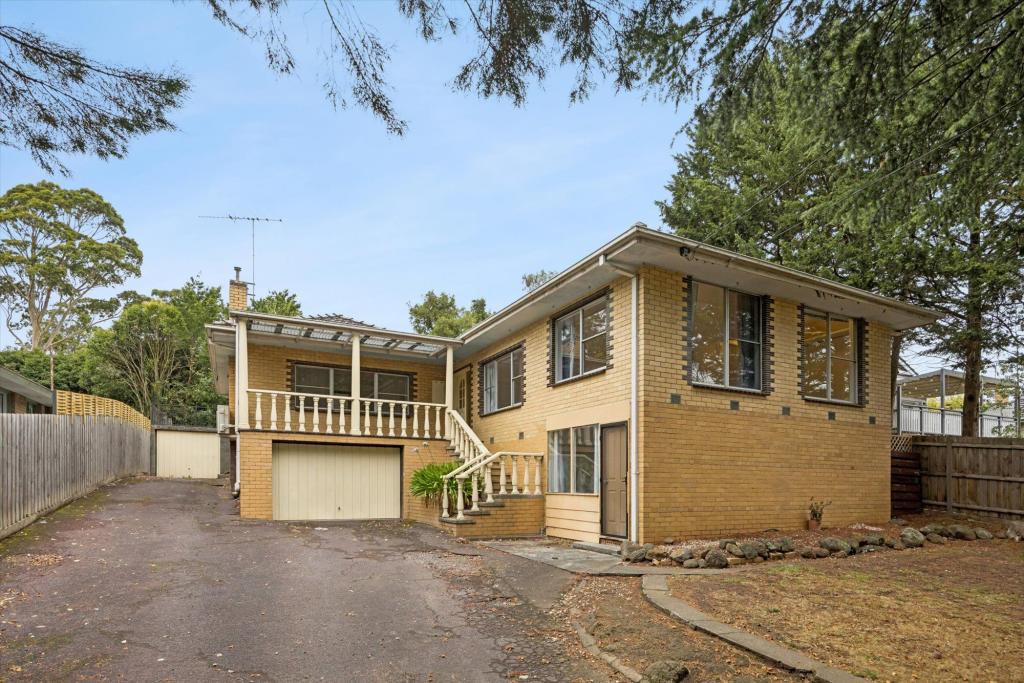 0
0 0
0About Upper Ferntree Gully 3156
The size of Upper Ferntree Gully is approximately 3.6 square kilometres. There are 6 parks, covering nearly 8.9% of the total area. The population of Upper Ferntree Gully in 2016 was 3416 people. By 2021 the population was 3417 showing a population growth of 0.0% in the area during that time. The predominant age group in Upper Ferntree Gully is 50-59 years. Households in Upper Ferntree Gully are primarily couples with children and are likely to be repaying $1800 - $2399 per month on mortgage repayments. In general, people in Upper Ferntree Gully work in a professional occupation.In 2021, 84.30% of the homes in Upper Ferntree Gully were owner-occupied compared with 84.40% in 2016.
Upper Ferntree Gully has 1,552 properties. Over the last 5 years, Houses in Upper Ferntree Gully have seen a 7.68% increase in median value, while Units have seen a 12.54% increase. As at 30 June 2026:
- The median value for Houses in Upper Ferntree Gully is $897,544 while the median value for Units is $697,547.
- Houses have a median rent of $640 while Units have a median rent of $600.
Suburb Insights for Upper Ferntree Gully 3156
Market Insights
Upper Ferntree Gully Trends for Houses
N/A
N/A
View TrendN/A
N/A
Upper Ferntree Gully Trends for Units
N/A
N/A
View TrendN/A
N/A
Neighbourhood Insights
© Copyright 2026. RP Data Pty Ltd trading as Cotality (Cotality). All rights reserved. No reproduction, distribution, or transmission of the copyrighted materials is permitted. The information is deemed reliable but not guaranteed.
While Cotality uses commercially reasonable efforts to ensure the Cotality Data is current, Cotality does not warrant the accuracy, currency or completeness of the Cotality Data and to the full extent permitted by law excludes all loss or damage howsoever arising (including through negligence) in connection with the Cotality Data.
This product uses cookies and other similar technologies to improve and customise your browsing experience, to tailor content and adverts, and for analytics and metrics regarding visitor usage on this product and other media. We may share cookie and analytics information with third parties for the purposes of advertising. By continuing to use our website, you consent to cookies being used. View our Privacy Policy here.
X