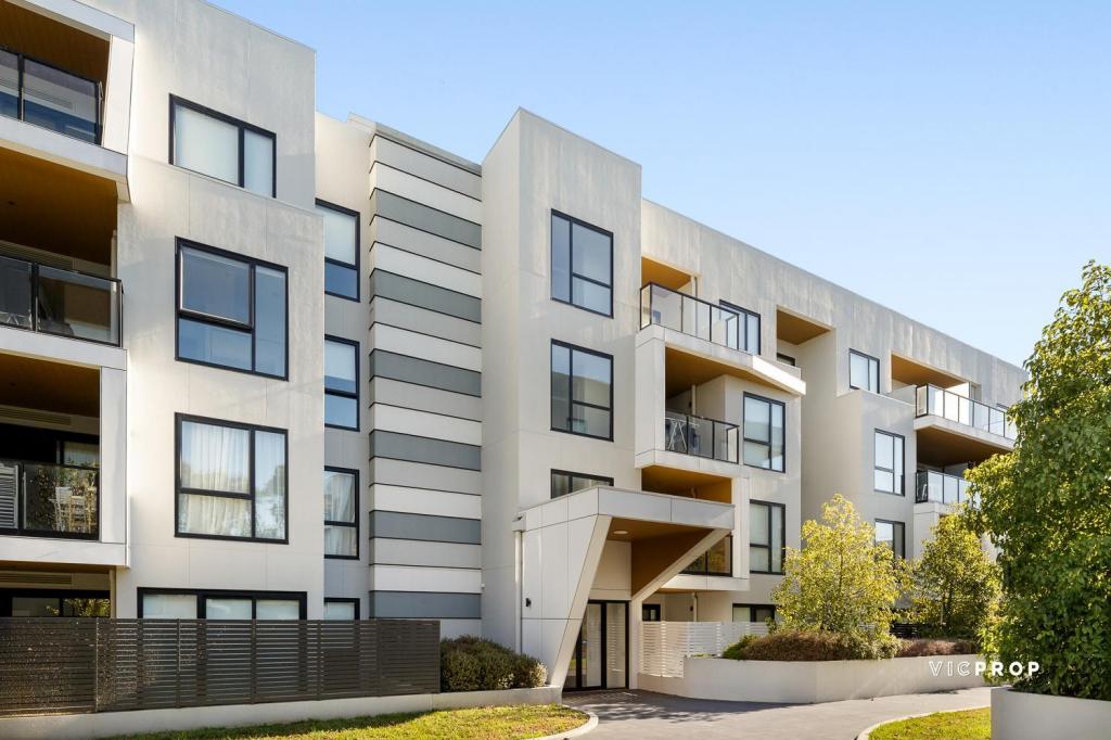
18/2 Greenfield DriveClayton VIC 3168

Property Details for 18/2 Greenfield Dr, Clayton
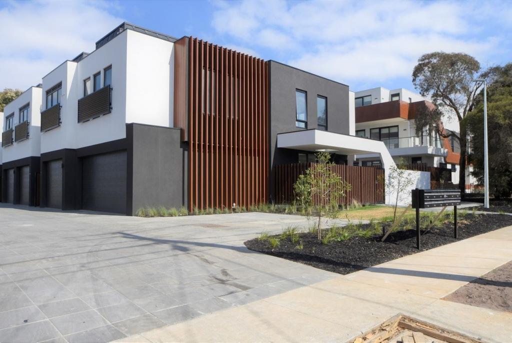
18/2 Greenfield Dr, Clayton is a 1 bedroom, 1 bathroom Unit with 1 parking spaces and was built in 2004. The property has a land size of 3650m2 and floor size of 60m2. While the property is not currently for sale or for rent, it was last sold in February 2023.
Last Listing description (March 2023)
Conveniently located within walking distance to Monash University, Monash Hospital, Princes Highway and with Clayton Shops and Clayton Station at your doorstep, this outstanding residence is ideal for the astute investor looking for a long term rental and can enjoy the benefits of a set and forget property.
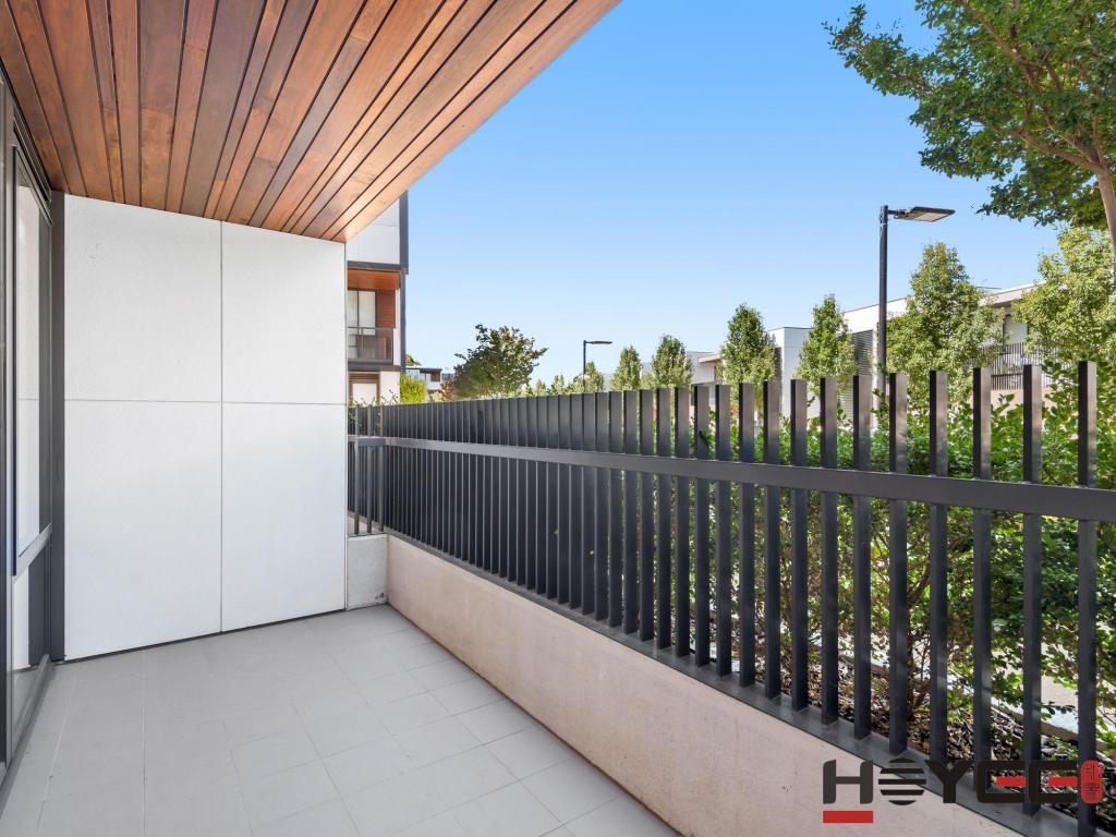
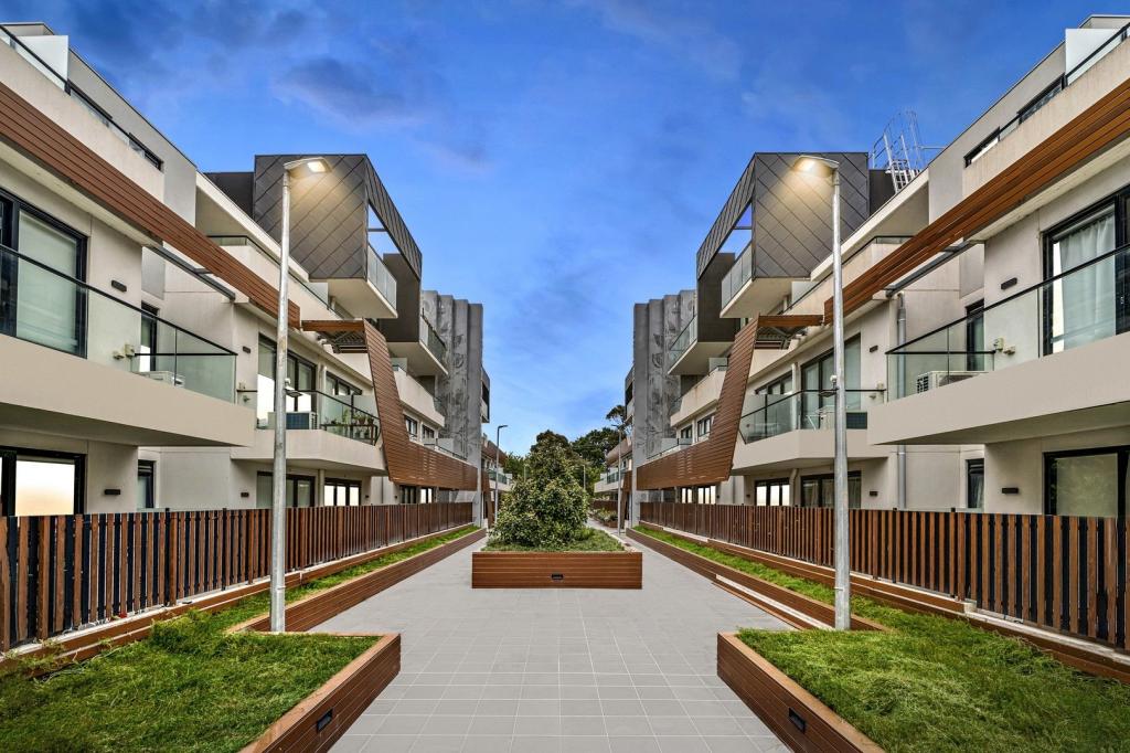
Spacious throughout with light filled living this 2 bedroom residence enjoys open plan living and is further complemented with single carport, two way bathroom and an expansive balcony overlooking the communal swimming pool.
Creature comforts include:
- New Split System airconditioning
- Newly renovated floorboards
- Simple Floorplan
- Access to Communal Swimming Pool
- New Vanity installed
- Undercover Carport
Please contact Lin Zhang on 0403 187 808 to book an inspection
*Photo I.D required upon inspection*
Property History for 18/2 Greenfield Dr, Clayton, VIC 3168
- 17 Feb 2023Sold for $380,000
- 01 Feb 2023Listed for Rent - Price not available
- 25 Jul 2022Listed for Sale $360,000 - $390,000
Local Area Liveability Score
This Liveability Score is a rating "out of 10" and a guide to how well connected properties within a local area are to facilities such as public transport, healthcare services, shopping outlets, schools and parkland. The scores apply to the local area (or "mesh block") in which a property is located. The scores are largely comprised of 2 main elements:
- Walking time to a local facility
- Number of facilities within a 20-minute walk
The overall Liveability Score is made up of smaller sub-scores, as described below.
Recent sales nearby
See more recent sales nearby
Similar properties For Sale nearby
See more properties for sale nearby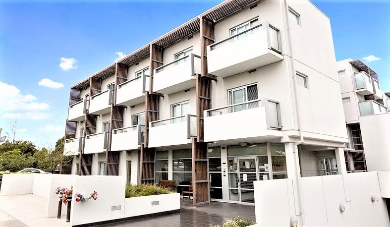
Similar properties For Rent nearby
See more properties for rent nearby

About Clayton 3168
The size of Clayton is approximately 7.9 square kilometres. It has 9 parks covering nearly 4.1% of total area. The population of Clayton in 2011 was 15,543 people. By 2016 the population was 19,348 showing a population growth of 24.5% in the area during that time. The predominant age group in Clayton is 20-29 years. Households in Clayton are primarily couples with children and are likely to be repaying $1800 - $2399 per month on mortgage repayments. In general, people in Clayton work in a professional occupation. In 2011, 40.2% of the homes in Clayton were owner-occupied compared with 35.2% in 2016.
Clayton has 11,993 properties. Over the last 5 years, Houses in Clayton have seen a 7.41% increase in median value, while Units have seen a -1.81% decrease. As at 30 April 2025:
- The median value for Houses in Clayton is $1,200,455 while the median value for Units is $643,502.
- Houses have a median rent of $600 while Units have a median rent of $580.
What's around 18/2 Greenfield Dr, Clayton
18/2 Greenfield Dr, Clayton is in the school catchment zone for Clayton North Primary School and Westall Secondary College.


Suburb Insights for Clayton 3168
Market Insights
Clayton Trends for Houses
$1.20M
2.15%
View Trend$600/W
2.88%
Clayton Trends for Units
$644k
3.11%
View Trend$580/W
4.77%
Neighbourhood Insights
Age
Population 19,348
0-9
7%
10-19
13%
20-29
41%
30-39
15%
40-49
7%
50-59
5%
60-69
4%
70-79
3%
80-89
3%
90-99
1%
Household Structure
Occupancy
© Copyright 2025 RP Data Pty Ltd trading as CoreLogic Asia Pacific (CoreLogic). All rights reserved.
This product uses cookies and other similar technologies to improve and customise your browsing experience, to tailor content and adverts, and for analytics and metrics regarding visitor usage on this product and other media. We may share cookie and analytics information with third parties for the purposes of advertising. By continuing to use our website, you consent to cookies being used. View our Privacy Policy here.
X