
26 Spafield RoadBeveridge VIC 3753
Property Details for 26 Spafield Rd, Beveridge
Last Listing description (December 2025)
Building a home offers unparalleled freedom to choose the perfect location that aligns with your lifestyle, work requirements, and long-term financial goals.
Set against a serene, semi-rural setting that's less than an hour out of Melbourne and occupying a prominent position in the thriving Lyra Estate, this vacant plot, and rare gem, offers a peaceful community lifestyle that's walking distance to parkland, playgrounds, and moments from everyday services and essentials.
Completely cleared and nestled on a sunny 263sqm with 10.5m frontage, the level allotment is the ideal blank canvas to achieve your real estate goals.
One of the key financial benefits of building is the potential to save on stamp duty. When buying an established home, stamp duty is calculated on both the house and the land.
Customise a home that meets all your needs, while enjoying choosing every feature, big and small.
With easy access to the Hume Freeway, walking distance to the Beveridge pub plus a short commute to Mandalay Golf Course, Beveridge Primary School, childcare centres, Wallan, Mickleham, and Craigieburn, the super-convenient locale will also benefit from future town centre developments, and a proposed train station.
Providing peace-of-mind and a high-quality of life, 26 Spafield Road is priced to sell in a tightly-held location.
DISCLAIMER
The vendor, agent and agency in preparing this information have used our best endeavours to ensure that the information contained therein is true and accurate but accept no responsibility and disclaim all liability in respect of any errors, inaccuracies or misstatements contained herein. Prospective purchasers should make their own inquiries to verify the information contained herein
Property History for 26 Spafield Rd, Beveridge, VIC 3753
- 04 Dec 2025Sold for $265,000
- 24 Jul 2024Listed for Sale Contact Agent
- 29 Aug 2022Sold for $272,000
Recent sales nearby
See more recent sales nearbySimilar properties For Sale nearby
See more properties for sale nearby 0
0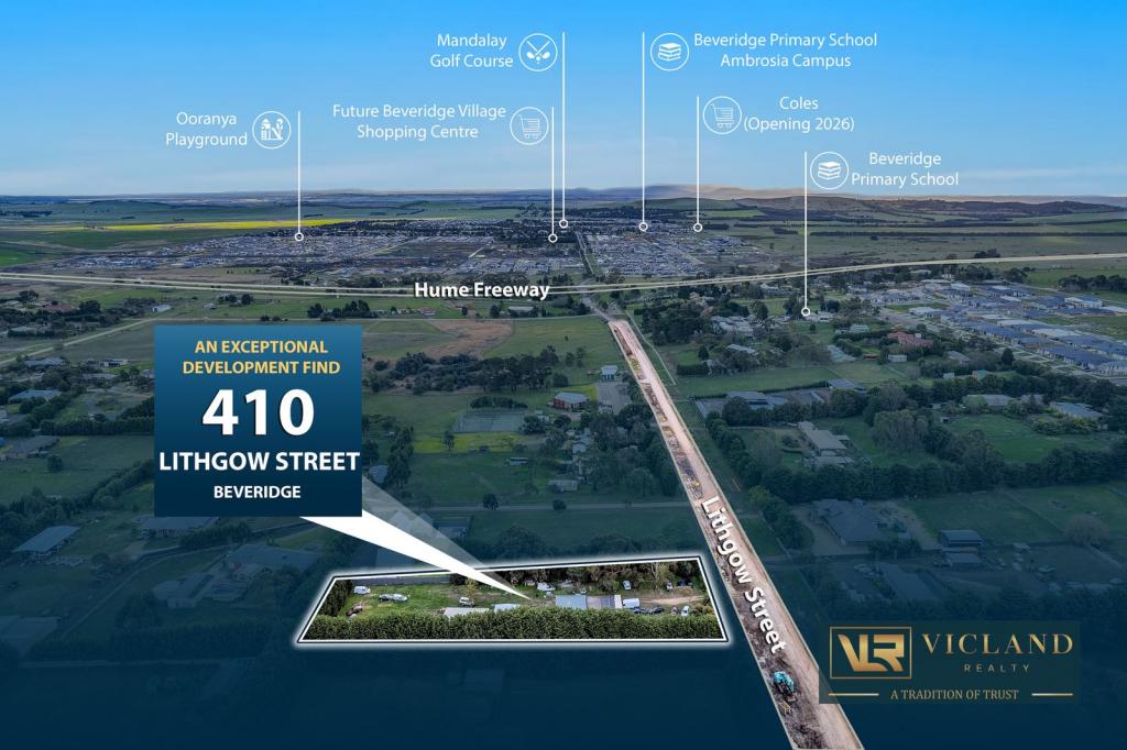 0
0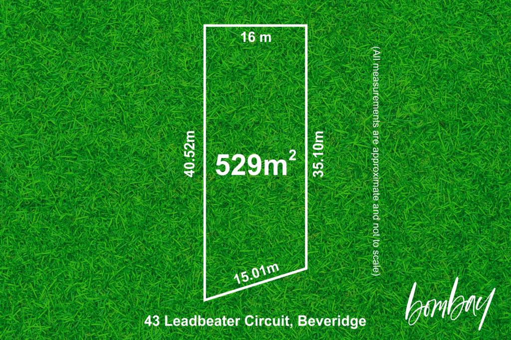 0
0Similar properties For Rent nearby
See more properties for rent nearby 0
0 0
0 0
0About Beveridge 3753
The size of Beveridge is approximately 111.7 square kilometres. It has 10 parks covering nearly 0.3% of total area. The population of Beveridge in 2016 was 2330 people. By 2021 the population was 4642 showing a population growth of 99.2% in the area during that time. The predominant age group in Beveridge is 30-39 years. Households in Beveridge are primarily couples with children and are likely to be repaying $1800 - $2399 per month on mortgage repayments. In general, people in Beveridge work in a trades occupation.In 2021, 80.40% of the homes in Beveridge were owner-occupied compared with 83.90% in 2016.
Beveridge has 8,245 properties. Over the last 5 years, Houses in Beveridge have seen a 11.46% increase in median value, while Units have seen a 16.26% increase. As at 28 February 2026:
- The median value for Houses in Beveridge is $702,263 while the median value for Units is $549,333.
- Houses have a median rent of $480 while Units have a median rent of $460.
Suburb Insights for Beveridge 3753
Market Insights
Beveridge Trends for Houses
N/A
N/A
View TrendN/A
N/A
Beveridge Trends for Units
N/A
N/A
View TrendN/A
N/A
Neighbourhood Insights
© Copyright 2026. RP Data Pty Ltd trading as Cotality (Cotality). All rights reserved. No reproduction, distribution, or transmission of the copyrighted materials is permitted. The information is deemed reliable but not guaranteed.
While Cotality uses commercially reasonable efforts to ensure the Cotality Data is current, Cotality does not warrant the accuracy, currency or completeness of the Cotality Data and to the full extent permitted by law excludes all loss or damage howsoever arising (including through negligence) in connection with the Cotality Data.
This product uses cookies and other similar technologies to improve and customise your browsing experience, to tailor content and adverts, and for analytics and metrics regarding visitor usage on this product and other media. We may share cookie and analytics information with third parties for the purposes of advertising. By continuing to use our website, you consent to cookies being used. View our Privacy Policy here.
X