
4/186 North RoadLangwarrin VIC 3910

Property Details for 4/186 North Rd, Langwarrin
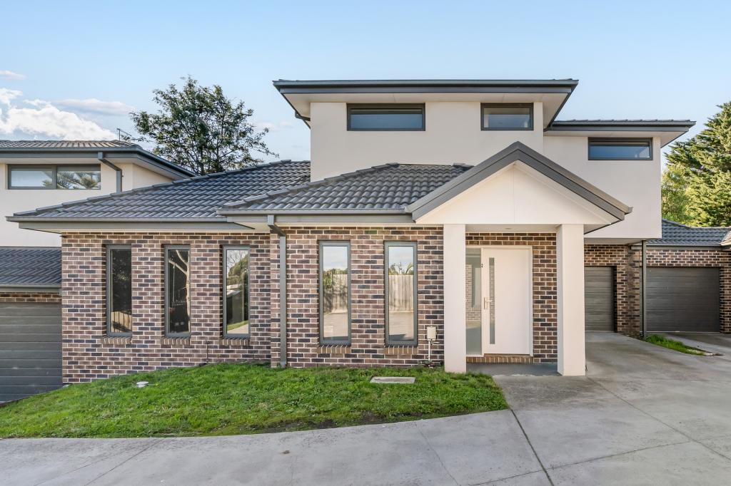
4/186 North Rd, Langwarrin is a 3 bedroom, 1 bathroom Unit with 1 parking spaces and was built in 2006. The property has a land size of 263m2 and floor size of 117m2.
Last Listing description (August 2024)
This 3 bedroom family home, may have a unit address but feels more like a spacious house.
Offering formal lounge with split system cooling, ducted heating, flowing through to the open plan modern kitchen and dining area complete with stainless steel appliances and dishwasher . Master bedroom with walk in robe and 2 way access to the central family bathroom, other two bedrooms with built in robes, separate toilet and laundry room.
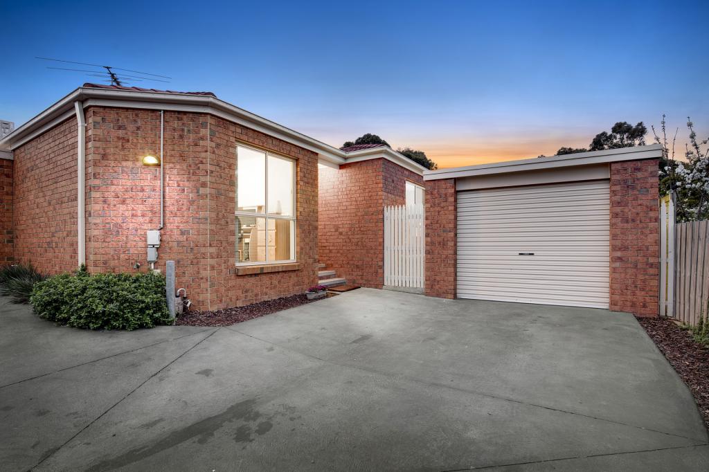
Outside boast a covered decked entertaining area surrounded by beautifully landscaped gardens and water feature, garden shed, single remote control garage and additional designated car space Located at the rear of the complex for your quiet enjoyment, this property is close to all amenities and within walking distance to local shops and schools. Don't delay and book your inspection today!
**** BOOK ONLINE NOW TO INSPECT ****
Simply click 'EMAIL AGENT' and we'll respond instantly with available appointment times.
Register to confirm your chosen inspection times so that we can advise you of any changes or alternatively you can suggest your own time and we will confirm
Property History for 4/186 North Rd, Langwarrin, VIC 3910
- 23 Jul 2024Listed for Rent $560 / week
- 04 May 2023Listed for Rent - Price not available
- 17 Feb 2022Listed for Rent $500 / week

Local Area Liveability Score
This Liveability Score is a rating "out of 10" and a guide to how well connected properties within a local area are to facilities such as public transport, healthcare services, shopping outlets, schools and parkland. The scores apply to the local area (or "mesh block") in which a property is located. The scores are largely comprised of 2 main elements:
- Walking time to a local facility
- Number of facilities within a 20-minute walk
The overall Liveability Score is made up of smaller sub-scores, as described below.
Recent sales nearby
See more recent sales nearby
Similar properties For Sale nearby
See more properties for sale nearby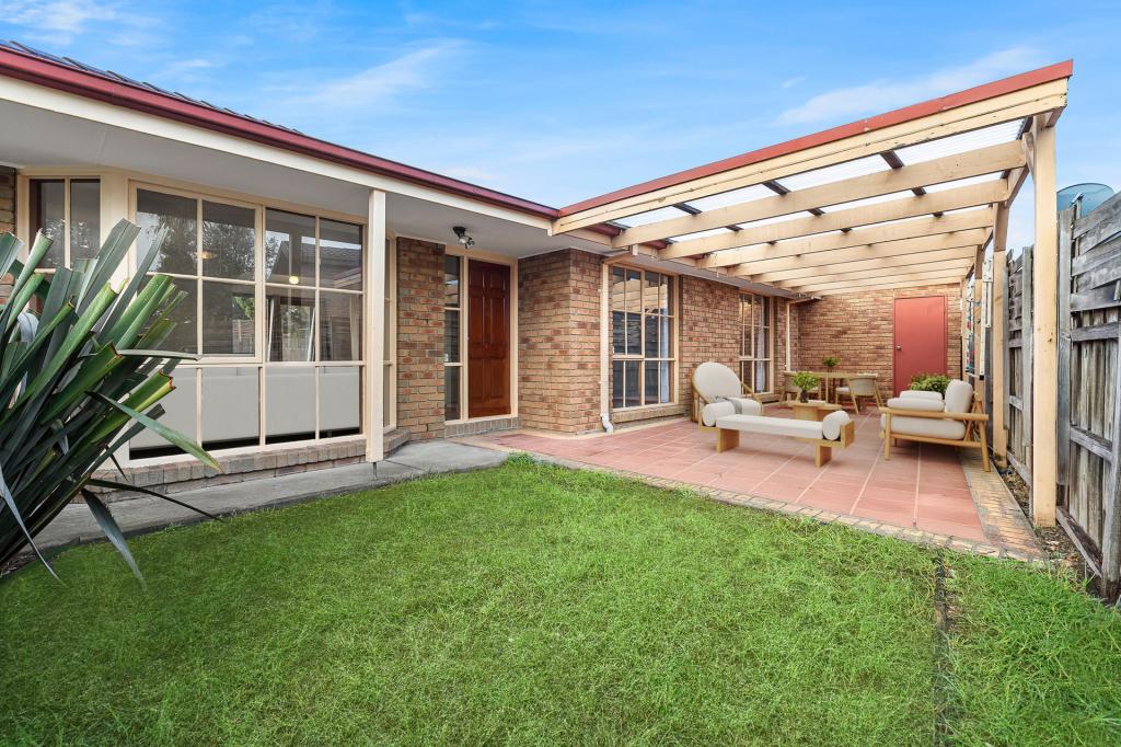

Similar properties For Rent nearby
See more properties for rent nearby


About Langwarrin 3910
The size of Langwarrin is approximately 28.8 square kilometres. It has 39 parks covering nearly 12.2% of total area. The population of Langwarrin in 2016 was 22588 people. By 2021 the population was 23588 showing a population growth of 4.4% in the area during that time. The predominant age group in Langwarrin is 30-39 years. Households in Langwarrin are primarily couples with children and are likely to be repaying $1800 - $2399 per month on mortgage repayments. In general, people in Langwarrin work in a trades occupation.In 2021, 80.40% of the homes in Langwarrin were owner-occupied compared with 78.30% in 2016..
Langwarrin has 10,250 properties. Over the last 5 years, Houses in Langwarrin have seen a 33.88% increase in median value, while Units have seen a 35.98% increase. As at 30 June 2025:
- The median value for Houses in Langwarrin is $909,490 while the median value for Units is $609,501.
- Houses have a median rent of $620 while Units have a median rent of $520.
What's around 4/186 North Rd, Langwarrin
4/186 North Rd, Langwarrin is in the school catchment zone for Langwarrin Primary School and Elisabeth Murdoch College.


Suburb Insights for Langwarrin 3910
Market Insights
Langwarrin Trends for Houses
$909k
4.03%
View Trend$620/W
3.91%
Langwarrin Trends for Units
$610k
4.28%
View Trend$520/W
4.67%
Neighbourhood Insights
Age
Population 23,588
0-9
13%
10-19
13%
20-29
12%
30-39
14%
40-49
13%
50-59
14%
60-69
11%
70-79
7%
80-89
3%
90-99
1%
Household Structure
Occupancy
© Copyright 2025 RP Data Pty Ltd trading as CoreLogic Asia Pacific (CoreLogic). All rights reserved.
This product uses cookies and other similar technologies to improve and customise your browsing experience, to tailor content and adverts, and for analytics and metrics regarding visitor usage on this product and other media. We may share cookie and analytics information with third parties for the purposes of advertising. By continuing to use our website, you consent to cookies being used. View our Privacy Policy here.
X