
26 Botany WayCranbourne East VIC 3977
Property Details for 26 Botany Way, Cranbourne East
26 Botany Way, Cranbourne East is a 4 bedroom, 2 bathroom House with 2 parking spaces and was built in 2019. The property has a land size of 410m2 and floor size of 180m2. While the property is not currently for sale or for rent, it was last sold in June 2016.
Last Listing description (June 2025)
Stylish family home within minutes to Public Transport, Schools Shops and Chisholm Tafe.
Features include four large bedrooms with double built in robes to each which would all easily fit queen beds and still have room to move!
Master bedroom of course having its own walk in robe and good sized ensuite!
Central open plan kitchen and meals area with heaps of bench space and stone finish, ducted heating throughout, landscaped but low maintenance gardens and double garage with internal access to home!
Disclaimer: This advertisement has been prepared with our best endeavours to ensure the information contained in this document is true and correct. We accept no responsibility and disclaim all liability in respect to any errors, omissions, inaccuracies, or exclusions in this document. Prospective Renters must make their own enquiries to verify the information contained in this material is true and correct.
Property History for 26 Botany Way, Cranbourne East, VIC 3977
- 08 Apr 2025Listed for Rent $560 / week
- 04 Feb 2022Listed for Rent $420 / week
- 12 Aug 2019Listed for Rent $400 / week

Recent sales nearby
See more recent sales nearby
Similar properties For Sale nearby
See more properties for sale nearby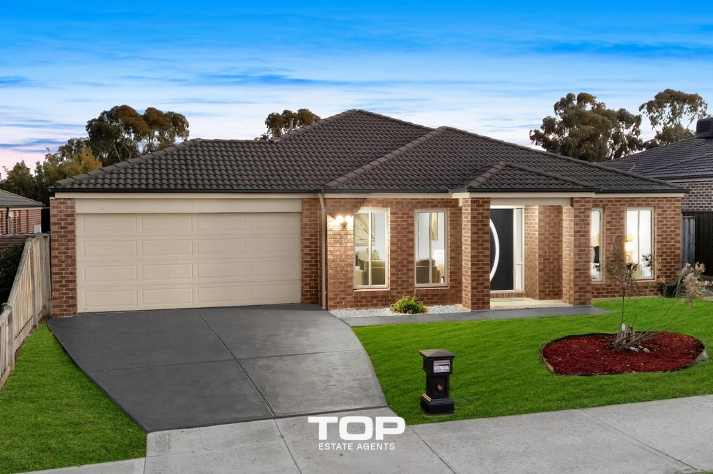 0
0 0
0 0
0Similar properties For Rent nearby
See more properties for rent nearby 0
0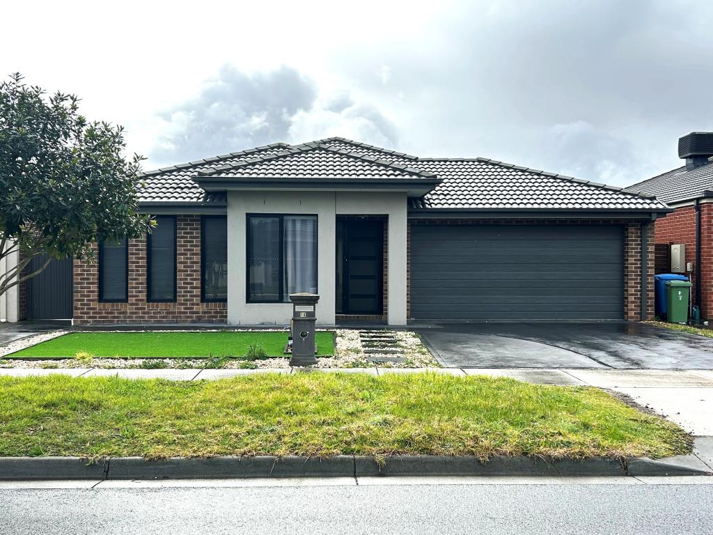 0
0 0
0About Cranbourne East 3977
The size of Cranbourne East is approximately 13.4 square kilometres. It has 35 parks covering nearly 9.1% of total area. The population of Cranbourne East in 2016 was 16195 people. By 2021 the population was 24679 showing a population growth of 52.4% in the area during that time. The predominant age group in Cranbourne East is 30-39 years. Households in Cranbourne East are primarily couples with children and are likely to be repaying $1800 - $2399 per month on mortgage repayments. In general, people in Cranbourne East work in a trades occupation.In 2021, 71.30% of the homes in Cranbourne East were owner-occupied compared with 76.70% in 2016.
Cranbourne East has 10,821 properties. Over the last 5 years, Houses in Cranbourne East have seen a 31.98% increase in median value, while Units have seen a 39.35% increase. As at 30 November 2025:
- The median value for Houses in Cranbourne East is $798,894 while the median value for Units is $569,620.
- Houses have a median rent of $590 while Units have a median rent of $515.
Suburb Insights for Cranbourne East 3977
Market Insights
Cranbourne East Trends for Houses
N/A
N/A
View TrendN/A
N/A
Cranbourne East Trends for Units
N/A
N/A
View TrendN/A
N/A
Neighbourhood Insights
© Copyright 2025. RP Data Pty Ltd trading as Cotality (Cotality). All rights reserved. No reproduction, distribution, or transmission of the copyrighted materials is permitted. The information is deemed reliable but not guaranteed.
While Cotality uses commercially reasonable efforts to ensure the Cotality Data is current, Cotality does not warrant the accuracy, currency or completeness of the Cotality Data and to the full extent permitted by law excludes all loss or damage howsoever arising (including through negligence) in connection with the Cotality Data.
This product uses cookies and other similar technologies to improve and customise your browsing experience, to tailor content and adverts, and for analytics and metrics regarding visitor usage on this product and other media. We may share cookie and analytics information with third parties for the purposes of advertising. By continuing to use our website, you consent to cookies being used. View our Privacy Policy here.
X