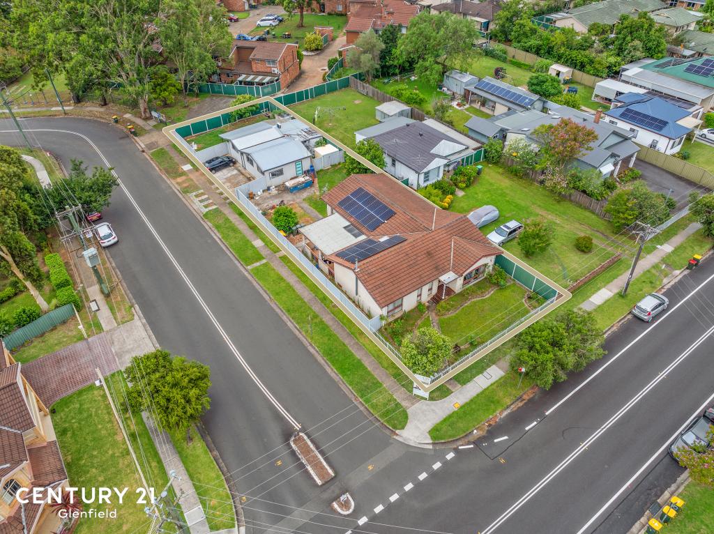
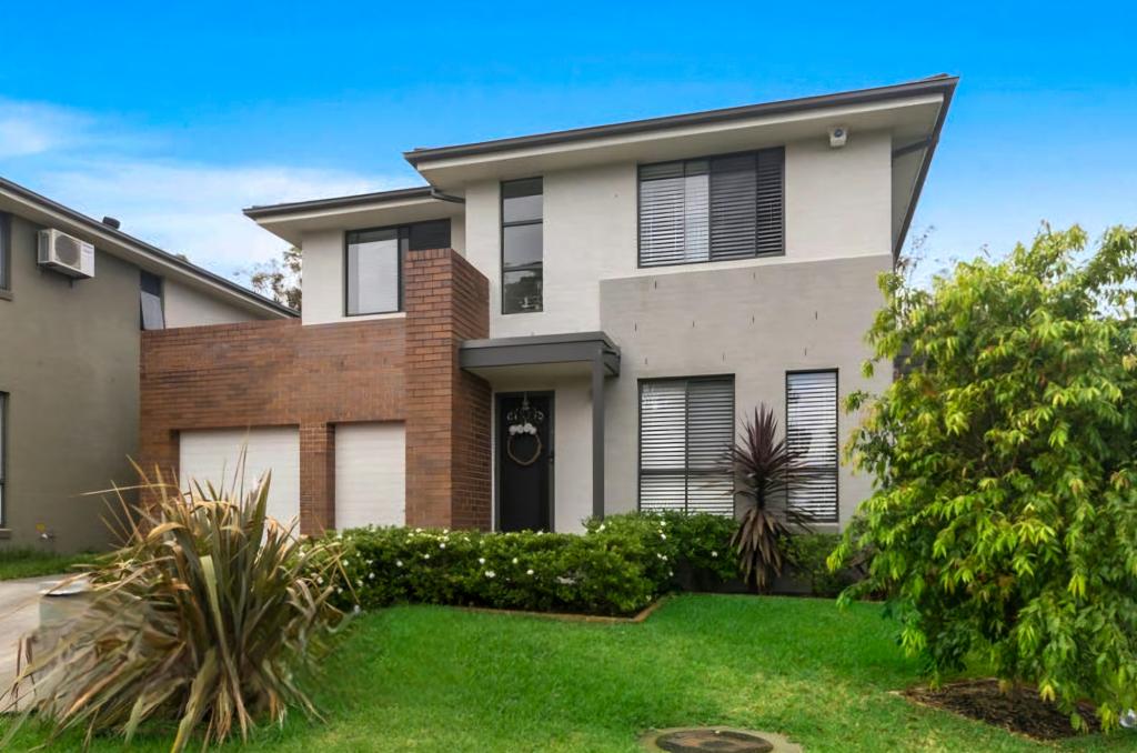
42 Sovereign CircuitGlenfield NSW 2167

Thinking about insurance?
Get estimated rebuild costs for this property with Sum SureProperty Details for 42 Sovereign Cct, Glenfield
42 Sovereign Cct, Glenfield is a 3 bedroom, 3 bathroom House with 2 parking spaces and was built in 2013. The property has a land size of 199m2 and floor size of 128m2. While the property is not currently for sale or for rent, it was last sold in October 2012.
Last Listing description (May 2025)
Enjoy the lifestyle and facilities within the Panorama Estate. Including full use of the parks and BBQ's only a short walk to the Crossroads Homemaker Center & Costco.
Spacious combined lounge and dining area with split system air conditioning and gas outlet for heating
Modern kitchen with stainless steel appliances such as gas cooktop and dishwasher
3 really good size bedrooms with built-in robes for all
The master bedroom has air conditioning, a walk-in robe, and an ensuite
Downstairs powder room
Covered entertainment area
Single garage with internal access and more
New floorboards are installed
All this 1 minutes' walk to the bus stop, a short distance to M5, M7, Glenfield shopping centre, train station, and Hurlstone High School & Glenfield Primary School
Property History for 42 Sovereign Cct, Glenfield, NSW 2167
- 14 Apr 2025Listed for Rent $689 / week
- 08 Feb 2024Listed for Rent $640 / week
- 17 Aug 2018Listed for Rent - Price not available
Recent sales nearby
See more recent sales nearbySimilar properties For Sale nearby
See more properties for sale nearby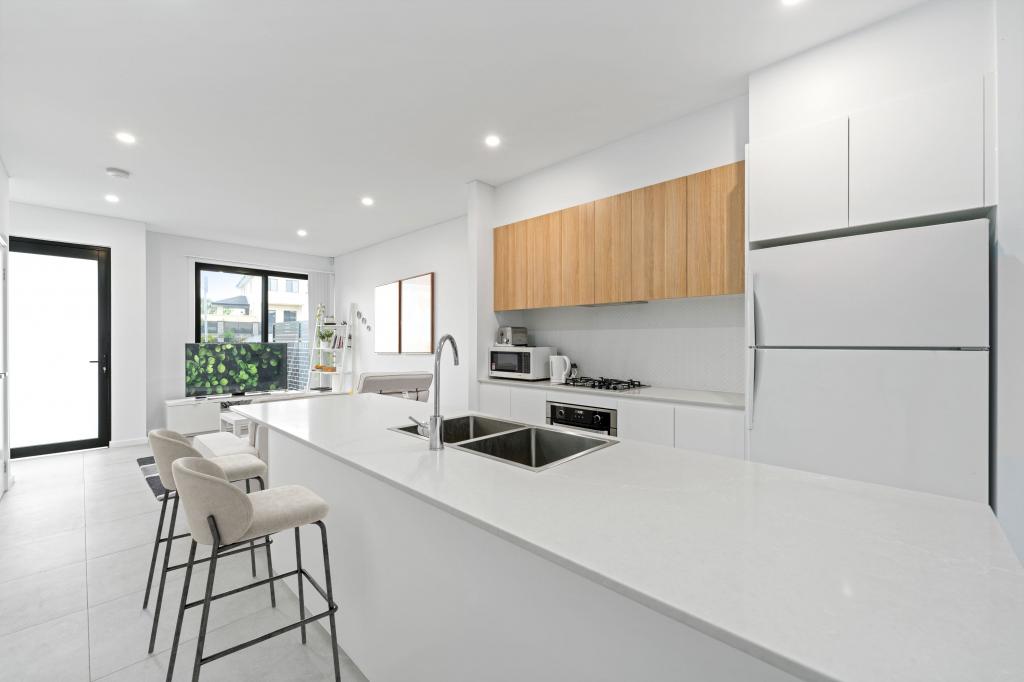

Similar properties For Rent nearby
See more properties for rent nearby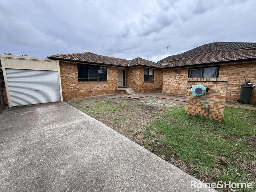
About Glenfield 2167
The size of Glenfield is approximately 7 square kilometres. It has 17 parks covering nearly 11.9% of total area. The population of Glenfield in 2011 was 7,558 people. By 2016 the population was 9,614 showing a population growth of 27.2% in the area during that time. The predominant age group in Glenfield is 30-39 years. Households in Glenfield are primarily couples with children and are likely to be repaying $1800 - $2399 per month on mortgage repayments. In general, people in Glenfield work in a professional occupation. In 2011, 72.1% of the homes in Glenfield were owner-occupied compared with 66.9% in 2016.
Glenfield has 3,827 properties. Over the last 5 years, Houses in Glenfield have seen a 60.43% increase in median value, while Units have seen a 40.72% increase. As at 30 April 2025:
- The median value for Houses in Glenfield is $1,110,838 while the median value for Units is $663,106.
- Houses have a median rent of $665 while Units have a median rent of $570.
What's around 42 Sovereign Cct, Glenfield
42 Sovereign Cct, Glenfield is in the school catchment zone for Casula High School and Glenfield Public School.


Suburb Insights for Glenfield 2167
Market Insights
Glenfield Trends for Houses
$1.11M
5.24%
View Trend$665/W
3.29%
Glenfield Trends for Units
$663k
3.54%
View Trend$570/W
4.32%
Neighbourhood Insights
Age
Population 9,614
0-9
16%
10-19
12%
20-29
13%
30-39
18%
40-49
13%
50-59
11%
60-69
8%
70-79
4%
80-89
3%
90-99
1%
Household Structure
Occupancy
© Copyright 2025 RP Data Pty Ltd trading as CoreLogic Asia Pacific (CoreLogic). All rights reserved.
This product uses cookies and other similar technologies to improve and customise your browsing experience, to tailor content and adverts, and for analytics and metrics regarding visitor usage on this product and other media. We may share cookie and analytics information with third parties for the purposes of advertising. By continuing to use our website, you consent to cookies being used. View our Privacy Policy here.
X