80/15-19 Boundary StreetDarlinghurst NSW 2010

Property Details for 80/15-19 Boundary St, Darlinghurst
80/15-19 Boundary St, Darlinghurst is a 2 bedroom, 1 bathroom Unit with 1 parking spaces and was built in 1930. The property has a land size of 4363m2 and floor size of 107m2. While the property is not currently for sale or for rent, it was last sold in August 2007.
Last Listing description (August 2024)
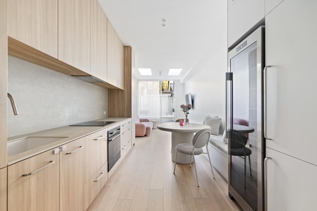
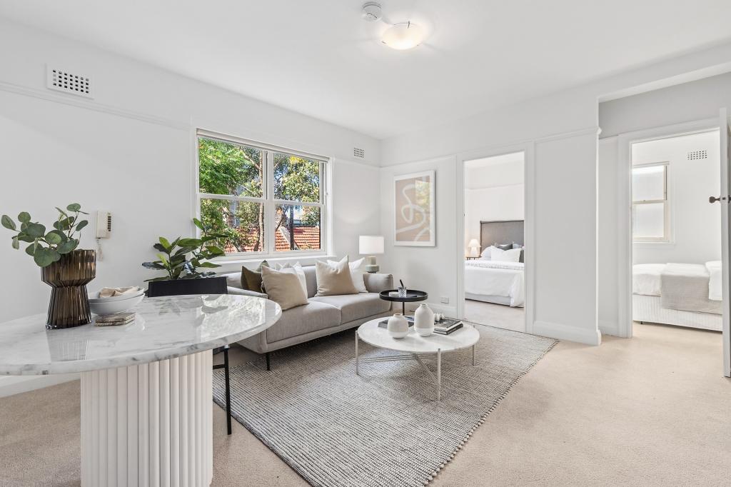
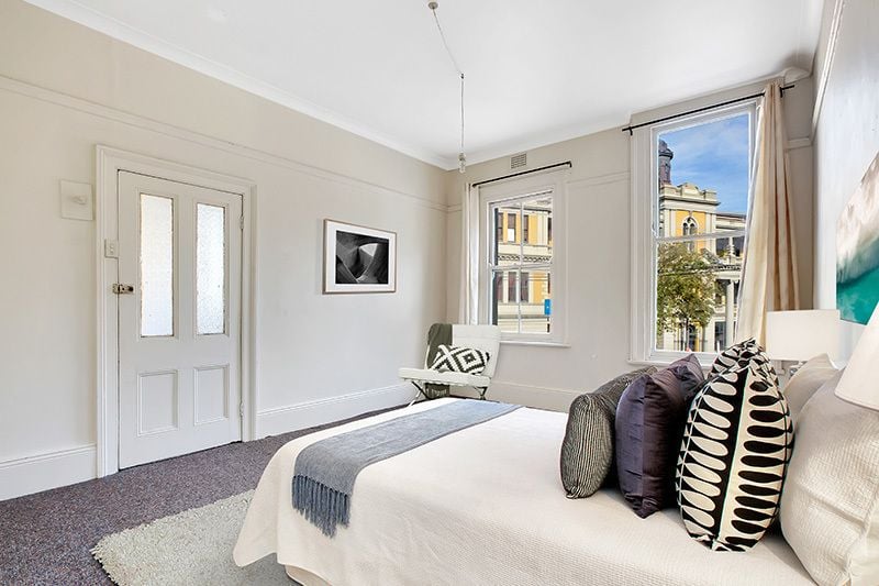
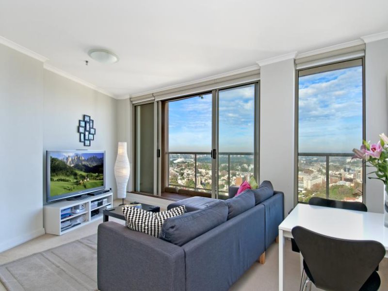
Facing north and found on the top floor of the landmark Allen Jack + Cottier warehouse conversion known as The Block, this dual level two bedroom apartment captures the essence of urban style in a cosmopolitan harbourside setting.
* Large open plan living + dining leads to generous balcony
* North facing, ample natural light, automated timber louvres
* Second floor bedrooms with built ins + separate walk in robe
* Spacious bathroom with bath, internal laundry with dryer
* Contemporary gas kitchen with dishwasher, secure parking
* Very well presented, timber flooring, ducted air conditioning
* Renowned warehouse conversion, secure access with lift
* Walk to popular cafe hubs + Rushcutters Bay Parklands
* Painting to be considered upon approving a new tenant
* Offered unfurnished with preference for a 12 month lease
Property History for 80/15-19 Boundary St, Darlinghurst, NSW 2010
- 09 Aug 2024Listed for Rent $950 / week
- 09 Jun 2022Listed for Rent - Price not available
- 13 Jun 2019Listed for Rent - Price not available
Recent sales nearby
See more recent sales nearbySimilar properties For Sale nearby
See more properties for sale nearby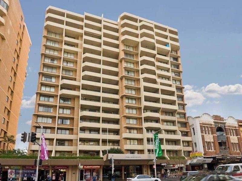


Similar properties For Rent nearby
See more properties for rent nearby
About Darlinghurst 2010
The size of Darlinghurst is approximately 0.9 square kilometres. It has 10 parks covering nearly 2.1% of total area. The population of Darlinghurst in 2011 was 10,060 people. By 2016 the population was 11,325 showing a population growth of 12.6% in the area during that time. The predominant age group in Darlinghurst is 30-39 years. Households in Darlinghurst are primarily childless couples and are likely to be repaying over $4000 per month on mortgage repayments. In general, people in Darlinghurst work in a professional occupation. In 2011, 37.7% of the homes in Darlinghurst were owner-occupied compared with 36.3% in 2016.
Darlinghurst has 9,522 properties. Over the last 5 years, Houses in Darlinghurst have seen a 30.64% increase in median value, while Units have seen a 6.92% increase. As at 30 April 2025:
- The median value for Houses in Darlinghurst is $2,500,651 while the median value for Units is $1,087,750.
- Houses have a median rent of $850 while Units have a median rent of $730.
What's around 80/15-19 Boundary St, Darlinghurst
80/15-19 Boundary St, Darlinghurst is in the school catchment zone for Darlinghurst Public School.


Suburb Insights for Darlinghurst 2010
Market Insights
Darlinghurst Trends for Houses
$2.50M
-4.40%
View Trend$850/W
2.55%
Darlinghurst Trends for Units
$1.09M
-3.68%
View Trend$730/W
3.54%
Neighbourhood Insights
Age
Population 11,325
0-9
4%
10-19
3%
20-29
26%
30-39
28%
40-49
15%
50-59
12%
60-69
8%
70-79
4%
80-89
1%
Household Structure
Occupancy
© Copyright 2025 RP Data Pty Ltd trading as CoreLogic Asia Pacific (CoreLogic). All rights reserved.
This product uses cookies and other similar technologies to improve and customise your browsing experience, to tailor content and adverts, and for analytics and metrics regarding visitor usage on this product and other media. We may share cookie and analytics information with third parties for the purposes of advertising. By continuing to use our website, you consent to cookies being used. View our Privacy Policy here.
X