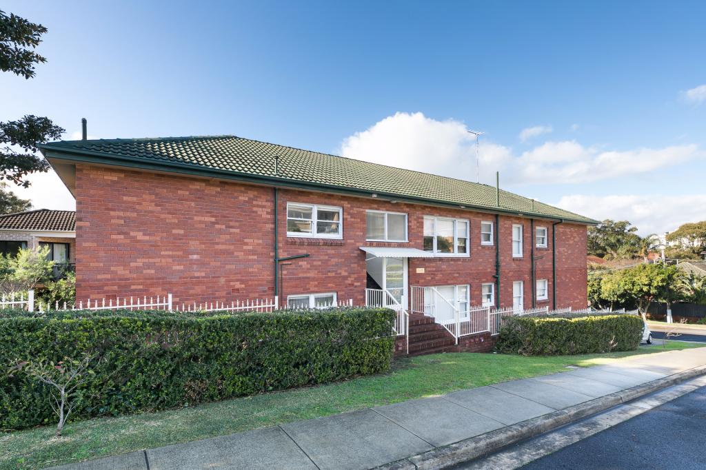
3/25 Gosport StreetCronulla NSW 2230

Thinking about insurance?
Get estimated rebuild costs for this property with Sum SureProperty Details for 3/25 Gosport St, Cronulla
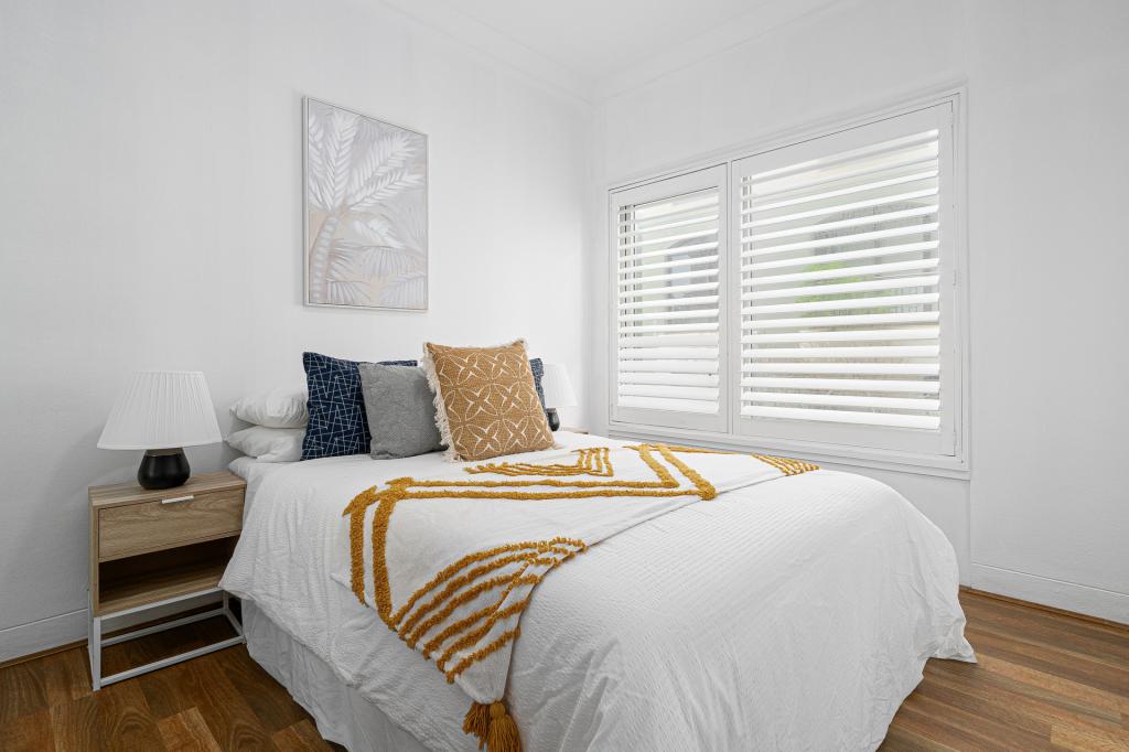
3/25 Gosport St, Cronulla is a 2 bedroom, 1 bathroom House with 1 parking spaces and was built in 1970. The property has a land size of 94850m2 and floor size of 65m2. While the property is not currently for sale or for rent, it was last sold in November 2002.
Last Listing description (July 2025)
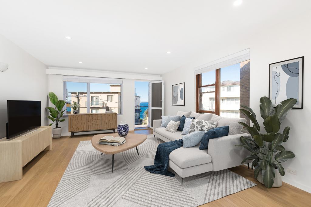
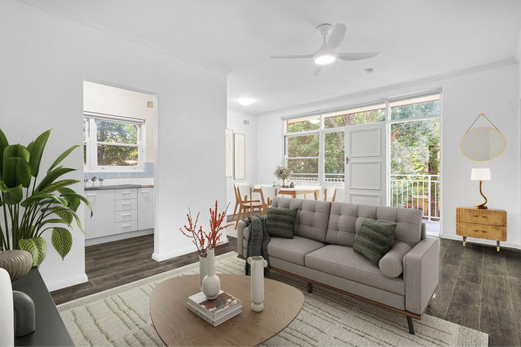
Perfectly positioned on the second floor of a well-maintained security complex, this immaculate two-bedroom apartment offers a lifestyle of convenience and comfort, just moments from Cronulla's vibrant shops, cafes, transport options, and pristine beaches.
- Spacious combined lounge and dining area
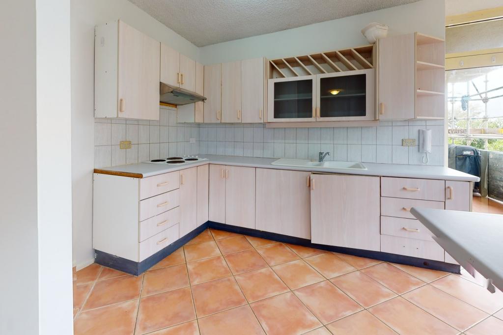
- Neat kitchen with a built-in breakfast bar
- Immaculate bathroom, internal laundry
- East facing balcony off main bedroom
- Single car space, store room, intercom
- Close to shops, transport and beaches
Please register for inspections via 'Book Inspection' or 'Email Agent' buttons.
Otherwise, we unfortunately aren't able to notify you of any inspection changes.
To 'Apply Now' click on the 'External Link' below or visit this property on our website at www.gibsonpartners.com
Property History for 3/25 Gosport St, Cronulla, NSW 2230
- 01 Jul 2025Listed for Rent $670 / week
- 04 Oct 2023Listed for Rent $540 / week
- 16 Mar 2020Listed for Rent $460 / week
Recent sales nearby
See more recent sales nearby
Similar properties For Sale nearby
See more properties for sale nearby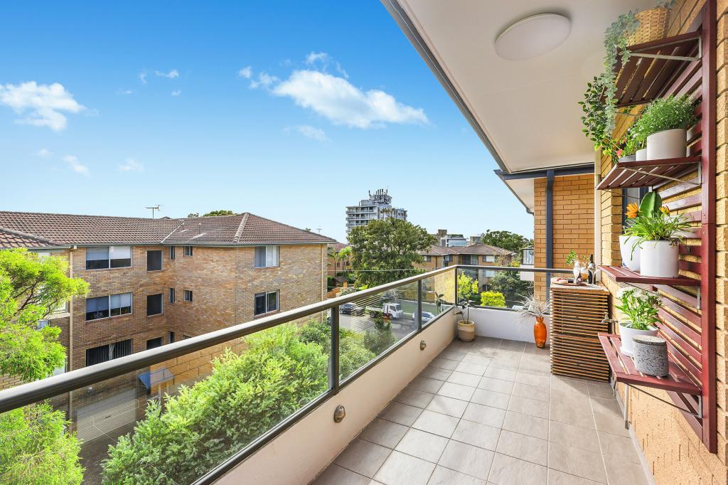
Similar properties For Rent nearby
See more properties for rent nearby

About Cronulla 2230
The size of Cronulla is approximately 5.4 square kilometres. It has 22 parks covering nearly 15.2% of total area. The population of Cronulla in 2016 was 18070 people. By 2021 the population was 17899 showing a population decline of 1.0% in the area during that time. The predominant age group in Cronulla is 30-39 years. Households in Cronulla are primarily childless couples and are likely to be repaying over $4000 per month on mortgage repayments. In general, people in Cronulla work in a professional occupation.In 2021, 56.90% of the homes in Cronulla were owner-occupied compared with 55.70% in 2016..
Cronulla has 12,173 properties. Over the last 5 years, Houses in Cronulla have seen a 51.19% increase in median value, while Units have seen a 25.85% increase. As at 30 June 2025:
- The median value for Houses in Cronulla is $2,923,946 while the median value for Units is $1,157,624.
- Houses have a median rent of $700 while Units have a median rent of $680.
What's around 3/25 Gosport St, Cronulla
3/25 Gosport St, Cronulla is in the school catchment zone for Cronulla Public School and Cronulla High School.


Suburb Insights for Cronulla 2230
Market Insights
Cronulla Trends for Houses
$2.92M
1.14%
View Trend$700/W
2.24%
Cronulla Trends for Units
$1.16M
0.89%
View Trend$680/W
3.08%
Neighbourhood Insights
Age
Population 17,899
0-9
8%
10-19
8%
20-29
15%
30-39
15%
40-49
12%
50-59
13%
60-69
14%
70-79
10%
80-89
4%
90-99
1%
Household Structure
Occupancy
© Copyright 2025 RP Data Pty Ltd trading as CoreLogic Asia Pacific (CoreLogic). All rights reserved.
This product uses cookies and other similar technologies to improve and customise your browsing experience, to tailor content and adverts, and for analytics and metrics regarding visitor usage on this product and other media. We may share cookie and analytics information with third parties for the purposes of advertising. By continuing to use our website, you consent to cookies being used. View our Privacy Policy here.
X